Curated OER
Of Maps and Worldviews
Students explore Ptolemy's world map as an expression of the Renaissance view of the world.
Curated OER
Lesson Design Archaeology- World Map
Students practice locating positions on the world map. In this map skills lesson, students explore the world map and items such as the compass rose, Equator, mountains, cities, etc. The students practice locating positions on the world...
Curated OER
World Map and Globe - Lesson 15 Mountains of the World
Students locate major world mountain ranges. In this geography lesson, students identify major mountain ranges on 6 on of the 7 continents on a large world physical map.
Curated OER
World Map and Globe-Equator, North Pole, and South Pole
Students identify the Equator, North Pole, and South Pole on a map. In this geography lesson, students use a world map and circle the North and South Pole. Students locate the Equator on a globe and use a map marker to highlight it.
Curated OER
Memorable Maps
Students draw an assigned map from memory about the United States or any other region they are studying. In this maps lesson plan, students draw a map from their memory at the beginning of the year, and do the same assignment at the end...
Curated OER
Walking on Maps
Students are introduced to the various types of maps and their functions. As a class, they play a game similar to twister to review map concepts. They answer questions about the map and use the internet to view larger maps of the world.
Curated OER
Kid Maps: Reading and Creating Maps with Human Characteristics
Young scholars look at maps. In this map lesson, students listen to the book My Map Book by Sara Fanelli and they see the difference between human characteristics (buildings, etc.) and natural characteristics (rivers, etc.)....
Curated OER
Introduction to the World Globe
Young scholars examine a globe and the world map to see what constitutes the differences. In this world map introductory lesson, students discuss what they see when they view the globe. Young scholars then, look at a world map and...
Curated OER
Map Skills: Explorers, Continents, and Oceans
Third graders use a software program to make and label a map of the world. On the map, they locate the seven continents, oceans and the countries of Europe. They also draw the routes of Christopher Columbus, Juan Ponce de Leon and...
Curated OER
World Map and Globe- Introduction to Symbols
Young scholars investigate picture symbols. In this symbols instructional activity, students define symbols and discuss symbols that they see in everyday life. Young scholars identify symbols on maps by using post-it notes.
Curated OER
Homes Around the World
Students investigate houses and homes from around the world and create a map collage. They compare how the homes are similar and different and why houses match the weather and geography.
Curated OER
Organization of a Territory, Map Elements
Third graders compare printed and online maps and use proper geographic terminology to answer questions.
Curated OER
Leapin' Landmarks: Locating 10 Man-made Landmarks Around the World
Third graders label continents, oceans, and major mountain ranges on maps and use the maps to write an informational report about landmarks. In this landmarks lesson plan, 3rd graders write about 1 major landmark.
Curated OER
Rhythmic Travel Around the World
Students explore and play rhythm sticks while listening to songs from around the world. They locate the countries of origin on a map, and tap their rhythm sticks to the beat of the music.
Education World
Map Skills Worksheet 5
In this map skills practice worksheet, students practice reading a legend as they respond to 12 short answer questions regarding a legend and a map.
Curated OER
Map Projections
Learners view examples of various map projections using a website. Students record differences between the map projections. Learners discuss uses for the various map projections and the differences between the maps they viewed. ...
Curated OER
The Physical World: Continents and Oceans
In this world map worksheet, study the map of the continents and oceans. Learners label each of the 12 sections of the world map.
Curated OER
Landscape Picture Map - Lesson 8 (K-3)
Students explore the functions of landscape picture maps. In this geography skills lesson, students examine a landscape picture map and identify buildings on the map where people are employed. Students also participate in a discussion...
Curated OER
Treasure Map
In this writing worksheet, students find a treasure by following the correct path on the map. Students write directions telling exactly how to get there. A list of sequential words is provided to help students write directions.
Curated OER
Map of Town
Third graders draw a map of the town given different sites to locate on the map by the teacher. They explain that latitude and longitude are used to locate places on maps and globes, identify the distinctive physical and cultural...
Curated OER
Around the Town
In the world of GPS, make sure your kids can still read maps and determine distances between locations. You will need neighborhood street maps, ideally of your class' home turf. Ask kids questions about different locations in relation to...
Curated OER
Things That Stick Out Or: How To Find Your Way Around on a Map
Students explain the meaning of and recognize the map outlines of a peninsula, an isthmus, and a cape.
Curated OER
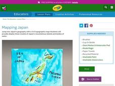
Mapping Japan
Young scholars research the islands of Japan to investigate their location in the world and the islands' characteristics. They comprehend map making and topography. Studnets construct a scale-model map of the Japanese islands and...
Curated OER
Mountains
An informative and well-designed presentation on mountains awaits your geographers. Excellent photographs from mountain ranges around the world are includedin this terrific PowerPoint. The last slide effectively sums up what pupils have...
Other popular searches
- World War Ii Map
- World War I Map
- World War 2 Map
- World War I Outline Map
- World Climate Map
- World Biomes Map
- World Outline Map
- Blank Map of the World
- World Political Map
- Ancient World Greece Map
- World Time Zone Map
- Deciduous Forests Map World


