Curated OER
Glory, God and Gold: Voyages and Adventures - America 1500
By providing an in-depth and interesting overview of European exploration in the New World, this presentation would be a wonderful complement to a unit on this topic. The 17 slide presentation is both thought-provoking and informative....
Curated OER
Investigating Latitude and Longitude
Students examine the lines of latitude and longitude on a map, and explain why these lines might be useful. In this lesson plan students also explore websites that provide information to improve their understanding of how and why...
Baylor College
People and Climate
Model how the sun's energy strikes the planet and help your class relate it to a climate map. Assign small groups an individual climate zone to discuss. They reflect on and research how humans survive in the assigned climate and write a...
Curated OER
"Where in the World is my School?"
Students learn new vocabulary and discuss what GPS is and does. They locate their school using the equipment.
Curated OER
Equator, North Pole, and South Pole
Students identify the Equator, North Pole, and South Pole on the globe. In this map skills lesson, students use a globe marker to locate specific locations on the globe. Students find where they live in relation to the Equator.
Curated OER
Wwf Activity on Exploring Feelings
Students explore feeling about the natural world and how those feelings are being affected by human action. They write poetry after viewing images of swallows in action and listening to poetry about the birds.
Curated OER
Appreciating The World By Learning About Landforms
Children can learn about the Earth's landforms and develop a greater appreciation of our world.
Curated OER
Who's Hungry?
Students research the importance of a healthy diet and the world's nutrition. In this health and diet lesson, students discuss the foods animals and people eat. Students discuss the food chain and create a food chain. Students create a...
Curated OER
Tropical Rainforests
Students create their own rainforest environment. This tropical rainforest lesson, introduces where rainforests are located, their real world connections, and their structural make up. It includes further resources online.
Curated OER
What They Left Behind: Early Multi-National Influences in the United States
Students examine how the European voyages of discovery influence American culture even today. They map eighteenth century Europe's impact on the United States.
Curated OER
The Branding of America (And Your State)
Students investigate about the origins of some major U.S. brands. They explore local products that stimulate the economy. Students create a map showing where those products originate. Students discover the products that their local area...
Curated OER
The Mekong River
Junior geographers explore the region through which the Mekong flows, its pathway, the landscape, how people depend on the Mekong, and future uncertainties. They apply the five themes of geography to examine the region. They create a...
Curated OER
Day to Day Life in a Small African Village
Learners analyze what it is like to live in an African village. They locate Tanzania on a map and compare life there to life here in the United States. They write about the health issues in East Africa.
Classics for Kids
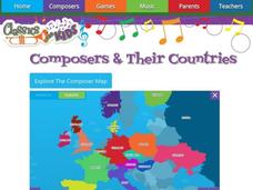
Composers and Their Countries
How many of the world's greatest composers were born in Austria? Or Germany? Or the United States? An interactive map provides young musicians with information about prominent composers in the last few centuries, as well as the periods...
Curated OER
Sound Walk: Discovering Data and Applying Range, Mode, and Mean
Elementary schoolers sharpen their listening skills as they use sound maps, tallies, and line plots to organize and interpret data. Everyone takes a "sound walk," and focuses on the sounds around them. They chart and tabulate the sounds...
Curated OER
Ann Arbor Growth & Immigration
Third graders describe some of the factors that brought early settlers to Ann Arbor. They read Narrative-A Trip from Utica, New York, to Ingham County, Michigan in 1838. As an added challenge, 3rd graders can use maps to track Silas...
Curated OER
Tracking the Salt Front
Using the Hudson River as the focus, learners discuss the difference between salt water and fresh water environments, analyze maps and graphs, and complete addition and subtraction problems. This lesson comes with a wealth of...
National Geographic
Ocean Exploration
Dora, Dora, Dora, Dora, Dora! This may be your little ones' best guess as to what it's like to be an explorer! Give them a deeper understanding with this compact examination. A four-minute video introduces them to Robert Ballard,...
Curated OER
The Aztecs - Mighty Warriors of Mexico
Upper elementary learners identify the Aztecs as the builders of a great city and rich civilization in what is now Mexico. They locate the Aztec Empire and its capital on a map and place the Aztecs in the chronology of American history....
Perkins School for the Blind
Modified Golf
Golf is a popular game that is enjoyed around the world. Invite your pupils with visual impairments or blindness to putt a few balls or make a hole in one. This activity provides several very good suggestions as to how you can teach an...
Curated OER
Couriers in the Inca Empire: Getting Your Message Across
Learners examine how the Inca communicated over large distances. They locate the Inca Empire on a map, define key vocabulary terms, play the game, 'telephone,' and create a quipu to show the year they were born.
Curated OER
The Eagle Has Landed: Aztecs Find a Home
Students investigate the Aztec civilization and locate it on a map. They explain the legend of the city of Tenochtitan and investigate the symbolism of the Mexican flag.
Curated OER
Molly Pitcher -- "Out of Many, One"
Young scholars research, brainstorm and analyze the events that lead up to the Revolutionary War. They critique a piece of artwork depicting a scene from the Revolutionary War. Each major battle is plotted on a map to show a visual...
Curated OER
Pastimes: Music and Dance
Play the lively music of flamenco and tango for your emerging Spanish speakers, and introduce them to popular dances from Spanish-speaking countries around the world. Discuss various types of music and dance, showing either pictures or...
Other popular searches
- World War Ii Map
- World War I Map
- World War 2 Map
- World War I Outline Map
- World Climate Map
- World Biomes Map
- World Outline Map
- Blank Map of the World
- World Political Map
- Ancient World Greece Map
- World Time Zone Map
- Deciduous Forests Map World


