Curated OER
A World of Information
Students analyze data and statistics about countries around the world. They read graphs and charts, color a world map to illustrate the top ten statistics about the world, and write a paragraph to summarize their information.
Curated OER
Where Did Foods Originate? (Foods of the New World and Old World)
What do papayas, peanuts, pineapples, and potatoes have in common? Why, they are foods explorers brought back to the Old World. Young researchers use the Internet to investigate how New World explorers helped change the Old World's diet....
Curated OER
Where in the World Is Mexico?
Learners practice map-reading skills as they locate Mexico and its cities on a world map. By creating a puzzle out of a map of Mexico, students engage in a meaningful hands-on activity to help them explore that country's geography.
Curated OER
Maps
Maps, globes, and computer software aid young explorers as they locate state capitols, major cities, geographic features, and attractions for states they are researching. They then use desktop publishing software to create a map to share...
Curated OER
World: Continents Map
In this outline map worksheet, students note the political boundaries of the continents of the world. The map is labeled with the names of the 7 continents.
Curated OER
World: Continents
In this blank outline map worksheet, students note the political boundaries of the continents of the world on a Robinson projection map.
Curated OER
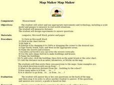
Map Maker, Map Maker
Map maker, map maker, make me a map! Your class can sing this tune as they work to create their own regional maps by taping paper to the wall, projecting an overhead transparency image, and tracing. Where this lesson plan intends for the...
Curated OER
Map a World of Facts
Pupils mark ten places on a world map while they follow fun facts on the included printable sheet. They research using a variety of resources to determine the location of the ten places.
Curated OER
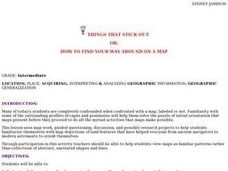
Things That Stick Out Or: How To Find Your Way Around on a Map
Students explain the meaning of and recognize the map outlines of a peninsula, an isthmus, and a cape.
Roald Dahl
Matilda - The Reader of Books
The titular Matilda from Roald Dahl's famous novel adored books above all things. Discuss why it is important to read stories from across cultures and around the world using the first chapter from the ever-loved story Matilda.
Curated OER
Organization of a Territory, Map Elements
Third graders compare printed and online maps and use proper geographic terminology to answer questions.
Curated OER
Say Hello! Around the World
Hello! Bonjour! Paivaa! Ni hao! Teach learners of all ages how to say hello in several different languages. There are project ideas for younger learners and older learners. Kids love learning a different language, even if it's just this...
Curated OER
Where Is Rome?
Third graders discover Ancient Rome through maps and worksheets. In this world history activity, 3rd graders locate Rome on a world map and identify the scope of the Roman Empire. Students label an entire map of Italy after...
Curated OER
Where in the World?
Students locate famous landmarks around the world. They identify the location of natural and manmade landmarks using a worksheet that provides ten clues.
Core Knowledge Foundation
Year 2: Northern Europe
How is life in Northern Europe different from other areas of the world? Historians journey through the various regions of Northern Europe discovering what type of climate, animals, and lifestyles exist in that section of the world. They...
Curated OER
Ancient Egypt: Connecting Literature and Geography
Students brainstorm prior knowledge of Ancient Egypt, locate Egypt on map of Africa and on world map, watch King Tut film, discuss term biography, and map geographical information mentioned in stories and documentaries about Ancient Egypt.
Curated OER
Introduction to the United States Map
Students identify the United States of America and it's states on a map. In this mapping lesson, students examine a globe and find the United States as well as a few land marks (Florida and the Great Lakes). Students then look at a...
Curated OER
Continents
Students investigate World Geography by researching the different continents. In this Asian Geography lesson, students discuss the continent of Pangaea and color a worksheet of the continents. Students locate China on the map worksheet...
Curated OER
Mapping the Circulatory System
Students investigate the circulatory system in human beings. In this human body lesson, students create an outline of a human body using colored markers and butcher paper. Students use red and blue colors to simulate the...
Curated OER
Three Mapping Activities
Pupils label three maps of China after being introduced to background information about the country. In this geography lesson plan, students color two maps and label various points of interest in China. Finally, pupils draw...
Curated OER
How Many Ways Can You Say Merry Christmas?
Students create a multicultural holiday bulletin board map! students research and study saying Merry Christmas in different languages. They correctly locate the countries on a world map.
Curated OER
What They Left Behind: Early Multi-National Influences in the United States
Students examine how the European voyages of discovery influence American culture even today. They map eighteenth century Europe's impact on the United States.
Curated OER
Penguins Around the World
Students gain an awareness of the diverse habitats of the 17 species of penguins. Standard: 4.4 Interdependence of Life Changes in an organism's habitat are sometimes beneficial to it and sometimes harmful.
Curated OER
Street Cows
A light, and humorous lesson on "street cows" is here for you. Learners listen to the story, "Street Cows," which is embedded in the plan. On a map of the US and the World, they locate the cities where the "Cows on Parade" exhibit was...
Other popular searches
- World Outline Maps
- World War I Outline Map
- Blank World Outline Maps
- World Outline Political Map
- World Climate Map Outline
