Curated OER
New Perspectives
Students examine maps that are designed to give different perspectives. They create mental maps that illustrate their own perspectives and those of people from other parts of the world.
Curated OER
Computer Activities: Countries of the World
Students research a country. In this research and computers lesson, students select a country and research various aspects about it including the capital city, the flag and fun facts. Students create slides about their country and then...
Curated OER
Edible Resource Maps
Third graders work in groups to create an edible resource map showing locations of at least five resources in the United States. Students research on the internet different regions and the resources that are found in those areas. They...
Curated OER
I Can Compass, Can You?
Young scholars discover how to use geographic tools. In this compass lesson, students identify cardinal directions by appropriately using compasses along with a number of various maps.
Curated OER
Discovering Dinosaurs: Planning your Summer Vacation
Students use the online Atlas of Canada to gather information about places in Canada.
Curated OER
Cartography
Students research about cartography and how to be a cartographer. In this math activity, students draw a map of their classroom. They use a robot to explore navigation using a compass rose.
Curated OER
Nunavut, Our Communities
Students locate the communities of Nanavut on a territorial map and identify community characteristics. They research the online Atlas of Canada
Curated OER
Tear the Continents
Students tear paper into representative continent shapes and configure them with world oceans through relative location, direction and latitude and longitude starting points. They recognize the shape of the continents. Students recognize...
Curated OER
Sunrise, Sunset: Quickly Go the Days
Students explore the concept of daylight. In this daylight lesson plan, students compare the amount of daylight on a particular day in Anchorage compared with daylight where they live. Students color maps of the US according to amount of...
Curated OER
Natural Disaster Blooms Taxonomy
Students complete activities that lead to greater understanding of the variety of natural disasters that occur all over the world.
Curated OER
Asian Americans: Where Do They Come From?
Students identify 15 places (14 countries plus Hawaii) from which large populations of Asian Americans originate. They create a graph to help themselves visualize the places from which large populations of Asian Americans originate. Then...
Curated OER
Celebrate Your Heritage
Students investigate what countries their ancestors originally came from and locate them on a world map. They use a map to plot the ancestral path that has led to their hometown. They create a travel log outlining facts/data about...
Curated OER
Au Marche Sandaga a Dakar
A 3-day French lesson plan targeting food shopping vocabulary. It is designed for elementary French learners pretending to communicate with merchants in a small village outside of Dakar. The plan follows a class reading of the picture...
Curated OER
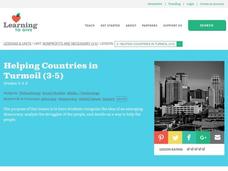
Helping Countries in Turmoil
Students discover the struggles of emerging democracies. In this service learning lesson, students research a non-profit agency that is assisting the people of an emerging democracy and create and advertisement.
Curated OER
Identifying Border States of the U.S.
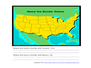
For this identifying border states of the U.S. worksheet, 3rd graders visually identify then write the names of the states that border Canada and Mexico; page 1 is a lesson, page 2 is the worksheet.
Curated OER
ExplorA-Pond: 4th Grade Perimeter Estimation
Your geometers are used to finding the perimeter of a square or rectangle, so give them something different this time! With this lesson, small groups will receive a picture of a shoreline and calculate the perimeter. The website listed...
Curated OER
Human Beings / Human Rights
Students brainstorm and discuss what it means to be "human." They relate human rights to human needs and discuss what a universal right is and read about Eleanor Roosevelt and the Universal Declaration of Human Rights.
Curated OER
Nunavut, Our Communities
Students research the Online Atlas of Canada to locate the communities of Nunavut. Students examine the geographic area and characteristics of the communities.
National Endowment for the Humanities
Neh: Edsit Ement: Mapping Our Worlds
In this lesson, introduce your learners to the world of maps and discover a world of information online. Students learn how to identify different types of maps, comparing maps to the rooms of a house.
Other popular searches
- World Outline Maps
- World War I Outline Map
- Blank World Outline Maps
- World Outline Political Map
- World Climate Map Outline


