Curated OER
Earth at Night
Students examine the Earth at night. In this geography lesson, students identify the continents at night using various Internet Web sites. This lesson may be adapted for use with middle school and high school students.
Curated OER
This Is Tanzania
Students study the volcanic history and the wildlife of Tanzania. They examine how most Tanzanians live on a subsistence agricultural economy.
Curated OER
Water Creates a Cave
Pupils study the role of water in limestone cave formation and create a cave on karst-like grid on paper.
Curated OER
Chinese New Year
Students complete a variety of activities as they study Chinese New Year and the Chinese Zodiac. They act out a story of the Chinese Zodiac. They make several crafts including Chinese lanterns and paper fortune cookies.
Syracuse University
Erie Canal
While canals are not the way to travel today, in the first half of the nineteenth century, they were sometimes the best way to move goods and people. Scholars examine primary sources, including maps and pictures, to investigate the role...
Roy Rosenzweig Center for History and New Media
American Indians and their Environment
People could take a page in ingenuity and survival from the Powhatans. Deer skins became clothes, and the members of the Native American group farmed the rich Virginia soil and hunted in its forests for food. Using images of artifacts...
Council for the Curriculum, Examinations and Assessment
Victorian Historians
Take the class back in time to the Victorian Era! The resource provides a plethora of activities that create experiences for scholars in class. Some activities include a fun fair, viewing the starry-night painting, and even experiencing...
Arcademics
Capital Penguin
Hop across the country like a penguin from ice floe to ice floe using an interactive video game. Acting as a penguin, learners match capitals to their states. Game features allow teachers to set up competitions and check learning progress.
pps.k12.or.us
50 States
An absolute must-have for your unit on the 50 states, this resource contains reading handouts, activity-based worksheets, and comprehension questions for each and every one of the United States of America.
Curated OER
World Map and Globe - Lesson 15 (K-3)
Students discover mountain ranges and their locations in the world. In this physical map lesson, students locate and identify major mountain ranges of the world on a large physical map.
Curated OER
Geography Terms
In this PowerPoint, students review geography terms. Slides feature illustrations and facts about mountains, hills, islands, deserts, lakes, rivers, oceans, plains, valleys, and forests.
Curated OER
Australian Geography
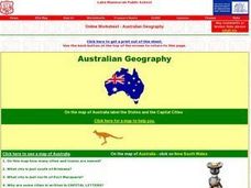
In this map reading worksheet, students label a map of Australia by adding the names of states and cities. They answer eight questions about the map.
Curated OER
Geography of Our Environment
Students explore geographical elements. In this geographical elements lesson, students create a map showing the geographical elements in their area. Students take pictures of these elements to glue to their map and present it to the class.
Curated OER
Where People Start Communities
Explore the difference between man-made and natural features in nature with your students. While not an in-depth look at this topic, it would be a way to introduce this communities in your classroom.
Curated OER
Mountains and Beach
Students discover the world of geography, assessing new geographic terms and combining them into one colorful scene. They complete their scenes and exchange them with a partner to name the geographic features illustrated in their...
Curated OER
Santa Lucia Crown
Pupils identify the countries, Sweden, Norway, Denmark, Finland, and Italy, that celebrate Saint Lucia Day and locate them on a world map. They research the Christmas holiday customs in these countries and represent their findings in a...
Curated OER
The Great Lakes
In this Great Lakes geography worksheet, learners identify Lakes Superior, Huron, Michigan, Erie, and Ontario on a map. Students also practice writing the lakes names in cursive and respond to 2 short answer questions.
Curated OER
Welcome to Africa
Expose your students to the wonders of a different culture. This series of slides contain facts about African culture, geography, government, and costumes. It could be viewed as a compliment to a larger lesson or as an anticipatory set...
Curated OER
Mapmaker, Mapmaker, Make Me a Map
Second and third graders practice with basic map skills. They create their own map including a legend and a compass rose. This fabulous plan has many excellent websites linked which allow learners to explore maps of all kinds; including...
Curated OER
Winter Olympic Torch Traveling Across Italy
Students react to statements about the 2006 Winter Olympics, then read a news article about the Olympic torch's journey through Italy. In this current events lesson (written prior to the 2006 Winter Olympics), the teacher introduces the...
Curated OER
The Arkansas State Flag
Young historians take a look at the history of the Arkansas state flag. Pupils color, cut, and paste together their own versions of the flag. They learn about the meaning of the flag's colors, and what the various symbols on the flag...
Curated OER
Gas Prices Keep Rising
Students discuss rising gas prices, then read a news article about how the increase in fuel cost may affect other prices. For this economics and current events lesson, the teacher introduces the article with a discussion and vocabulary...
Curated OER
Trailers Become Schools After Hurricane Katrina
Students share their thoughts about natural disasters, then read a news article about how life at an elementary school was changed after Hurricane Katrina. In this current events lesson, the teacher introduces the article with a...
Curated OER
Oh, What A Day
Learners listen as the teacher reads A Country Far Away. They predict what they will do and what they think their partner student will be doing. Students create a KWL chart for Japan. They collect information about their activities on an...


