Curated OER
Indiana State Map
In this state maps worksheet, students identify the state of Indiana and fill in the state capital, major cities, and other attractions in the state.
Curated OER
social studies: Life in Colonial America
Students explore the trials and tribulations early colonial life and note its successes. Through literature, Internet research, and interactive software, they engage in various activities to evaluate early social and cultural development.
Curated OER
World Map and Globe - Lesson 15 (K-3)
Students discover mountain ranges and their locations in the world. In this physical map lesson, students locate and identify major mountain ranges of the world on a large physical map.
Curated OER
African life VS American life: Food and 3rd World and 1st World counties
Third graders explore the difference in 3rd world and 1st world countries. For this social studies lesson, 3rd graders are divided into groups and given varying amounts of food. Students discuss the unfair distribution of the food....
Curated OER
Geography Terms
In this PowerPoint, students review geography terms. Slides feature illustrations and facts about mountains, hills, islands, deserts, lakes, rivers, oceans, plains, valleys, and forests.
Curated OER
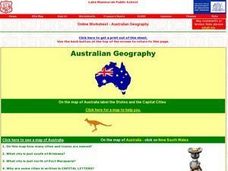
Australian Geography
In this map reading worksheet, students label a map of Australia by adding the names of states and cities. They answer eight questions about the map.
Curated OER
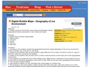
Geography of Our Environment
Students explore geographical elements. In this geographical elements lesson, students create a map showing the geographical elements in their area. Students take pictures of these elements to glue to their map and present it to the class.
Curated OER
Where People Start Communities
Explore the difference between man-made and natural features in nature with your students. While not an in-depth look at this topic, it would be a way to introduce this communities in your classroom.
Curated OER
3D Textured Globe
The earth, our home planet, and the star of Earth Day celebrations everywhere! Celebrate Earth Day or examine Earth's place in the solar system, with a fun and easy craft, perfect for children nine and up. Paper mache ornaments, paint,...
Curated OER
Mountains and Beach
Students discover the world of geography, assessing new geographic terms and combining them into one colorful scene. They complete their scenes and exchange them with a partner to name the geographic features illustrated in their...
Curated OER
Santa Lucia Crown
Pupils identify the countries, Sweden, Norway, Denmark, Finland, and Italy, that celebrate Saint Lucia Day and locate them on a world map. They research the Christmas holiday customs in these countries and represent their findings in a...
Curated OER
The Great Lakes
In this Great Lakes geography worksheet, learners identify Lakes Superior, Huron, Michigan, Erie, and Ontario on a map. Students also practice writing the lakes names in cursive and respond to 2 short answer questions.
Curated OER
Welcome to Africa
Expose your students to the wonders of a different culture. This series of slides contain facts about African culture, geography, government, and costumes. It could be viewed as a compliment to a larger lesson or as an anticipatory set...
Curated OER
Winter Olympic Torch Traveling Across Italy
Students react to statements about the 2006 Winter Olympics, then read a news article about the Olympic torch's journey through Italy. In this current events lesson (written prior to the 2006 Winter Olympics), the teacher introduces the...
Curated OER
The Arkansas State Flag
Young historians take a look at the history of the Arkansas state flag. Pupils color, cut, and paste together their own versions of the flag. They learn about the meaning of the flag's colors, and what the various symbols on the flag...
Curated OER
Gas Prices Keep Rising
Students discuss rising gas prices, then read a news article about how the increase in fuel cost may affect other prices. For this economics and current events lesson, the teacher introduces the article with a discussion and vocabulary...
Curated OER
Trailers Become Schools After Hurricane Katrina
Students share their thoughts about natural disasters, then read a news article about how life at an elementary school was changed after Hurricane Katrina. In this current events lesson, the teacher introduces the article with a...
Curated OER
Oh, What A Day
Learners listen as the teacher reads A Country Far Away. They predict what they will do and what they think their partner student will be doing. Students create a KWL chart for Japan. They collect information about their activities on an...
123 Homeschool 4 Me
Christmas Around the World
Young travelers keep a travel journal as they tour the world and research the holiday traditions of over 30 countries. The directions packet for this journey includes an eBook filled with all the necessary templates, loads of links,...
Peace Corps
Celebrating Our Connections Through Water
Water is vital for survival, but how does it help global cultures flourish? Elementary and middle schoolers learn about the different cultures around the world that celebrate water and incorporate it into their festivals or traditions.
Curated OER
Illusions of Depth
Learning to create depth when painting or drawing takes skill and the ability to understand how things should be placed on the canvas. The class will use the Charles Deas painting Long Jakes to learn about composition, sharing...
Curated OER
Introduction to Maps
Students develop their map skills. In this geography lesson, students participate in an activity that requires them to survey their social studies book in order to find different types of maps and purposes for their uses.
Curated OER
Cardinal Directions
Students explore cardinal directions. In this social studies instructional activity, students create maps of home and school using the cardinal directions.
Curated OER
World Map and Globe - Four Main Directions
Students study the four main directions on a map. In this map lesson, students locate the North and South pole, and learn the four cardinal directions. They use the compass rose on a map to help with the directions. (Map is not included...


