Curated OER
Discovering the Local Community
Third graders create a mini-atlas of the human and physical characteristics of their local community, which includes landforms, climate, vegetation, population, and economics. They use nonfiction map-related resources to obtain ...
Curated OER
Changes in the Community
Third graders examine and describe a series of primary sources (mostly photographs) to observe and analyze changes over time. The focus is on the local community. The local community might be a city, township, county or surrounding area.
Curated OER
Dust In The Distance
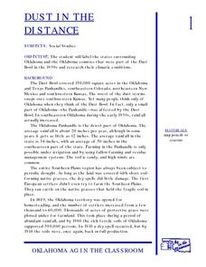
Students are introduced to the events of the Dust Bowl. Using a map, they locate and label all of the states surrounding and including Oklahoma. After also labeling the counties in Oklahoma, they use the internet to research the...
Curated OER
How to Make a Lake
Delve in the creation of the Great Lakes in Michigan. After listening to stories about the formation of the lakes in this area, pupils perform experiments to investigate how this occurred. This provides a great way for learners to...
Curated OER
Valentine Village
Students build a small city by using a half-gallon milk or juice carton to "build" a miniature home. They decorate their buildings with construction paper, yarn, beads, or whatever they have and become mailmen, delivering Valentine's to...
Curated OER
Indians of the Pacific Northwest
Young scholars organize acquired information and make inferences as to the kind of habitat and its probable location. They identify and replicate art forms characteristic of the Pacific Northwest coast involving the use of ovoids and "u...
Curated OER
Tissue Paper Geography
Young scholars explore geographic features of the desert and apply their understanding of the topography of the desert by creating a tissue paper painting.
Curated OER
Enchanting Egypt
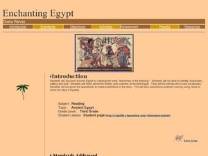
After reading the Magic Tree House book Mummies in the Morning, learners talk about Ancient Egypt. They identify the plot, characters, setting, etc., explore vocabulary terms, and construct a pyramid. This will motivate your class...
Curated OER
Using Map Skills
Third graders study maps. In this U.S. geography lesson, 3rd graders explore directions on a compass rose and use a map scale to determine distances between two points on a map. They listen to a lecture and use their own maps to practice...
Curated OER
Quick-Sketch Artist Tips on Mind Mapping the Urban Landscape
Students interpret maps. They also create mental maps of regions in which they are studying. Students then explain the historical or cultural significance of map features orally or in written form. Students take a walking field trip...
Curated OER
Landscape Picture Map: Natural Features
Students discover six landscapes. In this natural features instructional activity, students review the meaning and examples of natural features. Students use a landscape picture map to identify six natural features.
Curated OER
Where Do You Live?
Students discuss the community in which they live. They take an observation field trip and then use paper and boxes to design and construct a model of their community.
Curated OER
Filling Up Florida
Students study factors controlling Florida's population growth and related environmental impacts. They research natural community types and construct maps (including a large-sized map of Florida) to be used for a simulation activity.
Curated OER
Countries of Africa
Students study the coutries of Africa. In this African American history, small groups of students research a different country, color the country on the map of Africa, write a paragraph about the country, and draw pictures of its flag.
Curated OER
Cyber Hunt Activities: Lewis & Clark
Learners participate in cyber hunt activities involving Lewis and Clark in order to gain a better idea of what it was like to be an explorer of the vast western lands. In this history lesson, students may choose to study the route that...
Curated OER
Chocolate Place - Factories around the world
Students create a PowerPoint presentation on how chocolate is made. In this chocolate lesson plan, students locate chocolate factories around the world, and study the process of converting the cacao seed into a chocolate bar. Students...
Curated OER
Locating Places
Students demonstrate how to use the map grid system. In this map skills lesson, students are given coordinates to locate several locations on a world map. Students use the map grid system to identify these locations.
Curated OER
Where Should We Put a Store?
Students analyze population data. They convert population data into simple density maps to help make decisions about their world. They select the best location for a school store based on population density. They present their maps...
Curated OER
Using 4 main directions in a classroom
Students use the four directions of a compass rose to locate classroom features. In this directions lesson plan, students locate the features by identifying directions.
Curated OER
Other Countries
Learners select a country and conduct research on the culture, population, geography, and government of their country. They conduct research using the Internet and a variety of resource books, and write and publish a report that...
Curated OER
Filigree Jewelry
Young scholars describe physical and human characteristics of North Africa and the Middle East, plot on a map areas populated by nomadic people in those areas, explain importance of filigree jewelry in Arab culture, and create their own...
Curated OER
Wales
Students read passages and look online to discover the history and important people, culture, and icons of Wales. In this Wales lesson plan, students participate in a jigsaw reading and learn a few phrases in Welsh.
Curated OER
Time Zones
Third graders have a greater understanding of time zones, explain the basic history and purpose in the creation of time zones, and use time zone maps to calculate the time/day in a certain area.
Curated OER
The History of Rice
Third graders explore the history of rice. In this history of rice lesson plan students use a timeline to help determine important events in the spread of rice throughout the world. They use a map to locate rice production in the United...


