Curated OER
The History of Rice
Third graders explore the history of rice. In this history of rice lesson plan students use a timeline to help determine important events in the spread of rice throughout the world. They use a map to locate rice production in the United...
Curated OER
Amelia Earhart Putnam
Learners travel the world with Amelia Earhart, mapping out their own route and then comparing it to the one she flew as she attempted to circle the earth in an airplane. They apply military time as it pertained to Earhart's disappearance.
Curated OER
Communities
Students examine the similarities and differences between rural, suburban, and urban communities. They read about type of community in their social studies textbook, analyze the differences between Tokyo and Chicago, and complete a chart...
Curated OER
Cotton Journey
Students use "Cotton Journey-A Field Trip In A Box" kit to relate the significance of cotton to the Civil War period and to study the cotton industry in general.
Curated OER
Prairie Voices: Community Development, Investigating Local History
Students investigate local history. In this research skills lesson, students examine historic landmarks, tax records, fire maps, town plans, historic photographs, newspapers, and other primary sources to learn about local communities in...
Curated OER
Filling Up Florida
Students study factors controlling Florida's population growth and related environmental impacts. They research natural community types and construct maps (including a large-sized map of Florida) to be used for a simulation activity.
Curated OER
Let's Play Geography Twister
Students practice geography skills by playing a game based on Twister. Students manipulate their position on a map by placing their arms and legs on the appropriate state or country called out by the teacher.
Curated OER
Countries of Africa
Students study the coutries of Africa. In this African American history, small groups of students research a different country, color the country on the map of Africa, write a paragraph about the country, and draw pictures of its flag.
Curated OER
Time Zones
Third graders have a greater understanding of time zones, explain the basic history and purpose in the creation of time zones, and use time zone maps to calculate the time/day in a certain area.
Curated OER
A View from Overhead
Students explore the concept of mapping. Using given illustrations, students observe views of a park from above the ground. They compare and contrast the different views. Students discuss uses for maps. Using a resource from the...
Curated OER
Cyber Hunt Activities: Lewis & Clark
Learners participate in cyber hunt activities involving Lewis and Clark in order to gain a better idea of what it was like to be an explorer of the vast western lands. In this history lesson, students may choose to study the route that...
Curated OER
Are There Really Fifty-Three Nations Within Africa?
Students color a map showing that Africa consists of 53 nations and recognize the difference between a nation and a continent. The main objective of this activity is for students to realize that Africa is a continent with many nations...
Curated OER
Easter Egg Orienteering Hunt
Students develop map reading and team building skills. After being divided into teams, students use a map of the school grounds to discover the location of Easter eggs. The first team to return with and eat their eggs wins the challenge.
Curated OER
Graphing Regions: Lesson 2
Students identify and analyze geographical locations of inventors. They each identify where their inventor is from on a U.S. map, discuss geographic patterns, and create a t-chart and graph using the Graph Club 2.0 Software.
Curated OER
Four Main Directions
Students describe directions using a globe for north, east, south and west. In this mapping lesson students identify the north and south pole. Students understand the importance of the equator and the Prime Meridian. Students explain how...
Curated OER
Our Country's Geography
Third graders study geography. In this United States landforms lesson, 3rd graders create a map of the U.S. made out of dough. They use various edible treats to mark the country's capital, the plains, the mountains and the rivers &...
Curated OER
Quarters from the Coast
Students discuss Fifty State Quarters Program, compare and contrast location of land and water on map of United States, while also becoming aware of physical shape of nation and home state, and explore coastal areas in United States.
Curated OER
My Neighborhood:
Pupils act as tour guides for their communities after conducting research about their neighborhoods. After conducting research, students write stories and create maps of their communities to share with classmates and community members.
Curated OER
Continents and Critters
Students investigate and identify the continents of the world. They identify and locate the seven continents on a map, and label a coloring page of a world map. Students then conduct research on an assigned continent, and write and...
Curated OER
Chocolate Place - Factories around the world
Students create a PowerPoint presentation on how chocolate is made. In this chocolate lesson plan, students locate chocolate factories around the world, and study the process of converting the cacao seed into a chocolate bar. Students...
Curated OER
Columbus' Perception of the New World
students investigate readings relating to the voyage of Columbus in 1492 and to make historical connections based on those readings. They form pairs to share insights and answer specific questions, and share information in a final class...
Curated OER
Where Should We Put a Store?
Students analyze population data. They convert population data into simple density maps to help make decisions about their world. They select the best location for a school store based on population density. They present their maps...
Curated OER
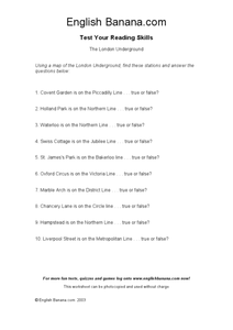
The London Underground
In this identifying stations of the London Underground transportation system worksheet, students use a map of the London Underground, which is not provided, to answer true or false questions. Students answer 10 questions.
Curated OER
Leapin' Landmarks: Locating 10 Man-made Landmarks Around the World
Third graders label continents, oceans, and major mountain ranges on maps and use the maps to write an informational report about landmarks. In this landmarks lesson plan, 3rd graders write about 1 major landmark.


