Curated OER
Mapping Community Values
Pupils discuss the origin of various maps focusing on the values behind them. Students also explore how human needs and geography influence community settlement patterns. Pupils extend learning by creating and mapping their own ideal...
Curated OER
Play Doh Map of Your State
Young scholars create a state map using Playdoh. In this hands-on state geography lesson, students work in groups to form a three-dimensional map of their state using Playdoh made at home following a (given) recipe. Young scholars...
Curated OER
Mapping India
Students participate in an activity in which they place placards listing geographic features, landmarks, etc. in the correct place on a large fabric map of a given country. They also examine artifacts, photos, sounds/music, etc. from...
Curated OER
Read a Map ... It's a Snap!
Students are introduced to map and globe skills. They use grids and are able to construct their own simple maps of familiar places. Students are able to define a map, globe, and symbol and use the direction words north, south, east,...
Curated OER
U.S. Geography for Children
In this U.S. map activity worksheet, students observe maps of the continental United States, Hawaii, and Alaska, locate and label landforms and bodies of water, and create symbols for natural resources and places of interest. Students...
Curated OER
Where in the World is Hawaii?
Learners compare a globe and a two-dimensional world map and explore how they both represent the planet Earth. They locate the Hawaiian Islands on the globe or the world map and describe how the geographical position is unique.
Curated OER
Countries of the World
Learners define the meaning of the word country. In this countries of the world map lesson plan, students identify boundaries, countries, and symbols within countries on the map. Learners distinguish the words country and continent.
Curated OER
Earth at Night
Students examine the Earth at night. In this geography lesson, students identify the continents at night using various Internet Web sites. This lesson may be adapted for use with middle school and high school students.
Curated OER
You Can Find It!
Students, in groups, use longitude and latitude to locate various places on a map.
Curated OER
Our Country's Geography
Third graders study geography. In this United States landforms lesson, 3rd graders create a map of the U.S. made out of dough. They use various edible treats to mark the country's capital, the plains, the mountains and the rivers &...
Curated OER
World Map and Globe - Lesson 15 (K-3)
Students discover mountain ranges and their locations in the world. In this physical map lesson, students locate and identify major mountain ranges of the world on a large physical map.
Curated OER
Mapping It Out
This PowerPoint provides information about maps. Students discover the functions of legends, compasses, indexes, and scales on maps. Two resources links are provided, however one of them is broken.
Curated OER
United States Map - Lesson 11
Young scholars explore lakes of the United States. In this geography lesson, students identify noteworthy lakes on a map of the United States.
Curated OER
Water Features - Lesson 2 - U.S. Political Map Grade 4-5
Students locate water features on maps. In this geography lesson, students complete worksheets that require them to identify water features on a U. S. political map.
Curated OER
Washington Map
In this Washington state outline map worksheet, learners examine political boundaries of the state and the placement its capital city as well as its major cities. This map is not labeled.
Curated OER
Follow the Light
Here is another in the interesting series of lessons that use the special State Quarters as a learning tool. During this lesson plan, pupils learn about lighthouses, maps, the cardinal directions on a compass, and U.S. geography. There...
Space Awareness
How To Travel On Earth Without Getting Lost
Have you ever wanted to travel the world? Take a virtual trip with a geography lesson that uses longitude and latitude, the position of the sun, an astronomy app, and a classroom globe.
Curated OER
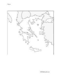
Map And Flag of Greece
In this Greece learning exercise, students color and study a Greek flag. Students also color and label a map of Greece. This could be used in writing a report.
Curated OER
Memorable Maps
Students draw an assigned map from memory about the United States or any other region they are studying. In this maps lesson plan, students draw a map from their memory at the beginning of the year, and do the same assignment at the end...
Curated OER
Map Study
In this geography instructional activity, students study the United States. Students respond to 6 multiple choice questions about the map.
Curated OER
Walking on Maps
Students are introduced to the various types of maps and their functions. As a class, they play a game similar to twister to review map concepts. They answer questions about the map and use the internet to view larger maps of the world.
Curated OER
Map Skills: Explorers, Continents, and Oceans
Third graders use a software program to make and label a map of the world. On the map, they locate the seven continents, oceans and the countries of Europe. They also draw the routes of Christopher Columbus, Juan Ponce de Leon and...
Curated OER
Where in the World Is Mexico?
Learners practice map-reading skills as they locate Mexico and its cities on a world map. By creating a puzzle out of a map of Mexico, students engage in a meaningful hands-on activity to help them explore that country's geography.
Curated OER
The Mekong River
Junior geographers explore the region through which the Mekong flows, its pathway, the landscape, how people depend on the Mekong, and future uncertainties. They apply the five themes of geography to examine the region. They create a...


