Curated OER
Regions of the United States
Students explore the regions of the United States. In this geography lesson, students read the text When I Was Young in the Mountains and compare the setting of the story with their geographical setting. Students use a physical map to...
Curated OER
United States Map- State Capitals
Students explore the state capitals. In this geography lesson, students use a political map to identify the state capitals and place post-it notes on various capitals.
Curated OER
Reef Attack
Students identify the locations of coral reefs. In this oceanography lesson, students use the Coral Reefs website to locate the coral reefs on a world map and discuss ways to help protect the coral reefs.
Curated OER
Using the Internet to Learn About Marine Life in our Area
Students explore how living things interact with their environment. They research marine life that is studied by Mote Marine Laboratory. Students track sick and injured marine animals. They explore the red tide and the geography of Florida.
Curated OER
Bringing Illinois into the Curriculum
Students of all ages are introduced to the geography of Illinois. Depending on the grade level, they participate in different activities which allow them to discover Illinois in the past and present. They examine the animals and...
Curated OER
I Can Compass, Can You?
Young scholars discover how to use geographic tools. In this compass lesson, students identify cardinal directions by appropriately using compasses along with a number of various maps.
Curated OER
Mapping Districts
Students become literate in their use of maps. For this 2010 Census lesson plan, students visualize census data on maps, use map keys to read population maps, and explore the concept of population density.
Curated OER
Mapping Districts
Young scholars use maps to learn about the U.S. Census. In this 2010 Census lesson plan, students visualize census data on maps, use map keys to read population maps, and explore the concept of population density.
Curated OER
Lesson 2: Mapping Sub-districts
Students learn more about the census. For this mapping sub-districts lesson plan, students visualize census data on a map, use a map key to read a population map, and better understand the concept of population density.
Curated OER
The Arkansas State Flag
Young historians take a look at the history of the Arkansas state flag. Pupils color, cut, and paste together their own versions of the flag. They learn about the meaning of the flag's colors, and what the various symbols on the flag...
Curated OER
Lori Schmidt's Lovely Lesson
Young scholars color code a world map by region to show the different amphibians and reptiles that live there. They discuss the Nile Crocodile, Snapping Turtle, Komodo Dragon, Indian Python, and Lacertidae. When completed, they create a...
Curated OER
Celebrate Your Heritage
Students investigate what countries their ancestors originally came from and locate them on a world map. They use a map to plot the ancestral path that has led to their hometown. They create a travel log outlining facts/data about...
Curated OER
Riding With Alice
Student listen to Don Brown's, Alice's Grand Adventure before discussing cross country travel. They trace Alice's travels on an outline map of the US and focus on the state of Indiana. They color and label the counties that Alice...
Curated OER
Exploration of the Americas
Third graders demonstrate knowledge of exploration by naming and describing accomplishments of explorers. They use the internet to find corresponding information on the explorer and fill in a chart that is provided. Students also...
Little 10 Robot
YodelOh™ Math Mountain
Save the yodeler from falling off the top of the mountain using basic math skills. Have endless fun while developing fluency with addition, subtraction, multiplication, and division.
Curated OER
Get Your Kicks on Route 66
Learners research when and why Route 66 was started and how mom and pop businesses fit in with Route 66. Students associate what they've learned with the song.
Curated OER
Mills of New Hampshire
Students locate mill sites on a New Hampshire map. They describe who worked in the mills and their working conditions. They examine the environmental impact of the mills and work together to find out more information about mills.
Curated OER
Technology Integration
Third graders describe and locate the five geographical regions of the state of Virginia. Using that information, they organize the descriptions in a database they created. They are graded based on accuracy and spelling all noted on a...
Curated OER
Using Timelines
Students explore how to create a simple timeline and make one of their life.
Alabama Learning Exchange
Origami Geometry
Origami is an excellent way to combine Japanese culture, art, and geometric shapes into one engaging instructional activity! Scholars begin by listening to the story Sadako and the Thousand Paper Cranes and learn the origin of...
Curated OER
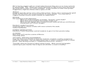
Jr. Chef Club Super Snacks Lesson 6
Students explore healthy snacks. In this nutrition and cooking lesson, students observe and identify food groups on USDA's MyPyramid food guide. Students discuss how fiber helps our digestive system and follow a recipe using yeast to...
Curated OER
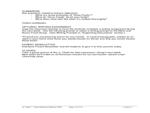
Delicious Dinners by Jr. Chefs
Students create a protein-rich dinner. In this nutrition lesson, students brainstorm foods that are rich in protein. Students make burritos and identify the color of meat when it is cooked thoroughly.
Curated OER
My Little Island
Students engage in a lesson plan which features a video trip to the Caribbean Island of Montserrat to teach about the human and physical characteristics of place and human/environmental interactions between the two. Students create their...
Curated OER
Follow The Road to Riches
Students examine the various events occurring at the time of the Gold Rush. They see archival photographs and hear historians talk about this era. They create a time line in order to facilitate thinking about this region during the...
Other popular searches
- Us Geography Climate
- Us Geography Skills
- Geography Map Skills Us
- Us Geography Pdf
- Us Geography Scavenger Hunt
- Us Geography Northeast
- Us Geography Activity
- Us Geography Slavery
- Us Geography and Economics
- Geography Us
- Us Geography West
- Us Geography Southeast


