K12 Reader
Location, Location, Location
Why do some places in the world have more people living there than other places? Learn about the ways the countries have formed around natural resources with a reading comprehension activity. After kids read a short...
Curated OER
Edible Resource Maps
Third graders work in groups to create an edible resource map showing locations of at least five resources in the United States. Students research on the internet different regions and the resources that are found in those areas. They...
Curated OER
Internet Fact Hunt at the "Fact Monster" Web Site- May #1
In this Internet fact hunt worksheet, students access the "Fact Monster" web site to answer 5 multiple choice questions. They answer US history, science, and geography questions.
Curated OER
Our 50 States
Students identify the location of the 50 states using an interactive map. They practice geography skills by playing a fun game. Pupils become familiar with the state abbreviations for the US states. Students become familiar with the...
Curated OER
United States Map- Map Legend/City Symbols
Students investigate the United States map. In this map skills geography lesson, students explore city symbols on the map legend and identify them. Students use post-it notes to mark various symbols.
NOAA
Why is Hawaii's Ocean Important?
Studying the oceans? Focus on Hawaii's ocean with a resource packed with activity-based worksheets. Everything from products that come from the ocean to the abundance of plants and animals that call the ocean their home, Hawaii's ocean...
Curated OER
3rd grade social studies
For this social studies worksheet, 3rd graders complete multiple choice questions about Native Americans, sequencing history, geography, and more. Students complete 20 questions.
Curated OER
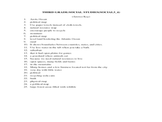
Third Grade Social Studies-Multiple Choice Activity
For this grade 3 social studies worksheet, 3rd graders complete a set of 25 questions about a variety of topics including geography, types of communities, map and questions about the environment.
Curated OER
Check My Writing: Diversity of Learners Adaptation
Young scholars explore different spellings of the same words within the English language, as well as different words for the same thing with the international pen pal classroom. They become familiar with units of measure and time. ...
Curated OER
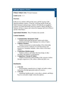
Ojala que viajemos a Mexico!
Learners research the names and locations of Spanish speaking countries throughout the world. They use a world map to become familiar with the locations of these countries and use the Internet to conduct further research. They sing...
Curated OER
Regions of the United States
Students explore the regions of the United States. In this geography lesson, students read the text When I Was Young in the Mountains and compare the setting of the story with their geographical setting. Students use a physical map to...
Curated OER
Water Features - Lesson 2 - U.S. Political Map Grade 4-5
Students locate water features on maps. In this geography lesson, students complete worksheets that require them to identify water features on a U. S. political map.
Curated OER
United States Map- State Capitals
Students explore the state capitals. In this geography lesson, students use a political map to identify the state capitals and place post-it notes on various capitals.
Curated OER
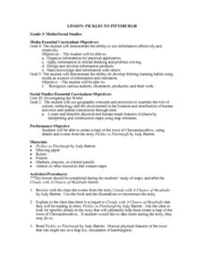
Pickles to Pittsburgh
Third graders explore the geography in the book "Pickles to Pittsburgh" by Judy Barrett. They read the story and identify the physical features of the town, discuss the elements included on a map, and create a map of the town of...
Curated OER
United States Map - Lesson 11
Young scholars explore lakes of the United States. In this geography lesson, students identify noteworthy lakes on a map of the United States.
Curated OER
Using the Internet to Learn About Marine Life in our Area
Students explore how living things interact with their environment. They research marine life that is studied by Mote Marine Laboratory. Students track sick and injured marine animals. They explore the red tide and the geography of Florida.
Curated OER
I Can Compass, Can You?
Young scholars discover how to use geographic tools. In this compass lesson, students identify cardinal directions by appropriately using compasses along with a number of various maps.
Curated OER
Mapmaker, Mapmaker, Make Me a Map
Second and third graders practice with basic map skills. They create their own map including a legend and a compass rose. This fabulous plan has many excellent websites linked which allow learners to explore maps of all kinds; including...
Curated OER
The Arkansas State Flag
Young historians take a look at the history of the Arkansas state flag. Pupils color, cut, and paste together their own versions of the flag. They learn about the meaning of the flag's colors, and what the various symbols on the flag...
Curated OER
Exploration of the Americas
Third graders demonstrate knowledge of exploration by naming and describing accomplishments of explorers. They use the internet to find corresponding information on the explorer and fill in a chart that is provided. Students also...
Curated OER
The Potential Consequences of Climate Variability and Change
Learners analyze the impact of climate variability and change utilizing a broad span of topics over a wide range of grade levels. This three lesson unit is easily adapted for the various instructional levels listed.
Curated OER
Moon Mining
Go on a moon mining expedition from the safety of your classroom with this space exploration simulation. Using simple models of the moon's surface prepared ahead of time by the teacher, young scientists are challenged with locating and...
Curated OER
Corn Exports Visually
Learners study imports and exports and the countries that import the most corn from the U.S. They construct mini paper corn plants and label a map with these plants to represent the amount of corn the U.S. exports to countries around the...
Curated OER
Technology Integration
Third graders describe and locate the five geographical regions of the state of Virginia. Using that information, they organize the descriptions in a database they created. They are graded based on accuracy and spelling all noted on a...


