Mr. Printables
Map of The USA Jigsaw Puzzle
Encourage young learners to explore the United States with this printable map puzzle. A fun activity that engages children in learning US geography.
Curated OER
U.S. Geography: The West
Students explore the national parks of the American West. In this geography skills lesson, students watch "U.S. Geography: The West," and examine print and Internet sources about the national parks found there. Students feature their...
Curated OER
U.S. Geography: The South
Young geographers complete a research project. They list the physical features found in the American South. They then discuss the economy, culture, and geography found in the South. They work in groups to research one of the five...
Curated OER
Discovering American Symbols
Help youngsters get to know their states and capitals, explore their own country, and study American symbolism. They take a "trip" across America collecting symbols, images, and information about each state as they go (through text and...
Curated OER
Geography Experience: Low Vision
The world is a big and beautiful place; but how do you begin to understand it when you have low vision? Here is a great set of ideas focused on transforming any small room into a sensory paradise, themed to incite understanding about...
Curated OER
US Geography, The Blues
This instructional activity enables teachers to use blues styles and performers to think about various geographical regions of the United States. By studying different blues styles from the Mississippi Delta, Texas, and the Piedmont...
Little 10 Robot
YodelOh™ Math Mountain
Save the yodeler from falling off the top of the mountain using basic math skills. Have endless fun while developing fluency with addition, subtraction, multiplication, and division.
Fremont Unified School District
4th Grade California Relief Map Project
Bring life to your next California geography lesson with this great project! Learners design a three-dimensional wall relief map of California, painting and decorating regions using a variety of materials and labeling major geographical...
Happy Housewife
State Notebooking Pages
When learning about US geography, it can hard to remember facts about 50 different states. Help your young scholars organize all of this information with a collection of easy-to-use note-taking guides.
Curated OER
Names and Places
Students explore where jobs are done. In this careers and geography lesson, students locate places in Canada on a map and list jobs that are done in their area of Canada. Lesson includes extension and differentiation ideas.
Curated OER
N is for Natural State
For any pupils who live in the state of Arkansas, this would be a fabulous educational experience to help them get to know their state better. Through the use of activities in literature, art, mathematics, science, social studies, and...
Curated OER
Map Skills
Thirds graders reinforce that a map is a drawing that shows what a place looks like from above. They use a map key and symbols to create a map of the school and its neighborhood.
Curated OER
World Map and Globe-Equator, North Pole, and South Pole
Students identify the Equator, North Pole, and South Pole on a map. In this geography lesson, students use a world map and circle the North and South Pole. Students locate the Equator on a globe and use a map marker to highlight it.
Education World
The African American Population in US History
How has the African American population changed over the years? Learners use charts, statistical data, and maps to see how populations in African American communities have changed since the 1860s. Activity modifications are included to...
NOAA
Why is Hawaii's Ocean Important?
Studying the oceans? Focus on Hawaii's ocean with a resource packed with activity-based worksheets. Everything from products that come from the ocean to the abundance of plants and animals that call the ocean their home, Hawaii's ocean...
Curated OER
Physical Features
Students draw physical land features using ClarisWorks or Kid Pix, write their definitions, create slideshow, and create class geography book.
Curated OER
Our Country's Geography
Third graders study geography. In this United States landforms lesson, 3rd graders create a map of the U.S. made out of dough. They use various edible treats to mark the country's capital, the plains, the mountains and the rivers &...
Curated OER
Abigail Adams: Integrating Social Studies and Language Arts
Third graders increase reading strategies while learning about Abigail Adams and her role in history. In this Abigail Adams instructional activity, 3rd graders read about the American Revolution and Abigail Adams using all the balanced...
Curated OER
People Change the Landscape
Students examine ways in which humans have brought change to the natural environment. In this ecology and literacy lesson, students listen to the book Island Boy by Barbara Cooney. Students observe and define map-reading vocabulary as...
Curated OER
United States Map- Map Legend/City Symbols
Students investigate the United States map. In this map skills geography lesson, students explore city symbols on the map legend and identify them. Students use post-it notes to mark various symbols.
Curated OER
World Map and Globe - Four Main Directions
Students study the four main directions on a map. In this map lesson, students locate the North and South pole, and learn the four cardinal directions. They use the compass rose on a map to help with the directions. (Map is not included...
Curated OER
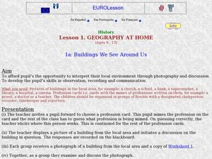
Geography at Home: Buildings We See Around Us
Students explore architecture. In this architecture lesson, students examine photographs of buildings in their communities. Students collaborate to discuss their observations regarding the buildings. Students record their observations in...
Curated OER
U.S. Geography: The Northeast
Students investigate U.S. Geography by creating a map in class. In this natural resource lesson, students create a map of the United States and research the Northeast based on their resources and recyclable materials. Students...
Curated OER
Social Studies: Looking at Regions
Quiz your 3rd graders on why we have regions. This regions quiz includes 16 questions on why and how we group areas into regions based on physical features, culture, politics or religion. A class discussion on technology completes this...


