Curated OER
Canada, O Canada
Students study the similarities and differences between Canada and the United State in this unit. They examine geography, government and culture as they "travel" through Canada.
Curated OER
Introduction to the Civilization of Ancient Greece
Students realize Greece's location in relation to the previously learned civilizations and learn the vocabulary needed for this unit of study. They use the interactive SMART board to locate places and learn necessary information of...
Curated OER
Earth at Night
Students examine the Earth at night. In this geography lesson, students identify the continents at night using various Internet Web sites. This lesson may be adapted for use with middle school and high school students.
Curated OER
This Is Tanzania
Students study the volcanic history and the wildlife of Tanzania. They examine how most Tanzanians live on a subsistence agricultural economy.
Curated OER
Newport Weather Project
Learners study weather and climate patterns using computer and Internet resources. They collect temperature information and share it with other classes via e-mail using graphs
Curated OER
Chinese New Year
Students complete a variety of activities as they study Chinese New Year and the Chinese Zodiac. They act out a story of the Chinese Zodiac. They make several crafts including Chinese lanterns and paper fortune cookies.
Curated OER
Ojala que viajemos a Mexico!
Learners research the names and locations of Spanish speaking countries throughout the world. They use a world map to become familiar with the locations of these countries and use the Internet to conduct further research. They sing...
Curated OER
Continents and Critters
Students investigate and identify the continents of the world. They identify and locate the seven continents on a map, and label a coloring page of a world map. Students then conduct research on an assigned continent, and write and...
Curated OER
Name That Continent
Students practice locating the seven continents, four hemispheres, and four oceans using a large world map and a review song. They also import a world map to the Kid Pix computer program then type in proper labels on the map. There are...
Curated OER
Point Me to Puerto Rico
Students research the physical features and geography of Puerto Rico as well as locate it on a world map and identify its major characteristics. Pictures and postcards are shown to each class for a visual connection to Puerto Rico as...
Curated OER
Of Maps and Worldviews
Students explore Ptolemy's world map as an expression of the Renaissance view of the world.
Curated OER
This Is Tanzania
Young scholars begin the lesson by locating Tanzania on a world map. While reading an article, they note what the author's opinion is of the people who live there and discover the connection the people have with the land. They examine...
Curated OER
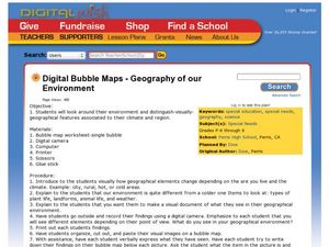
Geography of Our Environment
Students explore geographical elements. In this geographical elements lesson, students create a map showing the geographical elements in their area. Students take pictures of these elements to glue to their map and present it to the class.
Curated OER
Social Studies:
Learners identify various types of breads fromother countries and locate them on maps. In small groups, they make story maps of books that mention bread and make books resembling sandwiches. Students have a bread tasting party and...
Council for the Curriculum, Examinations and Assessment
Victorian Historians
Take the class back in time to the Victorian Era! The resource provides a plethora of activities that create experiences for scholars in class. Some activities include a fun fair, viewing the starry-night painting, and even experiencing...
Curated OER
America Grows - Trailblazers Pave the Way
Students study the time period after the Revolutionary War when people were striving to move away from the coastal areas and look for pathways to the west. Westerward expansion is a central theme and students use a variety of resources...
Curated OER
Rivers and Streams
Students research the rivers, streams and water bodies of Hawaii. They read a variety of books, play Bingo with water-related terms, create and maintain water-themed journals, view videos, conduct Internet research and participate in a...
Curated OER
Planning for the Voyage - Pilgrim Study Unit
Students locate Plymouth, MA, Hudson River, Cape Cod, Holland and England on a map. They identify the reasons the Pilgrims came to the New World and explain how the investors and the colonists would each benefit from a new colony. After...
Curated OER
"Hi" in Hieroglyphics
Young scholars locate Egypt on a world map. They discover the use of the ancient writing system of hieroglyphics. They practice writing their name and translating words to hieroglyphics
Curated OER
Natural Resources
Young scholars use magazines and newspapers to examine the Earth's natural resources. They identify ways that natural resources are protected, threatened, managed and mismanaged. They find the location of each story on a world map and...
Curated OER
Where Is Rome?
Third graders discover Ancient Rome through maps and worksheets. In this world history activity, 3rd graders locate Rome on a world map and identify the scope of the Roman Empire. Students label an entire map of Italy after...
Curated OER
Paper Mosaics
Third graders read the story "Pompeii...Buried Alive." They locate Italy on a world map and define the term artifact. Students conduct an artifact dig on the playground. Students study the characteristics of mosaics and their...
Curated OER
What on Earth is a Biome?
Students explore organisms and their environments. They examine change over time
demonstrate an understanding of physical positions on Earth. They survey earth's diversity, write a report, fill in a data table created on the...
Curated OER
Locating Places
Students demonstrate how to use the map grid system. In this map skills lesson, students are given coordinates to locate several locations on a world map. Students use the map grid system to identify these locations.

