Curated OER
Introduction to the Maya Civilization
Students investigate the Maya civilization. In this Maya civilization lesson, students view a PowerPoint presentation and record notes. Students explore several important landmarks, such as the "Magician's Palace" at Uxmal.
Curated OER
Tracing Highs and Lows in San Francisco
On a topographic map, students identify the scale bar, north arrow, and contour interval. They then locate a hill on the map and make note of the contour lines. Students then locate other places with similar contour line patterns....
Curated OER
We're on the Map!
Students identify a variety of topographic map symbols. They make generalizations about an unidentified community by reading and interpreting map symbols.
Curated OER
Regions of Virginia
In this geography worksheet, 5th graders identify the regions of the state of Virginia and sort them according to location. Then 10 questions focus upon the specifics of different regions.
Curated OER
Agriculture & Alaska's Economy
Students examine Alaska's agriculture numbers from previous years. They answer questions based on Alaska's production levels.
Curated OER
Flat Stanley Travels to U.S. Regions
Fourth Graders read the book Flat Stanley by Jeff Brown. In the story a bulletin board flattens the main character. He is then sent in an envelope to a friend in California. During a fantasy genre language arts unit, groups of students...
Curated OER
Where Do I Live?
Students gain a better understanding of the population of the region they live in by comparing U.S. census data on the internet.
Curated OER
Eastern Europe in 1989
Major political shifts occurred in Eastern Europe during the late 1980s. Locate, identify, and label 90 different areas on the provided map. A list of cities, countries, and water ways is provided.
Curated OER
The Expansion of Islam to 750
Track the expansion of Islam throughout the Mediterranean and Near East. Locate and label 17 different areas that adopted the tenets of Islam.
Curated OER
The Crimean War
Use the list of cities, countries, and water ways to correctly label a map of the regions associated with the Crimean War. There are approximately 20 locations to locate and identify.
Curated OER
Decolonization in Asia
Pin point areas in Asia that went through decolonization and regained independence from colonial rule. There are 32 countries and bodies of water to identify on the provided map.
Curated OER
Learning Lesson: The Rain Man
Learners participate in a demonstration showing the concept of precipitation. They view the hydrologic cycle and identify its stages, and discuss flash flood safety at the end the instructional activity.
Curated OER
Clothes World: Beginning ESL lesson
Take a tour around the world with this ESL presentation about international clothes. From South African tribal wear to Scottish kilts, your English learners will appreciate the vivid pictures and clear country labels for each slide. The...
Curated OER
The Spread of Printing
Document the spread of printing, which occurred in the 1500s. Use the provided list of water ways, countries, and cities to label specified locations on the map.
Curated OER
European Language Groups, 1850
Document the linguistic diversity and major language groups common to Europe in 1850. A map and a list of regions, countries, and water ways is provided.
Curated OER
The Barbarian Invasions of the Roman Empire
Fifteen different locations to map and correctly label. Use the provided list to show major areas of Barbarian invasions occurring during the Roman Empire.
Curated OER
The Netherlands: map
Use the provided list to label a map of Europe and the Netherlands. There are 77 locations to label. You have to know your stuff to fill out this challenging map.
Curated OER
Global History & Geography: Latin America
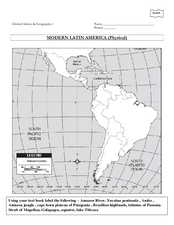
The instructions say to use a text-book to label 11 different regions in modern Latin America. If a text-book is not available a map can be found on-line and printed for student reference.
Curated OER
Ancient Egypt Geography
Nine questions to answer and one map to read. Seventh graders will use the map of Ancient Egypt to practice map reading skills and build a visual image of Ancient Geography.
Curated OER
Map of Africa
Using a completed map (not provided), pupils will use this map to fill in the geographic features of Africa. An appropriate map can be printed using the Internet and placed under a document camera for the class to reference.
Curated OER
Tides at the Battery, NY
Skill in using Excel and increasing proficiency in manipulating data are challenged with this data analysis work. A web link supplies data and step-by-step instructions help learners create a graph. There are many extension activities...
Curated OER
Leaf Peeping at Sharpe!
While this lesson focuses on observations made at Sharpe Reservation, another area could be used. Learners map out a route from their class to a nature preserve. Then, they identify the color and features of the leaves, and describe...
Curated OER
Rivers Run Through It
Using a relief map of New York State, learners answer questions about the distance between different cities, identify bodies of water, and more. First, they discuss vocabulary related to the Hudson River area. Then, they complete a...
Curated OER
Utah History & Geography
Fourth graders practice large digit addition. Students become familiar with column addition. Students develop knowledge of counties and county seats.


