Curated OER
Latitude and Longitude
In this latitude and longitude worksheet, learners find a set of 7 coordinates on a map. An answer key is included; a website reference for additional resources is given.
Scholastic
The Seven Wonders of the Ancient World
The Colossus of Rhodes, the Hanging Gardens of Babylon, the Lighthouse of Alexandria. Young archeologists investigate the Seven Wonders of the Ancient World, map their locations, and match their names with brief descriptions and images....
Curated OER
United States: Physical Features Fun
In this map worksheet, students color and trace eleven listed features on a map of the United States. Students answer six additional questions about the map. A United States map is not provided. However, websites are provided to find...
Curated OER
United States Map Quiz
In this online interactive geography quiz worksheet, students examine the map that includes all 50 states of the United States. Students match the names of the 50 states to the appropriate places on the map.
Curated OER
Kazakhstan Outline Map
In this blank Kazakhstan outline map worksheet, students study the political boundaries of the country. This outline map may be used for a variety of geographic activities.
Curated OER
Blank US Map
In this blank outline map worksheet, students study the physical boundaries of the 50 states that make the United States. This outline map may be used for a variety of geographic activities.
Geography 360°
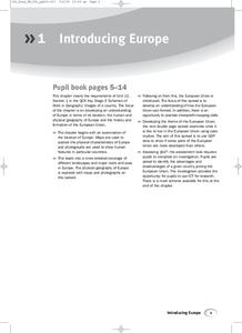
Introducing Europe
Provide your learners with a comprehensive introduction to Europe with this great set of worksheets. Map activities include matching European countries to their capitals and places on a political map, as well as exploring different...
Curated OER
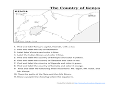
The Country of Kenya
In this map completion activity, students observe a map and map scale of Kenya to find and label bodies of water, cities, countries, and the equator. Students answer 11 questions.
Curated OER
Mexico Map
In this blank outline map learning exercise, students study the political boundaries of the North American country of Mexico. This map may be used in a variety of classroom activities.
Curated OER
Canada Outline Map
In this blank outline map activity, students study the political boundaries of the North American country of Canada as well as those of the provinces located there.
Curated OER
Canada Outline Map
In this blank outline map worksheet, learners study the political boundaries of the North American country Canada as well as those of the provinces located there. The capital cities of the provinces are listed.
Curated OER
Canada Outline Map
In this blank outline map activity, students study the political boundaries of the North American country of Canada as well as those of the provinces located there.
Curated OER
Canada Outline Map
In this blank outline map worksheet, students study the political boundaries of the North American country of Canada as well as those of the provinces located there.
Curated OER
Mexico Map
In this blank outline map worksheet, students study the political boundaries of the North American country of Mexico. The capital cities of each state are denoted with stars.
Curated OER
Mexico and Central America Map
In this blank outline map worksheet, students study the political boundaries of Mexico and Central America. Each of the counties is labeled and the capital cities are starred.
Curated OER
South American Outline Map
In this blank outline map worksheet, students study the political boundaries of the continent of North America and those of the countries located there.
Curated OER
Europe Outline Map (Labled)
In this blank outline map worksheet, students study the political boundaries of the labeled European nations.
Curated OER
States and Capitals - Lesson 4 - U.S. Political Map
In this U.S. state capitals worksheet, students identify the capital cities of the 50 states using the latitude and longitude coordinates provided.
Curated OER
Telling Direction - Compass Rose
Keep it simple when practicing directions using this compass rose labeling instructional activity. Learners read a brief text describing the cardinal and intermediate directions, then fill in the compass themselves. They can get...
Curated OER
North America Outline Map
In this blank North America outline map worksheet, students study the political boundaries of the continent. This outline map may be used for a variety of geographic activities.
Curated OER
U.S. Geography: California
In this map skills about the state of California worksheet, students locate and label specific places and areas and create a map key and symbolize the economy and areas of personal interest. Students answer 5 questions.
Curated OER
U.S. Geography for Children: The Northeast
In this map skills of the northeastern United States worksheet, students observe an outline map, locate and label the states, and designated landforms and bodies of water; and create symbols and a map key for sources of economy and other...
Curated OER
U.S. Geography for Children: State Capitals
In this United States map skills instructional activity, students locate and label specified states and their capitals, and create icons and a map key to show something for each state that is famous. Students answer 5 questions.
Curated OER
School-Home Link: Maps
In this atlas and parent communication form worksheet, students use an atlas to find several things: the capitol city of Japan, the number of countries in Africa, where to buy a newspaper, the names of Presidents of the United States,...


