Curated OER
Let's Go to Korea
Students prepare for travel to Korea. For this Korean travel lesson, students discover to steps of obtaining passports, airline flight options to Korea, and study places to see and visit in Korea.
Curated OER
Regions of Virginia
In this geography worksheet, 5th graders identify the regions of the state of Virginia and sort them according to location. Then 10 questions focus upon the specifics of different regions.
Montana State University
Meet Mount Everest
Learning about one landform might seem boring to some, but using the resource provided practically guarantees scholar interest. The second in a sequential series of eight covering the topic of Mount Everest includes activities such as a...
Curated OER
George Washington Teaches Map Directions
Learners follow teacher given directions, either oral or written to plot points on a grid to create a profile of George Washington. They apply cardinal and ordinal directions to find the points on the grid.
Curated OER
Oaxaca Geography and the Climate
Students examine the diverse geography of the country of Mexico and the state of Oaxaca. They analyze how the geography of the state of Oaxaca affects its climate and create maps showing the different climate areas.
Curated OER
Geography of the Study of the Spanish-speaking People of Texas
Students identify the physical features, demographic characteristics, and history of the four Texas towns featured in Russell Lee's photo essay, "The Spanish-Speaking People of Texas." They conduct Internet research, and create a travel...
Curated OER
Lesson 1: Map Data and the Census
Students learn about the history of the census. In this U. S. Census lesson plan, students develop an understanding about how the United States Constitution grants and distributes power and discover how the spatial organization of...
Curated OER
Tooling Around Arizona: Reading Arizona Maps
Students study geography. In this Arizona maps lesson, students develop their map reading skills. They have class discussions and work independently with various copies of Arizona maps to practice those skills. This lesson mentions...
Curated OER
Who's The Boss?
Upper elementary and middle schoolers research and analyze some different types of governments. Democracies, Monarchies, and Dictatorships are some of the types that are looked at. Learners use the Internet to gather information that...
Curated OER
Rivers that Flow from the Continental Divide: The Journey of Two Rivers
Learners explore river routes. In this social studies lesson, students trace the route of a river from its source and discuss the Continental Divide. Learners draw the route the river takes and name the states it flows through. Students...
Curated OER
A River Through Time
Students explore how construction of a dam on the Gila River affected the lifestyle of Pima Indians. In this social studies lesson, students locate the Gila River and the Coolidge Dam. Students record dates on a timeline and discuss how...
Curated OER
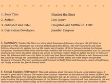
Number the Stars
Students read Number the Stars. For this social studies lesson, students read the story and use a map of western Europe and identify the countries involved in the war. Students locate the cities of Denmark that are discussed in the story.
Curated OER
MAP GRIDS, CLIMATES AND HEMISPHERES
Students compare/contrast the grid and latitude/longitude system used on a globe. They describe the areas which are considered to be a tropical, temperate, and polar, based on knowledge of climates.
US Mint
Absolutely and Relatively: The Puerto Rico Quarter Reverse
How much does your class know about Puerto RIco? How much can they learn from the back of a 2009 quarter? Use the coin, part of a series of quarters that depict US territories, to teach learners about the geography, culture, and history...
Curated OER
Tracking Fall's Falling Temperatures
Young meteorologists track weather from day to day and record results on graphs, maps, or other places. They see firsthand how weather temperatures trend cooler as fall progresses and practice grade-appropriate skills in geography (map...
Curated OER
Lost in Uruguay
This quiz on the culture and geography of Uruguay may serve best as a sponge activity for those who have finished an assignment. Questions are multiple-choice, and each correct answer is worth 15 points. Quiz-takers must earn 1000 points...
Curated OER
World Projections
Students identify map projections and examine polar maps. In this map skills lesson, students use a flat world map to identify various projections and calculate the distances between locations by using a map scale.
Curated OER
Absolute And Relative Location
Students create a map that takes someone from school to their home using both relative and absolute locations. They assume the person using the map is unfamiliar with the area.
Curated OER
Geographical Background on the Valley of Virginia
In this social studies worksheet, students learn the geography of the Valley of Virginia (Shenandoah Valley) by reading the information and using the word bank of place names to label a detailed map.
Curated OER
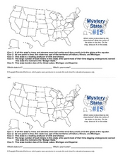
Mystery State #15
Do you know the name of the Badger State? Using five fantastic clues, your super sleuths will determine the name of mystery state number 15. A wonderful way to warm up the class!
Curated OER
Mystery State #2
Which is the mystery state for today? Using five super clues, your class will work to uncover which state is being described. They'll have no problem remembering facts about Nevada after this fun warm-up activity.
Curated OER
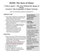
The Geography of Maine Tourism
Young scholars study topographical maps of Maine to identify the important physical features. They work in groups to create tourism pamphlet highlighting a region of the state.


