Curated OER
Japan: Images of a People
Students learn the geography of Japan and its location in reference to the United States.
Curated OER
Design Your Own Suburb
Students view and discuss urban and suburban scenes; and list the features of their ideal town and discuss whether these features can be found in cities and suburbs. They draw mental maps of a city and a suburb and brainstorm and list...
Curated OER
Louisiana Purchase
Students use maps, lecture and discussion to explore the unique contributions to the U.S. resulting from the purchase of the Louisiana Territory. They complete worksheets, label maps and participate in discussion groups.
Curated OER
To Walk the Sky Path
Fifth graders use maps of Florida. They locate places from a list on their map. Students use the places mentioned in the book, "To Walk the Sky Path," and locate them on the map. Students should have labeled a minimum of 10 places, and...
Curated OER
Route 66 And Population Patterns
Learners investigate the geography located along Route 66. They research how the population patterns change in certain areas along the highway. Students use the information in order to form hypotheses about how and why the population...
Curated OER
Touring the Regions of the United States
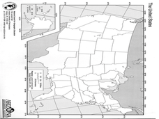
Fifth graders explore the regions of the United States. For this geography skills lesson, 5th graders examine the landforms, climates, and economies of the regions of the United States. Students conduct Internet research in order to...
Curated OER
The Mountain Community: Why Flagstaff?
Students identify geographical features that hindered or promoted settlement in the city of Flagstaff, Arizona. In this settlement lesson plan, students write a summary of what they learned and identify geographical features on a map.
Curated OER
Clothesline Sleuth
Fifth graders investigate the effect of North American colonization on human history. In this colonization lesson, 5th graders explore the global impact of colonization of North America. Students investigate the impact of geography on...
Curated OER
Natural Resources
Young scholars use magazines and newspapers to examine the Earth's natural resources. They identify ways that natural resources are protected, threatened, managed and mismanaged. They find the location of each story on a world map and...
Curated OER
Headin' West! The Life of a Pioneer
Students explore the life of a pioneer and the relationship between the concept of Manifest Destiny and pioneering. Students complete activities, maps, writing and reading to experience pioneer life. Handouts and worksheets are included...
Curated OER
Other Countries
Learners select a country and conduct research on the culture, population, geography, and government of their country. They conduct research using the Internet and a variety of resource books, and write and publish a report that...
Curated OER
Globe Lesson- The Revolutionary War
Students discover using globes. In this geography lesson, students use a globe to outline the original 13 colonies. Students also use a globe to measure the distance from London to New York City and determine how many days it would have...
Curated OER
Latitude and Longitude
Fifth graders study latitude and longitude. They estimate the latitude and longitude of their hometown and find the latitude and longitude of other cities using a map. They use a website to find out the cities' actual latitude and...
Curated OER
Land Bridge Theory
Fifth graders observe a map that includes where the land bridge was located and that its name was Beringia and look in the Social Studies books to read about the Land Bridge Theory. The class then brainstorms reasons why they think...
Curated OER
The 50 States
Fifth graders use maps and music to learn the 50 states. In this US Geography lesson, 5th graders map out a region of the United States and practice singing the song, The 50 States that Rhyme.
Curated OER
Population Change in Vermont, 1990-2000
Students improve their mapping skills and knowledge about population distribution and change in Vermont at the county level. They are divided into groups of two or four. Each group is given two county base maps and the population...
Curated OER
Continents and Critters
Students investigate and identify the continents of the world. They identify and locate the seven continents on a map, and label a coloring page of a world map. Students then conduct research on an assigned continent, and write and...
Curated OER
Movement of Native American Tribes 1830-1890
Students examine the movement of Native American tribes during the mid 1800's. For this American History lesson, students study two Native American tribes that live in the United States and complete a comparison/analyze project. Students...
Curated OER
Country Capitals
Students define the meaning of country capital. In this country capital instructional activity, students identify the symbol and find country capitals. Students locate and label capital cities on a map and insert the capital symbol.
Curated OER
Cities of the World
Students identify the symbol for cities on a political map. For this world map lesson, students identify specific cities on the World Political Map. Students should identify the country in which the city is located. Students discuss the...
Curated OER
Seas, Gulfs and Bays
Students define gulf, bay, and sea. In this bodies of water mapping instructional activity, students locate seas, gulfs and bays and explain how they knew which body of water it was.
Curated OER
Where in the World Am I: Latitude And Longitude
Students demonstrate their knowledge in using latitude and longitude measurements to find locations on a map, especially places in Hawaii.
Curated OER
Point Me to Puerto Rico
Students research the physical features and geography of Puerto Rico as well as locate it on a world map and identify its major characteristics. Pictures and postcards are shown to each class for a visual connection to Puerto Rico as...
