Curated OER
Discovering Dinosaurs: Planning your Summer Vacation
Young scholars use the online Atlas of Canada to gather information about places in Canada.
Curated OER
Nunavut, Our Communities
Learners locate the communities of Nanavut on a territorial map and identify community characteristics. They research the online Atlas of Canada
Curated OER
The Shot Heard Around the World
Fifth graders examine the events leading up to the beginning of the Revolutionary War. In groups, they put the events into chronological order and create a timeline. As a class, they discuss the reprecussions of the Stamp Act,...
Curated OER
Where in the World is Rubber?
Learners examine rubber. In this natural rubber lesson students identify a naturally producing rubber location and present a detailed description of a rubber producing country.
Curated OER
The Trail of Tears; Its Grief and Loss
Fifth graders trace the development and expansion of the US while studying the Trail of Tears. They examine the political factors and analyze the impact the Indian Removal Act had upon a society. They present a case for or against the...
Curated OER
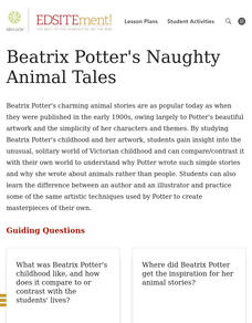
Beatrix Potter's Naughty Animal Tales
Learners gain insight into the unusual, solitary world of Beatrix Potter's Victorian childhood and can compare/contrast it with their own world to explain why Potter wrote such simple stories and why she wrote about animals rather than...
Curated OER
Country Capitals
Students define the meaning of country capital. In this country capital instructional activity, students identify the symbol and find country capitals. Students locate and label capital cities on a map and insert the capital symbol.
Curated OER
Journeys...The Voices of Change
Students trace the immigration patterns of their ancestors. They plot information on a world map, develop a timeline of target immigration patterns, research and write a report on immigration and participate in a class play.
Curated OER
Seas, Gulfs and Bays
Learners define gulf, bay, and sea. In this bodies of water mapping lesson, students locate seas, gulfs and bays and explain how they knew which body of water it was.
Curated OER
Westward Ho: The Difficulties of Emigrants Moving West
Students research the journey west of 19th century emigrants. In this pioneer lesson, students read the letters and diaries of a fictitious family traveling on the Oregon Trail. They mark their route on a US map, create a chart showing...
Curated OER
Controlling the Flow of the Colorado River: A Study of Dams
Students research and map the Colorado River and its dams and predict the effects of a dam on an area. They suggest reasons a dam would be built and compare the Colorado River system with other major river systems within the US and...
Curated OER
A Place Called Nepal
Students investigate maps of Nepal and then create their own to disover how human activity is influenced by terrain and climate. Students participate in a trek across Nepal simulation to imagine the challenges people have to face...
Curated OER
Let's Spice It With Pepper
Students identify and locate the areas in which pepper and spices orginated. On a map, they locate the areas and write the name of the spice that is found there. They use historical events to trace its route to the Americas. They...
Curated OER
Native Americans and Topography at Rose Bay
Students visit a wetland ecosystem. While they are there, students explore how to read topography maps of Rose Bay.
Curated OER
The Human Face of Flagstaff
Students make a brochure for Flagstaff, Arizona. In this geography lesson, students look at a map of Arizona and the Flagstaff Chamber of Commerce sheet to find natural and human features of the city. They create a brochure describing...
Curated OER
The Trail of Tears; Its Grief and Loss
Fifth graders are introduced to the removal of Native Americans along the Trail of Tears. In groups, they examine the political factors that caused this removal and its effect on society. To end the lesson plan, they discuss various...
Curated OER
From Sea to Shining Sea
Students study the geography of the United States of America. Students write letters, create travel brochures, make maps, graph population numbers, read fiction and nonfiction selections, complete KWL charts, and watch films.
Curated OER
Why Not Come to North Amercia?
Students examine the motives for French expansion into the New World, they evaluate primary source documents to determine who, what, when, where and why.
Curated OER
Number the Stars
Fifth graders examine threat to all people (particularly the Jews) resulting from the imposition of Nazi authority, and appreciate the courage exhibited by ordinary people acting out of conscience.
Curated OER
Early Growth and Expansion: Russia and Japan
Fifth graders examine the role of geography in both the political expansion of Russia and the isolation of Japan. They evaluate the costs and benefits of Russia's expansion. They complete a worksheet exploring Japanese feudalism and...
Curated OER
Island Countries
Students define the meaning of an island. In this island mapping lesson, students identify islands on the map. Students discuss the sizes of various islands.
Curated OER
Ticket to Ride
Students research a place they would like to visit. They write a report about that location that includes a map, the climate and other features that explain their desire to visit.
Curated OER
It's Happening, Where? Find the Absolute and Relative Location of News Articles
Students read newspaper articles. In this social studies lesson plan, students locate the latitude and longitude of the location where the news article takes place. Students write a summary of the news article.
Curated OER
On the Road Again": Moving People, Products, and Ideas
In this lesson students learn how to identify modes of transportation and communication for moving people, products, and ideas from place to place. Students also study the advantages and disadvantages of different modes of...
Other popular searches
- Political Map of World
- Blank World Political Map
- World Political Map Labeled
- Political Map of the World


