Curated OER
From North to South...Quebec's Forest Regions
Students identify and describe the different regions of Canada. With a focus on the forest regions, they use an atlas to locate the ecozones. They identify the characterstics of the climate and vegetation and the relationship between...
Curated OER
Buffalo Hide Paintings
To the Native American people living on the plains, the buffalo represented culture, art, sustenance, and survival. Explore the history of the buffalo with a social studies lesson, in which learners create a buffalo hide painting in the...
Curated OER
How Cultures Differ - Two Different Perspectives on the Same Even
Learners explore the effects of culture through the story Running by Peter Hessler. In this geography and cultural lesson, students act as newspaper reporters covering the story of the race. Learners write newspaper articles as reporters...
Curated OER
Alberta And Saskatchwan: the View in 1905
Students analyze the differences between maps 1905 and current maps of Alberta and Saskatchewan. They use maps from the Canadian Council for Geographic Education to complete a guided inquiry. This lesson also has many extension activities.
Curated OER
Nunavut, Our Communities
Students locate the communities of Nanavut on a territorial map and identify community characteristics. They research the online Atlas of Canada
Curated OER
Aboriginal Peoples And The Universals of Culture
Sixth graders research specific features of a province or territory of Canada. In this Canadian history lesson, 6th graders identify aboriginal culture areas on a map, identify cultural features represented in their region, and create...
Curated OER
Early Explorers Web Quest
Students use the Canadian atlas online to research early explorers and settlers in Canada. They also complete a Web Quest to gather information from maps. They make generalizations about the early settlement patterns as well.
Curated OER
Historical Indian Treaties and Aboriginal Population
Sixth graders navigate an online atlas of Canada and compare the land area of of historical Aboriginal peoples in Manitoba to present-day figures.
Curated OER
Exploring Ancient Greece
Sixth graders use play dough to create a relief map of Greece and through personal investigation and class discussion, draw conclusions about the impact of the geography of Greece on daily life and culture in Ancient Greece.
Curated OER
Memorable Maps
Students draw an assigned map from memory about the United States or any other region they are studying. For this maps lesson plan, students draw a map from their memory at the beginning of the year, and do the same assignment at the end...
Curated OER
Where in the World is Egypt?
In this geography worksheet, students investigate the location of the continent of Africa and the country of Egypt by studying a map of the region. Students color the map and locate Egypt.
Curated OER
European Explorers of North and South America
Sixth graders explore the connection between the geography of America and the migration of the Native Americans to the American continents to the future conquering of the continents by the Europeans. They discuss the causes and effects...
Curated OER
Enduring Cultures
Students research the art, dance or a game from the Pacific Northwest Coast Aborigines. In this Canadian Cultures lesson, students view a PowerPoint about the Inuits. Students choose a game , type of artwork or dance to research....
Curated OER
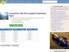
Countries w/ Longest Coastlines Quiz
In this online interactive geography quiz worksheet, learners respond to 20 identification questions about world countries with the longest coastlines. Students have 4 minutes to complete the quiz.
Curated OER
Nunavut, Our Communities
Young scholars research the Online Atlas of Canada to locate the communities of Nunavut. Students examine the geographic area and characteristics of the communities.
Curated OER
Population and Productivity: Two P's in a Pod
Students investigate the link between countries' population growth rates and levels of industrialization. They observe that, over time, as a country becomes more industrialized, its population growth rate decreases.
Curated OER
Modern Japan Unit Plan
Sixth graders research modern Japanese culture, society and traditions, examine relationship between Japanese culture and its environment,
compare and contrast Japanese Society with Canadian Society, compare lives of people in Japan with...
Curated OER
Exploring Canadian Heritage
Learners use the online Atlas as a research tool to find information on national parks and world heritage sites.
Curated OER
Social Studies: Canadian City Comparison
Students research Canadian population distribution while comparing and contrasting the quality of life in two cities. They discuss issues and problems that cities and rural towns face. Students apply various methods, such as graphs and...


