Curated OER
World: Political Map
In this world political outline map worksheet, students examine boundaries of each of the countries in the world. This map not is labeled.
Curated OER
World Pacific Map
In this world Pacific projection outline map worksheet, students examine boundaries of each of the countries in the world. This map not is labeled.
Curated OER
Africa & Asia: Physical Map
In this African and Asian physical map worksheet, learners investigate the major landforms and bodies of water located on the African and Asian continents.
Curated OER
American States and Their Capitals
In this United States capitals worksheet, students match the 15 states on the left side of the sheet to their respective capitals on the right side of the sheet.
Curated OER
Adapting and Modifying
In this environment worksheet, students read 10 scenarios and identify them as adaptations or modifications to one's environment.
Curated OER
Introduction to World Religions: Islam
Sixth graders explore religion by viewing a presentation in class. In this global culture lesson, 6th graders define the Islam religion and the stories that accompany it. Students read the story "Muhammad" by Demi and view an Internet...
Curated OER
Geography: Lengths, Perimeter, and Area of Similar Objects
Sixth graders explore characteristics of similar objects. Using attribute blocks, they explore the ratios of the perimeter, area and side length in similar shapes. They calculate and compare the area of shapes.
Curated OER
Where Do Hurricanes Happen?
In this hurricanes worksheet, students label the 6 different regions that hurricanes and tropical cyclones occur around the world.
Curated OER
Google Earth
In this Google Earth learning exercise, students access the Google Earth website and find the latitude, longitude, and elevation for their house and school. Then they do the same for a variety of world locations. This learning exercise...
Curated OER
U.S. Political Map
In this political map worksheet, students use the map of the United States and the 7 cities to measure the straight-line distance between the cities. Students add the total number of miles traveled and write their answers in the spaces.
Space Awareness
Let's Map the Earth
Before maps went mobile, people actually had to learn how to read maps. Pupils look at map elements in order to understand how to read them and locate specific locations. Finally, young cartographers discover how to make aerial maps.
Curated OER
Lesson: Culture & Change
Can a palace door be art? Can it facilitate an understanding of people and places? It certainly can! Using a palace facade as a lesson catalyst, kids will discuss geometric patterns, the kingdom of Swat, and geopolitical themes. They...
Curated OER
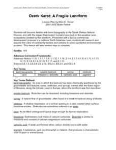
Ozark Karst: A Fragile Landform
Young geologists become familiar with the Karst Topography in the Ozark Mountains. They study how human activity has affected the cave ecosystem. They conduct a simulation in which a large development is proposed in the area, and they...
Curated OER
State or Region Project
Invite your youngsters to learn about a state or region through their choice of a creative project. The resource lists 15 project options that range from a 3-D map of the area, to a puppet show about the region. Pupils can also propose...
Curated OER
A Touch of Green: St. Patrick's Day in the Classroom
Try these ideas to add some Irish flair to your classroom this St. Patrick's Day.
Curated OER
Geographically Speaking
Young scholars play a matching game to reinforce the retention of vocabulary words. In this geography lesson, students watch a PowerPoint to define vocabulary words associated with geography, play a memory game with the words, and...
Curated OER
Beyond Demographics
Students study the culture of the Dominican Republic. In this Peace Corps lesson, students watch, "Destination: Dominican Republic." Students also examine primary source materials on the nation and discuss their findings.
Curated OER
Desert Views: First Impressions
Students are introduced to primary source material and the ways in which early travelers viewed aspects of the desert environment. The instructional activity addresses the geography themes of location, region, and human/environment...
Curated OER
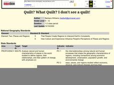
Quilt? What Quilt? I Don't See a Quilt!
Students analyze maps and cultures of major cities in the state of Arizona and designate different regions within the state according to geography and economy.
Curated OER
Passport to Africa
Learners begin the lesson by reading a novel about the diversity of geography in Africa. They are to create an oral report based on information they research. They also communicate with someone through email about the situation in Africa.
Curated OER
Understanding Topographic Maps
Underclassmen create a cone-shaped landform and then draw a contour map for it. Then they examine a quadrangle (which was easily located with an online search), and relate it to what they experienced. The accompanying worksheet is...
Curated OER
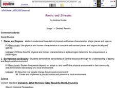
Rivers and Streams
Students research the rivers, streams and water bodies of Hawaii. They read a variety of books, play Bingo with water-related terms, create and maintain water-themed journals, view videos, conduct Internet research and participate in a...
Curated OER
Fan of Japan
Students research information about Japanese culture and geography. They identify symbols of historic and contemporary Japan, such as silk, baseball, fireworks, Mt. Fuji, electronics, and transportation. Afterward, they use their...
Curated OER
Magnetic Volcanoes
Learners research on world maps active volcanoes, those that have erupted recently as well as the dormant ones. They assess the conditions on Earth and how volcanoes erupt and then create an erupting volcano with magnets and a cookie...
Other popular searches
- Five Themes of Geography
- U.s. Geography
- China Geography
- Africa Geography
- Mexico Geography
- Canada Geography
- Asia Geography
- France Geography
- Japan Geography
- World Map
- Ireland Geography
- Geography Studies


