Curated OER
Maps that Teach
Students study maps to locate the states and capital on the US map. Students locate continents, major world physical features and historical monuments. Students locate the provinces and territories of Canada.
Polar Bears International
Top of the World
Learn about polar bears and the Arctic circle with a lesson about the countries and conditions of the region. After examining how the area differs from Antarctica, kids explore climates, animals, and geographical position...
Curated OER
Enduring Cultures
Students research the art, dance or a game from the Pacific Northwest Coast Aborigines. In this Canadian Cultures lesson, students view a PowerPoint about the Inuits. Students choose a game , type of artwork or dance to...
Curated OER
Underground Sleuths Discover Riches Beneath the Plains
Students identify Alberta, Saskatchewan, and Manitoba on map, and use Canadian Atlas to locate regions of natural resources in Central Plains, which have vital impact upon the economy. Students then complete scavenger hunt worksheet.
Curated OER
Alaska the Elephant
Students explore an Internet website, locating and matching the shape of an elephant's head to a state in the U.S. They complete an Alaska worksheet, identifying other geographical locations surrounding Alaska.
Curated OER
Population Counts
Middle schoolers investigate the analytical processes used to interpret the 2001 Canadian census. They examine the population statistics and trends.
Curated OER
Driving Forces Forestry In Canada
Learners discuss the natural and economic impact of forests and forestry. Using given statistics they construct different types of graphs in which they make observations and draw conclusions.
Curated OER
Historical Indian Treaties and Aboriginal Population
Sixth graders navigate an online atlas of Canada and compare the land area of of historical Aboriginal peoples in Manitoba to present-day figures.
Curated OER
Early Explorers Web Quest
Students use the Canadian atlas online to research early explorers and settlers in Canada. They also complete a Web Quest to gather information from maps. They make generalizations about the early settlement patterns as well.
Curated OER
Exploring Ancient Greece
Sixth graders use play dough to create a relief map of Greece and through personal investigation and class discussion, draw conclusions about the impact of the geography of Greece on daily life and culture in Ancient Greece.
Curated OER
Which Country?
In this geography worksheet, students study the names of 60 countries. Students indicate their home country by coloring its name in the word grid puzzle. Students then answer 8 questions about their country concerning what language is...
Curated OER
Languages of the World 2
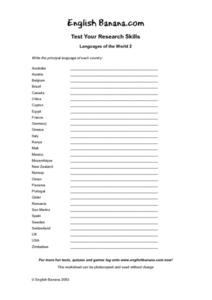
For this geography worksheet, students investigate the languages spoken in different countries of the world. Students read the names of 20 countries and write the principal language of each country.
Curated OER
Rivers of the World
For this geography worksheet, students match the name for each of 20 rivers of the world with the major city where it is located.
Curated OER
European Explorers of North and South America
Sixth graders explore the connection between the geography of America and the migration of the Native Americans to the American continents to the future conquering of the continents by the Europeans. They discuss the causes and effects...
Curated OER
North America Puzzle
For this geography worksheet, students complete a crossword puzzle in reference to North America. They identify capitals of some countries, the specific landforms of different areas, and languages spoken. There are 21 clues to solving...
Curated OER
Anagrams of World Cities
In this geography worksheet, students read and analyze a list of 25 world cities in which the letters are scrambled. Students write the names of the cities, then match them to one of the countries listed on the page. Example: SOLO...
Curated OER
Where in the World is Egypt?
In this geography worksheet, students investigate the location of the continent of Africa and the country of Egypt by studying a map of the region. Students color the map and locate Egypt.
Curated OER
Three Mapping Activities
Pupils label three maps of China after being introduced to background information about the country. In this geography lesson plan, students color two maps and label various points of interest in China. Finally, pupils draw...
Curated OER
Country Shape Quiz
In this online interactive geography quiz worksheet, students respond to 16 identification questions about the shapes of countries shown . Students have 4 minutes to complete the quiz.
Curated OER
Countries w/ Longest Coastlines Quiz
In this online interactive geography quiz worksheet, students respond to 20 identification questions about world countries with the longest coastlines. Students have 4 minutes to complete the quiz.
Curated OER
Nunavut, Our Communities
Students research the Online Atlas of Canada to locate the communities of Nunavut. Students examine the geographic area and characteristics of the communities.
Curated OER
Getting to Work
Students examine the modes of transportation people use to get to work in Canada. They examine how the methods chosen differ among provinces and among urban areas. They focus on the choices people make when selecting a method of getting...
Curated OER
From North to South...Quebec's Forest Regions
Middle schoolers identify and describe the different regions of Canada. With a focus on the forest regions, they use an atlas to locate the ecozones. They identify the characterstics of the climate and vegetation and the relationship...
Curated OER
Escape From Gilleleje
In this social studies worksheet, students read the history surrounding the captivity of the Jews in Denmark. They use the map for a geography lesson.
Other popular searches
- Canada Geography
- Canada Geography (Landforms)
- Canada Physical Geography
- Canada Geography Regions
- Canada Geography Land Use
- Canada Geography Landforms
- Us and Canada Geography
- Canada Geography and Culture
- Canada Geography Word Search
- U.s. Canada Geography
- Canada Geography Poem
- Canada Geography Land Form


