Curated OER
Blank Map of Canada
In this Canadian geography worksheet, students use a blank map of Canada to color and label important geographical features and cities. Students will need to do their own research before labeling this map.
Curated OER
What You Can Learn From a Map
Students discover how to interpret maps. In this geography skills lesson plan, students explore geographic themes as they complete worksheet activities regarding road maps, shaded relief maps, and topographic maps.
Curated OER
Geography of the Harbor
Students study estuaries and their boundaries. In this investigative lesson plan students locate an estuary on a map and use nautical and topographical maps.
Curated OER
Locations Of Countries In Europe
In this European geography worksheet, students describe where 12 countries in Europe are located by using directional phrases. Students also practice describing the nationalities of people from each country and how to pronounce each...
Curated OER
Where Does It Belong? The Climate Regions of Africa
In this African geography worksheet, middle schoolers read about the land and climate of 6 African countries. Students then complete a graphic organizer about the 5 climate regions of Africa and respond to 2 short answer questions.
Curated OER
North America
In this map of North America worksheet, students study the map of North America and then write the names of the 11 countries on the provided lines.
Curated OER
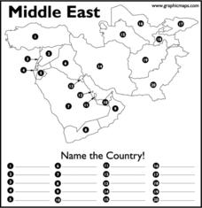
Middle East
In this map of the Middle East worksheet, students study the map of the Middle East and then write the names of the 20 countries on the provided lines.
Curated OER
Map Activities
In this geography learning exercise, students follow the directions and shade 3 different regions of a UK political map, shade European Union countries on a political map of Europe, match 4 physical feature of Africa to their...
Curated OER
Australia
In this map of Australia worksheet, students research and study a map of Australia. Students label Australia's regions, major states and important landmarks.
Curated OER
Europe Outline Map (Labled)
In this blank outline map worksheet, students study the political boundaries of the labeled European nations.
Curated OER
The Geography of Aboriginal Languages in Canada
Students study the relationship between geography and the Aboriginal language communities.
Curated OER
Five Themes of Geography
Middle schoolers choose one of the five themes of geography and create theme posters.
Curated OER
Affects of Geography on Colonial Cultures
Sixth graders examine the effects of geography on the development of culture. They discuss how geography can affect the lifestyles and development of a society's culture. Students examine the geography and climate of New England and the...
Curated OER
Connections Between World Events, Geography and the Human Quest for Knowledge
Students examine the relationship between innovations in geography and world events. Using maps, they report different information from a spatial perspective. They develop hypothesis about how man's quest for knowledge has impacted the...
Curated OER
Getting Comfortable with the Internet & Geography
Learners are introduced to the basic characteristics of Geography. Using maps, they practice identifying locations and other landmarks. They use the internet to explore websites with are geographically oriented.
Curated OER
Influence of Geography on the Migration of Virginians
Sixth graders study how geography influenced the westward migration of Virginians. They review the settlement patterns of early Virginians before discussing reasons why people move away from an area. Looking at maps, they determine how...
Curated OER
Geography of the Silk Road And the Tokaido Road
Students examine the geographical features of the Silk Road and the Tokaido Road in this introductory lesson on Chinese geography. Small group learning is emphasized and encouraged.
Curated OER
Geography: Map Making
Learners, working in groups, share notes and maps collected during a study of the Lewis and Clark Expedition. They draw large composite maps of the western United States on butcher paper including land formations, bodies of water, and...
NOAA
Into the Deep
Take young scientists into the depths of the world's ocean with the second lesson of this three-part earth science series. After first drawing pictures representing how they imagine the bottom of the ocean to appear, students...
123 Homeschool 4 Me
Christmas Around the World
Young travelers keep a travel journal as they tour the world and research the holiday traditions of over 30 countries. The directions packet for this journey includes an eBook filled with all the necessary templates, loads of links,...
Curated OER
Blank Europe Map
Simple blank map, limitless possibilities! Here is a single-page resource of a blank map of Europe, without any country boundaries or text.
Peace Corps
Celebrating Our Connections Through Water
Water is vital for survival, but how does it help global cultures flourish? Elementary and middle schoolers learn about the different cultures around the world that celebrate water and incorporate it into their festivals or traditions.
PBS
Tiger of the Snows: Tenzing Norgay
Tenzing Norgay, the Sherpa man who made history when he reached the summit of Mount Everest with Sir Edmund Hillary, is the focus of an informative article. Class members read about Norgay's perspective on the way up the mountain, the...
Curated OER
How Many Ways Can You Say Merry Christmas?
Students create a multicultural holiday bulletin board map! students research and study saying Merry Christmas in different languages. They correctly locate the countries on a world map.
Other popular searches
- World Geography Studies
- Geography Studies the Sea
- Geography Studies Rocks
- Elementary Geography Studies
- Geography Studies Cd Rom
- Social Studies Geography
- Social Studies Us Geography
- Social Studies and Geography
- Social Studies Maps Geography


