Hi, what do you want to do?
Curated OER
Spain and Bullfighting
Students research Spain and bullfighting. They use the Internet and other reference materials. Spain's bullfighting festivals and activities will be used as a springboard for inspiring students to write creatively.
Curated OER
Labeling the World
Sixth graders conduct research on the countries found on the labels on their clothing. They locate the countries on a map, research the labor practices on countries that export clothing to the U.S., and create a graph using the information.
Curated OER
Creation Mythology
Students construct a map from geographic data and explain relationships found in the information. Students identify ancient beliefs and customs through Hawaiian creation myths while comparing similarities and differences and appreciating...
Curated OER
Hemispheres & Continents
Students learn in cooperative learning groups to determine how the equator and the Prime Meridian divide the earth into hemispheres and use Venn diagrams. Students will locate and label the hemispheres, continents, and oceans.
Curated OER
The Battle of Brandywine
Students explore the Battle of Brandywine, how to analyze maps, and construct a model of a battlefield.
Curated OER
Zhou Dynasty
Students research the contributions of the Zho Dynasty. They identify the Mandate of Heaven, and the growth of the economy under the Zhou. They research the history of the discovery of silk and its role as an export. Finally, they...
Curated OER
Using Weather Reports In The LCTL Classroom
Students use authentic weather reports in order to investigate the processes involved in the creation of types of weather. They practice using key words for vocabulary. Then students analyze the weather reports and convey the information...
Curated OER
Social Studies: Canadian City Comparison
Students research Canadian population distribution while comparing and contrasting the quality of life in two cities. They discuss issues and problems that cities and rural towns face. Students apply various methods, such as graphs and...
Curated OER
Science: Trouble in the Troposphere
Students research a NASA Website and record information about an assigned city's tropospheric ozone residual monthly climate. In groups, they graph the information for the past year. They form new groups and compare their city's...
Curated OER
History of Japan
Students research the mythological and factual founding of early Japan. They compare and contrast the two accounts. As an assessment activity, they fill out a chart that compares and contrasts the facts and myths surrounding Japanese...
Curated OER
Religions of Japan
Students explore, analyze and study the religions that originated in Japan, including Shintoism and Zen Buddhism. They assess the beliefs of each religion and compare/contrast all the Eastern Religions and view their people and...
Curated OER
Nunavut, Our Communities
Students research the Online Atlas of Canada to locate the communities of Nunavut. Students examine the geographic area and characteristics of the communities.
Curated OER
From North to South...Quebec's Forest Regions
Students identify and describe the different regions of Canada. With a focus on the forest regions, they use an atlas to locate the ecozones. They identify the characterstics of the climate and vegetation and the relationship between...
Curated OER
Coral Bleaching in the Caribbean
Students use authentic satellite data on the NASA website to determine when the sea surface temperature meets the criteria to induce coral bleaching.
Curated OER
The Sky Show
Students use lecture and research to answer the question: Why is the sky blue? students research a variety of other sky phenomena, chart their observations and participate in experiments.
Curated OER
ProjectWILD Aquatic: Migration Headache
Students explore the important factors that affect habitat quality and the associated survival of migratory water bird populations. They discuss an organisms dependency upon a variety of habitats and habitat quality. Students play a game...
Curated OER
Appreciating The World By Learning About Landforms
Children can learn about the Earth's landforms and develop a greater appreciation of our world.
Scholastic
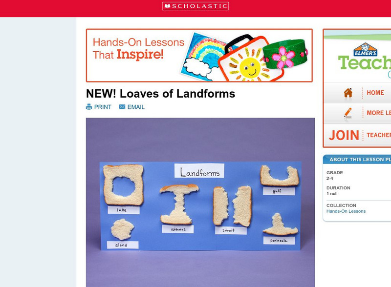
Scholastic: Loaves of Landforms!
A foundation in geography begins with an understanding of the terms geographers use to describe the features of Earth. This instructional activity is designed to help learners grow their vocabulary and learn to recognize common landforms...


