Curated OER
Cattle Trails
Students identify and locate cattle trails on a globe. In this map skill lesson, students use a marker to locate Texas and Montana and use the map scale to calculate the distance of the cattle trail.
Montana State University
Meet Mount Everest
Learning about one landform might seem boring to some, but using the resource provided practically guarantees scholar interest. The second in a sequential series of eight covering the topic of Mount Everest includes activities such as a...
Curated OER
Mapping Africa
Students identify the location of parallel and meridian coordinates. They illustrate their understanding of the physical shape of the continent of Africa through a mapping activity, then explain the processes that have influenced the...
Curated OER
Design an Island
Students explore islands. They create a two- or three-dimensional map of an island. They explain how the topography of an area influences the location of water sources, ecosystems, and human settlements. Lesson includes adaptations for...
Curated OER
Making a Map of the Classroom
Students create a map of the classroom using the computer programs AppleWorks and iChat in this math-based technology lesson. Lesson extension ideas include a scavenger hunt and maps of other school buildings.
Curated OER
Comparison of Snow Cover on Different Continents
Students use the Live Access Server (LAS) to form maps and a numerical text file of snow cover for each continent on a particular date and analyze the data for each map, corresponding text file to determine an estimate of snow cover for...
Midnight Martian
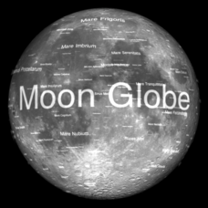
Moon Globe
Not just a simple globe of the moon, this interactive version allows you to choose lighting according to the location of the sun, views from different positions on Earth, and more! Satellite images and topographic data have been combined...
Curated OER
Mush! Tracking Travelers on the Trail
Students get to know Alaska and the Iditarod route that is run by dogs as they track the mushers' progress on a map that they create specifically for the race. They learn about latitude, longitude, plotting on a map, checkpoints, and...
Curated OER
Coral Bleaching in the Caribbean
Students use authentic satellite data on the NASA website to determine when the sea surface temperature meets the criteria to induce coral bleaching.
Curated OER
What A Tombstone Can Tell Us
For this coordinates worksheet, students determine the coordinates to visit a cemetery. Students determine 18 coordinates on this worksheet.
Curated OER
Plotting Earthquakes
In this earthquakes worksheet, students access a website to gather information about the magnitude and location of earthquakes for 5 days. Then students complete 7 short answer questions.
Curated OER
GPS Scavenger Hunt
Students go on a GPS scavenger hunt. They use GPS receivers to find designated waypoints and report back on what they found. They compute distances between waypoints based on the latitude and longitude, and compare with the distance the...
Curated OER
How to be a Great Navigator!
Students, through teacher lecture and class discussion, explore historical methods of navigation: dead reckoning and celestial navigation.
US Mint
Absolutely and Relatively: The Puerto Rico Quarter Reverse
How much does your class know about Puerto RIco? How much can they learn from the back of a 2009 quarter? Use the coin, part of a series of quarters that depict US territories, to teach learners about the geography, culture, and history...
Curated OER
Charles Lindberghs's Flight to Paris
Students practice map skills. In this map skills lesson, students locate the cities of New York and Paris on a map. Students read about the flight made by Charles Lindbergh in May 1927 from New York to Paris. Students answer 8 questions...
Curated OER
Walking that Line
Students attempt to describe and use longitude and latitude. They will identify different countries, their neighbors, and borders around the world. Included in the lesson the students identify natural features that control the borders of...
Mr. Head's 6th Grade Classroom
Absolute Location
How do we know where we are in the world? A presentation for middle schoolers explains absolute location and other geography terms such as relative location. It also gives scholars the opportunity to practice finding absolute location on...
Curated OER
Snow Cover By Latitude
Students examine computerized data maps in order to create graphs of the amount of snowfall found at certain latitudes by date. Then they compare the graphs and the data they represent. Students present an analysis of the graphs.
Curated OER
Geotagging in school
Students create a digital photo map of the world. In this digital photo map lesson plan, students pick topics such as the Olympics, natural disasters, or trip planning and create a photo map on the computer.
Curated OER
Exploring Marine Ecosystems in the Caribbean and Maine
Students compare the marine habitats of Maine and the Caribbean using temperature, tides, ocean currents, latitude and longitude. In this marine ecosystems instructional activity, students analyze maps to complete graphic organizers that...
Curated OER
Dalai Lama
Sixth graders use skills and knowledge that they gained from their Tibet unit to formulate a final product of their Tibet journey. This study covers topics such as Tibet's geographical location, religious beliefs, customs, dress, and way...
Curated OER
Welina's World
Students living in Hawaii draw a picture of themselves in their neighborhood. They draw their neighborhood in relation to their district and then in relation to the island they are from. They compare their pictures to their classmates'...
Curated OER
Mapping a Refuge
Pupils record observations gathered while at a national wildlife refuge. In this lesson plan on wildlife refuges, students choose an observation spot and record seasonal changes throughout the year.
Curated OER
Students Become Mapmakers
Students practice making a map of a continent and correctly plotting five cities on that map. They place latitude and longitude lines on a map, determine the need for various map projections and explain why map scales are necessary.
Other popular searches
- Maps Latitude and Longitude
- Maps, Longitude and Latitude
- Longitude & Latitude Maps
- Longitude Latitude Maps
- Maps, Longitude Latitude
- Maps, Latitude/longitude


