University of Colorado
Phases of Charon
Pluto, although no longer considered a planet, has five moons. Pluto's moon, Charon, is the focus of a resource that describes how the moon is viewed from the surface of Pluto. Photos help individuals see how Charon would look at...
Teach Engineering
Air Pollution in the Pacific Northwest
Scholars investigate levels of nitrogen dioxide in the Pacific Northwest by examining the role of nitrogen in air pollution and how remote sensing can be used to measure nitrogen levels. An Excel spreadsheet calculates the difference...
Curated OER
Cold, Clouds, and Snowflakes
Students explore satellite data and graphing. In this weather data analysis math and science lesson, students analyze NASA satellite data to draw conclusions about geographical areas where precipitation might have happened. Students...
Curated OER
True North, Magnetic North
Students explain why compass angles need to be corrected for regional magnetic variation. They observe the difference between magnetic and true north. Each student measures the angle of variation for a town in a different state.
Curated OER
Differences Between Ground and Air Temperatures
Young scholars examine the differences between air temperature and ground temperature. In this investigative lesson students find NASA data on the Internet and use it to create a graph.
Curated OER
Where Do I Live?
Students gain a better understanding of the population of the region they live in by comparing U.S. census data on the internet.
Curated OER
Where is ? ? ? ?
Students explain and explain the concept of a grid system. They define absolute and relative location and develop an imaginary city on graph paper using a grid system.
Curated OER
El Nino Lesson
Young scholars compare graphs of weather occurrences. In this environmental lesson plan, students will being using the website to gather weather related information for a certain time period. The young scholars will then graph the data...
Curated OER
The Earth Moves Under My Feet
Students study earthquakes, monitor seismic activity using the Web, and plot real-time activity. They examine movement of the Earth's tectonic plates. They create an earthquake preparedness project.
Curated OER
'Tis a Long, Long Way to Tipperary!
Students practice finding the location of cities across the world by using an interactive Web site, and figure out the world's time and the value of time zones the world over.
Curated OER
Biomes: Coastlines and Seas
Students study the different types of coastlines and their territories. In this marine coasts lesson students identify life forms that are in the coastal regions.
Curated OER
An Age of Exploration
Learners investigate U.S. history by examining North American timelines. In this American exploration lesson plan, students research the events that led to Columbus finding America and participate in a jeopardy game regarding his...
Curated OER
Observing the Sky
Students explore astronomy. For this astronomy lesson, students discuss the history of the movement of celestial bodies and then communicate with other students regarding the movements that they observe in the sky nightly. Students...
Montana State University
What's the Weather?
How many jackets do you need to stay warm and climb Mount Everest? An informatie resource covers the topic of Mount Everest, the resource helps young scientists discover the difference between climate and weather. Activities include...
Curated OER
Student Tracking
Here is an interesting lesson on satellite tracking. Learners use various tracking techniques to find out where they go on a daily basis, what the environmental conditions are, and what they are doing during their "migrations." A...
Curated OER
The Solstices
Compare surface temperatures when the solstice occurs in the different hemispheres. Young scientists draw conclusions from their investigation of data collected using spreadsheets and a globe.
Curated OER
Plot Current Earthquake Data
Students review earthquakes larger than 2.5 that have occurred over a span of several days using a given website reference. In this geology lesson, students plot epicenters on a world map and depth of the quake. All necessary...
Curated OER
Deep Blue: Exploring the Deep Ocean
Students examine landforms. In this social studies lesson, students bounce a beach ball around in order to discover that seventy percent of the Earth is covered in water. Students
Curated OER
Introducing The Gulf Stream
Sixth graders research the average temperatures of different places on Earth. In this earth science lesson, 6th graders explain how the sun's heat cause ocean movement. They discuss how temperature change affects the weather we experience.
Michigan Sea Grant
Fish Habitat and Humans
Strict habitat requirements are needed for the survival of fish populations and fish variety in the Great Lakes. Young scientists become experts in the basic needs of fish and understand how survival necessities can vary with different...
Curated OER
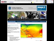
Surface Air Temperature Trends of the Caribbean
Students investigate the seasonal changes to sea surface and near-surface air temperatures near the equator. They use actual satellite data to track and graph the differences in air and sea temperatures during different seasons in the...
Curated OER
Create Your Own Country!
Students create their own countries. In this geography skills activity, students establish governments, cultural backgrounds, atlas/geography components, national anthems, and national symbols for a country they create.
Other popular searches
- Maps Latitude and Longitude
- Maps, Longitude and Latitude
- Longitude & Latitude Maps
- Longitude Latitude Maps
- Maps, Longitude Latitude
- Maps, Latitude/longitude


