Curated OER
Eastern Hemisphere Map
In this Eastern Hemisphere polar map worksheet, students examine the Eastern Hemisphere including the political boundaries formed by the countries in this region of the world.
Curated OER
Asia and the South Pacific : Political Map
In this Asia and the South Pacific map worksheet, students examine the boundaries of the nations in this region of the world. Students also note the location of capital cities as they are denoted by stars. Major bodies of water are labeled.
Curated OER
Maps
Maps, globes, and computer software aid young explorers as they locate state capitols, major cities, geographic features, and attractions for states they are researching. They then use desktop publishing software to create a map to share...
Curated OER
Weather Lesson Five
Young scholars define a weather forecast, make a forecast using a weather map, identify three prediction guidelines, and explain how computers help to make forecasts. Students make a 24-hour forecast for each of the thirteen states...
Curated OER
Map Maker, Map Maker
Map maker, map maker, make me a map! Your class can sing this tune as they work to create their own regional maps by taping paper to the wall, projecting an overhead transparency image, and tracing. Where this lesson plan intends for the...
Roald Dahl
Matilda - The Reader of Books
The titular Matilda from Roald Dahl's famous novel adored books above all things. Discuss why it is important to read stories from across cultures and around the world using the first chapter from the ever-loved story Matilda.
Curated OER
Central and Northern Asia: Political
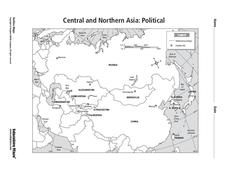
For this Central and Northern Asia map worksheet, students examine national political boundaries and national capitals in this region of the world. The map is labeled.
Curated OER
Southern Hemisphere Map
In this Southern Hemisphere polar projection map worksheet, students examine this region of the world. The continents shown are labeled.
Curated OER
Eurasia Physical Map
In this Eurasia physical map activity, students make note of the major landforms and bodies of water located in this world region.
Curated OER
Rivers, Maps, and Math
Middle schoolers use maps to locate and label the major rivers of North and South America. Using the internet, they identify forests, grasslands, mountain ranges and other landforms on the continents as well. They compare and contrast...
Curated OER
Geomnemonics: Facilitating the Teaching of Social Studies Content with Geography Skills
Students explore how to draw a world map by hand and how to locate countries.
Curated OER
What's Your Temperature?
Learners take a look at the local newspaper and focus on the weather section. They get into small groups, and each one looks at the same map, but of a different part of the country. They must prepare a presentation that shows how...
Curated OER
You Are Here
Students map local places and learn to use scale and distance. In this mapping instructional activity, students map their school and a favorite place. Students recreate their maps showing distance and scale sizes. Students...
Curated OER
Say Hello! Around the World
Hello! Bonjour! Paivaa! Ni hao! Teach learners of all ages how to say hello in several different languages. There are project ideas for younger learners and older learners. Kids love learning a different language, even if it's just this...
Curated OER
Solving the Puzzle
Students create a map showing the United States borders at a specific period in history and produce three questions to be answered by examining the map. They also write a productive paragraph explaining who, what, when, where, how/why a...
Curated OER
Giving Students a Little Latitude
Students use a world outline map to locate places using coordinates of latitude and longitude. They answer questions about places based on their knowledge of the map and on their research and make up more questions of this sort for each...
Curated OER
Map a World of Facts
Students mark ten places on a world map while they follow fun facts on the included printable sheet. They research using a variety of resources to determine the location of the ten places.
Curated OER
Ring of Fire
Students locate some of the 1,500 active volcanoes on a world map. Then by comparing their maps with a map of the world's tectonic plates, they discover that volcanoes occur because of the dynamic nature of the Earth's lithosphere.
Project Food, Land & People
Loco for Cocoa
Students create a time line and map about how chocolate traveled the world. In this chocolate lesson plan, students also create and taste chocolate.
Curated OER
Where in the World?
Students locate famous landmarks around the world. They identify the location of natural and manmade landmarks using a worksheet that provides ten clues.
Curated OER
World Continents
Students identify the continents of the world. In groups, students create a three-dimensional clay representation of their assigned continent. Using KidPix software, they draw and color their continent. Students research their continent...
Curated OER
What a Relief Map
Students create a map using cookie dough. In this geography lesson, students research the physical features of a country, draw a diagram and design and create a map out of cookie dough.
Curated OER
Through the Looking Glass: Recognizing Developing and Industrialized Countries
Students examine the regions of the world, and identify the basic characteristics of industrialized and developing countries. They conduct Internet research on the economic and population characteristics of industrialized and developing...
Curated OER
Mystery State #38
In this United States mystery worksheet, students determine which state is described by the 5 clues listed on the sheet and then mark it on the outline map of the United States.
Other popular searches
- World Outline Maps
- World War I Outline Map
- Blank World Outline Maps
- World Outline Political Map
- World Climate Map Outline


