Curated OER
Adapting and Modifying
In this environment worksheet, students read 10 scenarios and identify them as adaptations or modifications to one's environment.
Curated OER
U.S. Political Map
In this political map worksheet, students use the map of the United States and the 7 cities to measure the straight-line distance between the cities. Students add the total number of miles traveled and write their answers in the spaces.
Curated OER
Washington, D.C. Map
Here is an outline map of Washington, DC. Some of the points of interest in the city are labeled, as are Maryland, Virginia and Arlington. There are plenty of important monuments and locations not identified, making for a good...
Curated OER
South America Map
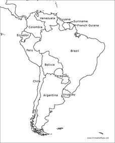
In this South American political map worksheet, students examine both national boundaries and national capitals.
Curated OER
Americas: Political Map
In this North America and South America outline map worksheet, students examine the political boundaries of the 2 continents.
Curated OER
Europe: Political Map
In this Europe political map learning exercise, students examine each country's boundaries. The map also highlights each of the nation's capitals with a star.
Curated OER
South America Map
In this South America political map worksheet, learners examine the country boundaries. The map also labels each of the countries and their capitals.
Curated OER
Europe Labeled Map
In this Europe political map worksheet, students examine the national boundaries. The map also highlights each of the nation's capitals with a star. The countries and capital cities in this map are labeled.
Curated OER
Europe at Exploration 1500
In this world empires and trade in 1500 worksheet, students examine a world empire map, world trade map, and Europe map. All maps display information from 1500.
Curated OER
South America Outline Map
In this blank outline map learning exercise, learners explore the political boundaries of South America and the nations there. This map may be used in a variety of classroom activities. The map is labeled with the country names.
Curated OER
South America Outline Map
In this blank outline map worksheet, students explore the political boundaries of South America and the nations there. This map may be used in a variety of classroom activities. The location of the capital cities are denoted with...
Curated OER
European Country Map
In this Europe political map worksheet, learners examine the national boundaries. The country names are labeled on the map.
Curated OER
Australia Map: Labeled
In this Australia outline map worksheet, students make note of the political divisions of the 5 provinces and territories of the nation. This map is labeled.
Curated OER
Australia Map: Labeled
In this blank outline map worksheet, students explore the political boundaries of Australia and its provinces and territories. This map is labeled and may be used in a variety of classroom activities.
Curated OER
Social Studies: The Connecticut Hill Community
Students discover the reasons for the settlement of the Connecticut Hill Community. Through an examination of the climate, occupations of the inhabitants, and demographics, they discuss reasons people choose locations for settlement. ...
Curated OER
Geography Golf
Students practice their knowledge of states and capitals while at the same time working on motor skills. This activity also promotes working together in small groups.
Curated OER
GEOGRAPHY GOES TO THE DOGS
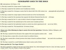
Students use countries and dogs from around the world to answer the questions.
Curated OER
The Geography of Land Planning
Students utilize simple maps to plan a town, supply water resources and then fit their towns into the a larger community. They assess how hard it is to plan a town by group decision-making as well as the services required to help a town...
Curated OER
Geography: Mapping Neighborhoods
Learners examine their neighborhoods and draw maps reflecting land use. In addition, they make predictions about their community's future. Students also consider the impact of business and industry on their communities and predict ...
Curated OER
We've got the whole world in our hands
Students explore spatial sense in regards to maps about the globe. In this maps lesson plan, students label oceans, locate the continents and poles, follow directions, and explain the symbols on a map.
Curated OER
Canadian Provinces Quiz
In this online interactive geography quiz worksheet, students examine the map that includes 13 Canadian provinces. Students identify the names of the provinces in 3 minutes.
Curated OER
Country Flags Quiz
In this online interactive country flag quiz learning exercise, students examine the 20 pictured country flags and try to name all of the countries represented in 4 minutes.
Curated OER
50 States: New England States
Students discover where certain states are located and what the look like. They look for their information on a web site. Each student is assigned a state which they must research then present to the entire class.
Curated OER
South America Map Quiz
In this online interactive geography quiz worksheet, students examine the map that includes all of South America's countries. Students identify the 13 countries in 2 minutes.


