Curated OER
Vermont Map
In this state maps worksheet, students identify the map of Vermont. Students fill in the state capital, the major cities, and other state attractions.
Curated OER
Maps
If your students are just starting a unit on Geography this could be the introduction you're looking for. This PowerPoint presents a clear and organized overview of the different types of maps people use and why each is important. Tip:...
Curated OER
Mystery State # 28
Using clues is a great way to increase deductive and logical reasoning skills. Boost thinking skills while quizzing kids about us geography. They use five clues to determine which state is in question.
Curated OER
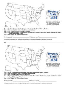
Mystery State # 24
Prepare those brains for a rousing day of learning with a fun geography activity. Your pupils use five different clues to determine the name of mystery state number 24. Where do all those potatoes come from? Idaho!
Curated OER
Mexico: Culture, Language, and History
Study the culture, language, and history of Mexico in this collection of lessons. Create maps of Mexico's geography, study Spanish language phrases, and create a fiesta, along with a Mexican Marketplace scene.
Curated OER
East Asia Country Project
Get your young historians thinking about East Asian culture and history during this partner research project, in which they analyze a variety of East Asian aspects to prepare for a presentation. After an initial "what do we already know"...
Curated OER
Be the Kiwi
Compare the North and South of New Zealand. Exploritive minds identify which island is better to live on, taking into consideration such things as social, political, and economic aspects. They research an argument to present and debate...
Curated OER
Nifty Fifty State Trivia
A wonderful game on U.S. States Trivia awaits your class. In this geography lesson, they will play a Jeopardy-style game. All the worksheets with the questions and answers are embedded in this beautifully-designed plan. Your class should...
Curated OER
Mapping the Past
Young scholars study historical maps to view how the world evolved from medieval times through the Renaissance. They work in groups to examine the maps and present a report on one of the listed maps.
Weebly
Ancient China
From China's physical geography and earliest beginnings of civilization to the Qin and Han dynasties, here is a nicely designed worksheet on ancient China, which includes a graphic organizer and timeline to summarize the reading...
Curated OER
Exploring our National Parks
Students utilize maps/Atlases to find key spatial information, locate U.S. National Parks, characterize the geography of a specific region, and create a National Park brochure.
Curated OER
Nature and Place Names in Arkansas
Middle schoolers examine the way that many place names in Arkansas came to be. By looking at Arkansas highway maps, they find names that come from the characteristics of each of the state's six geographical divisions. This interesting...
Curated OER
A Wall for Peace?
Students give examples that demonstrate how people are connected to each other and the environment. They idnetify current or historic conflicts and explain how those conflicts are or were influenced by geography. Students explore about...
Curated OER
Tour Of South America
Students explore South America. For this geography lesson, students research landmarks of historical or national significance and use their findings to create slideshows.
Arizona Cooperative Extension
Geocaching
Using GPS units, small groups participate in a scavenger hunt to find an object that you have hidden. They use coordinates for stopping points along a pre-planned path to get to the final cache. This is a terrific activity to include in...
Curated OER
Feudal Powers in Japan
A traditional textbook chapter focuses on feudal powers in Japan, and includes vocabulary, note-taking tips in the sidebar, main ideas, and follow-up assessment questions. It also incorporates opportunities for art...
Mesa Public Schools
Country Project
Give your young learners the chance to discover more about countries in their world community with a research project. Class members write reports on an assigned country and include such major features as geography, important historical...
Curated OER
The Civil Rights Movement
Students compare and contrast African-American, Asian-American, Chicano and Native-American movements with the civil rights movement and are exposed to the sociopolitical and economic factors involved in the rise of social movements.
Freecloud Design
Stack the Countries™
This resource does an excellent job of engaging and educating people on world geography. It includes informational flashcards as well as games. Though the graphics are designed for elementary players, people of all ages will...
Denver Public Schools
Kung-hsi Fa-ts' ai! – A Chinese New Year Celebration
Looking for ideas for your Lunar New Year celebration? Check out an interdisciplinary unit of study that includes lessons in counting, calligraphy, culture, geography, literature, art, and music. Kung-hsi Fa-ts' ai! (May you...
Curated OER
What Can a Map Tell You?
Young scholars investigate how maps can provide useful information about health issues. They study a map to draw conclusions about cholera death in London.
American Museum of Natural History
Mythic Creatures Challenge
Mythic creatures and where to find them is the subject of an engaging interactive resource. Young anthropologists click on a bright red X on a world map to see an image of and learn the stories of 15 legendary creatures.
Curated OER
Social Studies: Great Circle Route
Students compare routes between Minnesota and China using a map and globe. Using the "great circle route" method, students find the shortest route between two points.
Curated OER
Physical and Human Geography Review Worksheet and Study Guide
In this geography skills worksheet, students respond to 30 short answer questions pertaining to physical and human geography.


