Curated OER
Ancient China: Student Created Word Search Puzzles
Sixth graders classify and organize information about ancient China. In this Chinese history lesson, 6th graders create word search puzzles and record the processes they used to create them.
Curated OER
United States & Canada: How Are We The Same? How Are We Different?
Learners compare and contrast similarities and differences between Canada and the US. In this geography lesson, students read various articles and identify similarities and differences in economies, cultures, geography, climate,...
Curated OER
Strengthening Democracy in Latin America
Sixth graders examine the many challenges facing the nations of Latin America today. In this World Geography instructional activity, 6th graders analyze various documents that will help strengthen democracy. Students create a...
Curated OER
A Treaty Trail
Students complete vocabulary work related to the Native Americans of the past. For this Native American lesson plan, students read and answer questions about Native Americans and how they created their own resources.
Curated OER
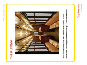
"L" Stands for Elevated
Learners play a trivia game to learn more about the Chicago public transportation system. In this transportation lesson plan, students also create an "L" car, and write advertising slogans for Chicago's elevated trains.
Curated OER
Create Your Own Country!
Students create their own countries. In this geography skills activity, students establish governments, cultural backgrounds, atlas/geography components, national anthems, and national symbols for a country they create.
Curated OER
Tower of Babel and Pentecost
Students list positive and negative aspects of a community. In this Tower of Babel and Pentecost lesson, students find examples of pros and cons of communities as they discuss their own communities and the Israelites. ...
Curated OER
Pile 'em High?
Students explore the concept of architectural heritage. For this architecture lesson, students visit selected websites to compare and contrast the architectural features in world cities.
Curated OER
Modern Marvels
Students examine the man-made wonders of the world. In this current events lesson, students research selected websites to learn more about the most recent wonders of the world competition. Students also research Stonehenge.
Curated OER
A Troubled Relationship
Learners discover information about Iran and Britain. In this current events lesson, students visit websites and listen to lectures to learn about Britain's Navy personnel that were taken hostage by Iran. Learners investigate the history...
Curated OER
Following the Slave Trade Route
Students identify and map the phases of the slave trade, the locations of colonies and communities settled by African slaves, and the impact the individuals have had on the area.
Curated OER
Where's the Barbecue?
Middle schoolers identify the major landforms, regions and rivers on a map of South Carolina. They compare the locations of the major Native American groups in the state as well. They chart where barbecue restaurants are located and...
Curated OER
Navigating Your Community
Students draw a map from memory describing the route between their classroom and the gym including a legend, a compass rose, a map scale, symbols, and a landmark at every change of direction. They then retrace their steps in their maps...
Curated OER
The Geography of Maine Tourism
Students study topographical maps of Maine to identify the important physical features. They work in groups to create tourism pamphlet highlighting a region of the state.
Curated OER
Invaders and Settlers
Students watch a video that illustrates the way in which an English community evolved based on geography and the settlers and invaders who lived there over different time periods. They create a map that shows how different villages are...
Curated OER
Into the Wilderness: Habitat vs. Development
By studying the once-assumed extinction, then rediscovery of the Ivory-Billed Woodpecker, learners look at the physical changes that have occured in habitats throughout Arkansas. This outstanding lesson is chock full of terrific...
Curated OER
Exploring Explorers
Young scholars research a selected explorer and teach their small group about their explorer during a jigsaw activity. Independently they write a letter as if they were on a voyage with their explorer, and create a world map that...
Curated OER
SAMMY DISCOVERS SHAPES AT SCHOOL
Pupils study maps and use them for real world experiences.
Curated OER
Zones of Conflict
Students read maps and identify specific countries involved in conflict. They classify countries in cultural realms. They relate maps to what they know about world conflict.
Curated OER
The Silk Road
Students explore the Silk Road of Asia in this multi-day lesson that includes a "Silk Road roll play" and a mapping activity. This lesson can be used in a social studies or language arts classroom.
Curated OER
The Fine Art of Paper-Cutting
Students create original examples of the ancient Chinese Folk Art technique of Paper-Cutting in this middle-level lesson highly adaptable for either the Art classroom or a Social Studies class.
Curated OER
Religious Freedom - Universal Declaration of Human Rights
Students examine the issue of religious freedom in the Universal Declaration of Human Rights. They annotate on maps places where religious persecution has occured. Students in pair participate in an active listening exercise as each one...
Curated OER
Choices and Commitments: The Soldiers at Gettysburg
Students investigate the Gettysburg Campaign and the major actions for each day of the battle. They read primary source documents, write a diary entry, analyze the Gettysburg Address, and write a persuasive speech regarding an issue in...
Curated OER
Using Cartograms t Learn about Latin American Demographics
Students make cartograms while drawing connections between physical, economic, social and cultural geography.


