Curated OER
Then and Now
Students list the similarities and differences seen as they compare and contrast historical and current street maps of their local communities.
Curated OER
Selecting A Destination
Students utilize atlases, maps, and Internet resources to select destinations and places to stop along the way on a day trip. They examine and write about the reasons they want to visit the particular places they chose.
Curated OER
Sorting the Loyalist Documents
Students organize the Canadian Loyalist primary source documents and add more information to their primary source document concept maps.
Curated OER
State Poster Fair: US Geography, Social Science, Art
Pupils research a US state, design and construct a state 'poster' to display important facts about that particular state. They present their work to the class.
Curated OER
Planning a Railroad
Students use a topographical map to plan a route from Doknner Summit to Truckee, then compare it to the route selected by Theodore Judah.
Curated OER
Walking that Line
Students attempt to describe and use longitude and latitude. They will identify different countries, their neighbors, and borders around the world. Included in the lesson the students identify natural features that control the borders of...
Curated OER
Courts: Interpreting The Law On Safe Employment
Students make arguments regarding the interpretation of the law and present an appeals case. They also name four characteristics of an appeal.
Safe Drinking Water Foundation
Water Pollution
An introductory lesson plan to a unit on water pollution, young environmentalists are asked to brainstorm examples of pollutants in water. This lesson plan will help develop a sense of what water pollution is and where the pollutants...
Curated OER
Create Learning Experiences with The Polar Express
Center content-integrated lessons around the timeless holiday book, The Polar Express.
Curated OER
Finding Latitudes and Longitudes
Students analyze Columbus' rationale for sailing west, and find the latitude and longitude of modern and ancient place names.
Curated OER
Historical Indian Treaties and Aboriginal Population
Sixth graders navigate an online atlas of Canada and compare the land area of of historical Aboriginal peoples in Manitoba to present-day figures.
Curated OER
Coordinate Grid: Mapping an Archaeological Site
Middle schoolers examine how archaeologists preserve context of sites through use of rectangular grid or Cartesian coordinate system, and develop sense of distance by pacing off and estimating distances.
Curated OER
"Where in the World is my School?"
Students learn new vocabulary and discuss what GPS is and does. They locate their school using the equipment.
Curated OER
Learning About Africa
Students examine one of the locations in Africa listed in the lesson focusing on location, climate, products, activities, and other information they use for their short story. They then write an outline of their story and organize their...
Curated OER
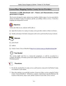
Mapping Fairfax County Service Providers
Learners brainstorm a list of services governments should have available to its citizens. Using the internet, they locate as many of these services as possible and compile a class list. They also analyze specific programs to consider...
Curated OER
Las Vegas Mormon Fort
Young scholars use maps, readings, letters, photos and drawings to identify why Mormons came to the Las Vegas area and what they hoped to accomplish by establishing an outpost. They consider the roles of early women pioneers and outline...
Curated OER
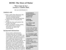
Lesson 3: Lobster Roll!
Students play a game that illustrates the delicate ecological balance between fishing, fishing regulations and fish populations. They collect data and analyze the results.
Curated OER
Lesson 2: Maine's Merchant Marines
Students simulate the quarters aboard a ship. They write a letter to Joanna Colcord or Alice Drinkwater that shows an understanding of the experience of being aboard ship, and asks further historical questions about the experience.
Curated OER
Deportation of the Acadians
Students use an online atlas to identify the presence of Acadian culture in the Maritime provinces of Canada and explore the deportation.
Curated OER
Rollin' on The River - the Hudson River!
Young scholars examine how the Hudson River was important to the development of the United States. They examine the role of steamboats played in the development of the Hudson River Valley.
Curated OER
Lewis and Clark and Native Americans, Part II
Young scholars research the Native Americans living in the regions explored by Lewis and Clark. They identify the modern-day names of sites claimed by the Lakota Indians, and create a poster of the original Native American names.
Curated OER
Building a Trading Post: How to Choose a Site
Students brainstorm what kinds considerations might have to be made when building a trading post. They create an artistic representation of what their trading post would look like (two- or three- dimensional).
Curated OER
Listen Up! Swinging with some Big Band Music
Students read about the music and life of Glenn Miller. They listen to Miller's "Jeep Jockey Jump" and analyze the piece for instrumentation, formal structure and stylistic characteristics.


