Curated OER
Condon National Bank
Use maps, readings, and photographs to analyze the historic, cultural, and social conditions surrounding the activities of the Dalton brothers and their gang. Learners identify how the residents of Coffeyville defended themselves against...
Curated OER
London Quiz 2
In this London worksheet, students answer short answer questions about the geography and history of London. Students answer 10 short answer questions.
Curated OER
"Yarning" About Latitude and Longitude
Students identify various locations using latitude and longitude. In this map skills lesson, students use yarn and labels to create a "human globe." Students identify the Prime Meridian, the Equator, and Northern and Southern Hemisphere.
Curated OER
Geography of South America
Students explore South America. In this geography skills lesson, students watch a video about the geographical features of the continent. Students complete worksheets on the topic.
Curated OER
Geography of the Roman Empire
Students explore the Roman Empire. In this ancient Rome lesson, students research regions of the Roman Empire and present their finding to their classmates. Students also use an interactive map to practice placement of the regions within...
Curated OER
World Landforms
In this blank outline map worksheet, students note the major landforms of the 7 continents of the world on a Robinson projection map.
Curated OER
World: Continents
In this blank outline map worksheet, students note the political boundaries of the continents of the world on a Robinson projection map.
Curated OER
The Physical Geography of South Asia
Students describe the physical forces that formed and shaped the Himalaya, then discuss the physical geography of Mount Everest and how it influences the routes climbers take to the summit.
NOAA
Into the Deep
Take young scientists into the depths of the world's ocean with the second lesson of this three-part earth science series. After first drawing pictures representing how they imagine the bottom of the ocean to appear, students...
Sharp School
Travel Brochure Project
Designing a travel brochure is a classic project that will help your class members develop a variety of skills, such as researching informational texts, designing creative visual products, and communicating what you have learned.
Curated OER
Mystery State #32
There is no better way to start a lesson, than with a good problem-solving activity. Give your class the chance to see if they can use each of the five clues to determine the name of mystery state number 32. Hint: It's the eastern most...
Curated OER
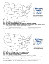
Mystery State # 39
Which state will be the answer to the five clues today? After considering each clue, learners will name the mystery state. If your class can determine which state was home to Chief Sitting Bull, they'll be able to answer South Dakota.
Curated OER
U.S. and Canada: How are We the Same? How are We Different?
Get high school geographers to compare and contrast Canada and the United States. They begin by drawing a freehand map of North America, then complete readings to gain insight into Canada. The text is not provided; however, another text...
Curated OER
America Grows - Trailblazers Pave the Way
Students study the time period after the Revolutionary War when people were striving to move away from the coastal areas and look for pathways to the west. Westerward expansion is a central theme and students use a variety of resources...
Curated OER
Exploring the Hudson in 1609
Learners follow the journey of Henry Hudson down the river with his name. Using journal entries and maps, they learn about its exploration. They use maps to identify stages of the journey, and practice converting distances into miles.
Curated OER
Where is Everybody?
Students collect data from different grade levels at their school and develop thematic maps which show population density, and determine how this might affect the school and themselves in the future.
Curated OER
Charting Neptune's Realm: Profiles
Students identify and describe the importance of nautical profiles in early navigation. They draw a profile of a street or mall and explore the effectiveness of different types of directions.
Curated OER
Radio Program #2: Ethnic Mix
Learners examine patterns of migration into the area. They complete various map activities and interviews. Students partake in family histories as well. On a map of Europe, identify the countries of immigrant origin mentioned in the...
Curated OER
Where We Live
Students forecast future population growth of the U.S. Virgin Islands. In this U.S. Census lesson plan, students explain the factors that influence population density on the U.S. Virgin Islands, including geography and economic activity.
Curated OER
Learning About Location: Charting the Path of the George W. Elder
Young scholars acquire a working knowledge of the geographical concepts: absolute location, relative location, longitude and latitude. They analyze primary sources that shows the physical and human characteristics of the places along...
Curated OER
The Cultural Geography of Egypt
Students describe Egypt's historical, cultural and recreational sites and activities. They explain Egyptian customs and conduct; and apply what they have learned to create a travel brochure about Egypt.
Curated OER
A Shuttle's Eye View
Students explore the goals of the Shuttle Radar Topography Mission as a springboard to exploring the topographical features of their own state or region. They synthesize their understanding of landforms and topography by mapping their...
Curated OER
Mapmaking
Students examine the craft of cartography and how the Lewis and Clark expedition created and used maps. They analyze maps, read a handout, create a map, participate in a mini expedition and map out a route based on travel directions,...
Curated OER
Hide and Seek with Geocaching
Students locate objects using a Global Positioning System. In this global geography lesson, students explore latitude and longitude using a GPS in order to locate objects.


