Curated OER
Giving Students a Little Latitude
Students use a world outline map to locate places using coordinates of latitude and longitude. They answer questions about places based on their knowledge of the map and on their research and make up more questions of this sort for each...
Curated OER
Where in the World Is ...?
Students move themselves around a "world" map on the classroom floor, using lines of latitude and longitude to locate specific spots. They determine the locations of 11 countries where Peace Corps Volunteers are serving and identify in...
Curated OER
The Role of Geography -- The United States and the Republic of Turkey
Preteens review the five themes of geography. In groups, they examine the United States and Turkey to discover how geography can impact the way people live. They create a foldable for each country, listing information for each of the...
Curated OER
Five Themes of Geography and Current Events
Basically, pupils look for a current world event from a reputable source and identify the five themes of geography within it. Throughout the school year, they keep a notebook of these current events. A grading guideline is outlined, and...
Curated OER
Mapping the Most Common U.S. City Names
Students discuss the most common U.S. place names. They map the locations of U.S. cities with the most common names and use an atlas, or an online map tool such as MapQuest or Yahoo Maps.
Curated OER
Treasure Hunt - Geography and Cultural Diversity along the Journey to the West
Students work in groups and use treasure cards and maps to go on a treasure hunt to several regions in China. They prepare a presentation on the geography and culture of the area that they are assigned to.
Curated OER
Introduction to the World Globe
Young scholars examine a globe and the world map to see what constitutes the differences. In this world map introductory lesson, students discuss what they see when they view the globe. Young scholars then, look at a world map and...
Curated OER
Fertile Crescent Map Project
Sixth graders develop a multimedia presentation of the Fertile Crescent that compares modern day geography, economics, government, and transportation resources. They work in groups to research their specific topic.
Curated OER
Village Children in Northern Pakistan
Student use maps to answer geographic questions. They analyze Earth's surface by using a map to identify physical features that lead to different transportation routes. Student create a collage to show geographic insight into the topic...
Curated OER
Czech Republic Outline Map
In this blank Czech Republic outline map worksheet, students study the physical boundaries of the country. This outline map may be used for a variety of geographic activities.
Curated OER
Social Studies and Children's Literature
Students write a journal in response to literature. The story that is read is about prairies. The subject of prairies becomes an object for research. The culminating activity is the making of a map where prairies exist in the United States.
Curated OER
Building an Empire Mapping China
Learners create travel brochures of China's nine regions and make a bulletin board display with them.
Curated OER
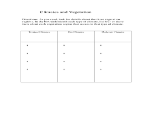
Physical Geography- Climate
Sixth graders explore different climates. In this compare and contrast instructional activity, 6th graders look at the differences in climates of America and Europe. Students use KWL charts and graphic organizers to record information...
Curated OER
States/Capitals L-N: Matching
In this geography practice worksheet, students match the 17 listed states to the appropriate 17 listed capital cities located in the United States.
Curated OER
Longitude and Latitude Lines
In this geography worksheet, middle schoolers examine the map and focus on the concept of latitude and longitude by finding the locations.
Curated OER
Let's Play Geography Twister
Students practice geography skills by playing a game based on Twister. Students manipulate their position on a map by placing their arms and legs on the appropriate state or country called out by the teacher.
Curated OER
The Geography of Tornadoes OR
Students learn some basic facts about tornadoes and map two selected tornado statistics by state, and observe, analyze and speculate about the pattern(s) created by the completed map.
Curated OER
MAPPING THE BLACK ATLANTIC
Young scholars examine the geographic characteristics of Western and Central Africa, the impact of geography on settlement patterns, cultural traits, and trade. They compare political, social, economic, and religious systems of...
Curated OER
Second Star To the Left and Straight On 'Till Morning" - Spreadsheet Driven Exploration of Pacific Asian Geography
Students explore the geography of Pacific Asia. The class is divided into two groups to participate in a role-play activity where they act as European explorers. Students utilize mathematics, spreadsheet and internet technology to make...
Curated OER
Geography, Map Skills & the Internet:
Learners research various websites focusing on Italy while enhancing student utilization of computer, keyboards and the Internet. They discuss their findings on the geography, history, topography, and culture.
Curated OER
U.S. Archaeological Sites: Geography Practice
In this archaeological sites worksheet, students read about sites in the Unites States and use a map to complete a set of 7 short answer questions.
Curated OER
Map Projections: The Grapefruit Activity
Students partcipate in activities in which they examine different map projections. They discover the positives and negatives of each type. They use grapefruits to help them with the different types of map projections.
Curated OER
Europe Map Quiz
In this online interactive geography quiz learning exercise, students respond to 45 identification questions about the countries located in Europe. Students have 5 minutes to complete the quiz.
Curated OER
Mapping Africa
Young scholars identify the location of parallel and meridian coordinates. They illustrate their understanding of the physical shape of the continent of Africa through a mapping activity, then explain the processes that have influenced...


