Curated OER
The Time Has Come: Poetry and Drama Use in the Geography Class
Students use drama and poetry in their Geography class. In groups, they role play an interviewer or the interviewee in various plays that were presented to them. In their role, they must locate and label where the countries mentioned...
Curated OER
International Custody Battle
Students research the relationship between the United States and Cuba by identifying key players and events in Cuban/U.S. history. They also focus on a battle waged between Cuban-Americans in Miami and a father in Cuba over the custody...
Curated OER
Maps that Teach
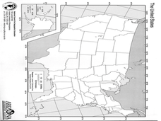
Students study maps to locate the states and capital on the US map. Students locate continents, major world physical features and historical monuments. Students locate the provinces and territories of Canada.
Curated OER
U.S. Archaeological Sites: Geography Practice
In this archaeological sites worksheet, students read about sites in the Unites States and use a map to complete a set of 7 short answer questions.
Curated OER
Fertile Crescent Map Project
Sixth graders develop a multimedia presentation of the Fertile Crescent that compares modern day geography, economics, government, and transportation resources. They work in groups to research their specific topic.
Curated OER
Geography Lesson Plan
Students examine the history of the Aborigines. In this Australia lesson, students research selected websites and print materials regarding the lives of the Aborigines and create posters that showcase their findings.
Mr. Arnayro
California Missions Project
Looking for alternative options to the traditional California missions project? This is the resource for you!
Curated OER
Following the Great Wall of China
Learners conduct research on the history of the Great Wall of China. They explore websites, complete various interactive activities, read a history of the Great Wall, write an essay, and take an online quiz.
Curated OER
Following the Great Wall of China
Students investigate the building of the Great Wall of China during the Ming Dynasty and utilize the story of the wall to examine some of the history of China.
Curated OER
Texas Commemorative Maps: Honoring Our Past
To celebrate Texas, groups plan and create a commemorative map for a topic or theme in Texas history. The richly detailed plan and the approach could easily be adapted to any state. Samples are included.
John F. Kennedy Presidential Library & Museum
Red States/Blue States: Mapping the Presidential Election
Young historians investigate how voting patterns have changed by comparing the outcome of the 1960 election to the outcome of the recent election. A creative final assessment has participants making a news show wherein they provide...
Curated OER
Rivers Quiz 3
In this rivers worksheet, students answer short answer questions about famous rivers around the world. Students complete 10 short answer questions.
Curated OER
The United States and Canada
While just a short review of some simple facts about the United States and Canada, this could be a useful resource for an introduction to North America. Teachers could use this as a model for student projects or could add more...
Curated OER
World War 1: A New Kind of War
Guide reading and enhance your students' understanding of WWI with this rich presentation. Topics covered are warfare, weapons, technology, government actions, women in war, and the effects of war on the home front and around the world....
Curated OER
Mesoamerica
Learners demonstrate knowledge of early Middle American civilizations. They study Mesoamerican i religions, governments, and achievements. They identify geographies of North and South America.
Curated OER
Election Vocabulary Brainstorm
Students participate in numerous activities pertaining to elections. They study election vocabulary and generate questions about campaigns and elections. They paraphrase articles and generate a class vocabulary list.
Curated OER
Exploring Our Country: An United States Scavenger Hunt
Students visit a selected web site and search answers to given questions. They investigate census data for a several states. They explore data such as business, geography, and people. Students demonstrate ways to navigate through a...
Education World
The African American Population in US History
How has the African American population changed over the years? Learners use charts, statistical data, and maps to see how populations in African American communities have changed since the 1860s. Activity modifications are included to...
Curated OER
U.S. and Canada: How are We the Same? How are We Different?
Get high school geographers to compare and contrast Canada and the United States. They begin by drawing a freehand map of North America, then complete readings to gain insight into Canada. The text is not provided; however, another text...
Curated OER
Route 66 And Population Patterns
Learners investigate the geography located along Route 66. They research how the population patterns change in certain areas along the highway. Students use the information in order to form hypotheses about how and why the population...
Curated OER
New Hampshire State Quarter
In this New Hampshire worksheet, students study a picture of the state quarter for New Hampshire. Using the information on the coin, students answer 5 short essay questions about New Hampshire.
Curated OER
Europe To The Max DVD: Four Great Cities of Europe Questions
In this geography skills worksheet, students watch the video "Europe to the Max." Students then respond to 18 short answer questions about London, Amsterdam, Brussels, and Paris.
Curated OER
USA's 50 Largest Cities
In this US Cities activity, students identify and locate USA's fifty largest cities. There are 50 cities listed for the students to locate in the word search.
Curated OER
Explorer Comprehension Worksheet
In this exploration worksheet, students draw the routes of the listed explorers on the blank world map. Students should also provide a color-coded map key.


