Curated OER
Using History to Teach Tolerance: A Ripple of Hope
Students investigate the prejudice and racism that has existed in the U.S. for centuries by attending a field trip. In this equality lesson, students visit the Tolerance Museum and discuss the history of the U.S. Students...
Curated OER
U.S. Archaeological Sites: Geography Practice
In this archaeological sites worksheet, students read about sites in the Unites States and use a map to complete a set of 7 short answer questions.
Curated OER
Men of Steel
Students explore early 20th century steel making. For this U.S. history steel making lesson, students view and describe a postcard and a picture depicting exaggerated aspects of the steel industry. Students listen to a poem...
Curated OER
Site and Situation: Right Place at the Right Time
Middle schoolers put their geography skills to work. In this geography skills lesson, students research maps and other primary and secondary sources to simulate the site selection process for the Pennsylvania Railroad Shops post World...
Curated OER
Focus on Russia; From Communism to Capitalism
In this Russian history learning exercise, learners respond to 12 short answer questions about Communism and Capitalism. Students also use the provided maps of the Russia and the U.S.S.R. to help them answer the questions.
Curated OER
The 50 States and its Holidays
Though the format of this ELL lesson is confusing (the standards listed are for plate tectonics, yet the objectives are for American geography and holidays), a teacher could glean some ideas from the main idea. Here, pupils complete a...
Happy Housewife
State Notebooking Pages
When learning about US geography, it can hard to remember facts about 50 different states. Help your young scholars organize all of this information with a collection of easy-to-use note-taking guides.
Curated OER
Fifty States Field Day
Students explore the 50 states in preparation for a special field day. On the actual field day, the oldest students in the school manage each of 50 physical activity stations. They share information about each state and introduce the...
Curated OER
This Is America! Flag Collage
In a visual essay of their thoughts about "What America Means to Me," kids of any age can create a collage about their country. Originally intended to be created physically, learners could share their projects online by using an...
Curated OER
What's In a Name?
Students examine the origins of the names of U.S. states, focusing on names that were derived from Native American words. They are provided with lists of the names of the 50 states, and then research online or in library resources the...
Curated OER
Where Do People Move To Or From?
Students identify countries of origin of their ancestors, graph patterns of migration to the U.S. and Hawaii, then utilize oral history as a primary document by interviewing their ancestors or parents to explain why they moved to their...
Curated OER
Where Do I Live?
Students gain a better understanding of the population of the region they live in by comparing U.S. census data on the internet.
Curated OER
Geography Puzzles
Students study the continents of the world. In this Internet geography lesson, students connect to online mapping games. Students collaborate in order to develop their understanding of world geography, including countries and capital...
Curated OER
Can You Name the Region?
While just a picture of the Rocky Mountains, this presentation could be used as an introductory activity to a geography lesson. The series of slides begins with a piece of a complete picture which is revealed little by little, until the...
Curated OER
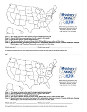
Mystery State # 39
Which state will be the answer to the five clues today? After considering each clue, learners will name the mystery state. If your class can determine which state was home to Chief Sitting Bull, they'll be able to answer South Dakota.
US Mint
Rename That State!
As Shakespeare famously wrote, "A rose by any other name would smell as sweet," but can the same be said for a state? For this elementary geography lesson, learners are assigned specific states to research using the information...
NASA
Outline Maps
Don't miss this gold mine of blank maps for your next geography lesson! Regions include traditional continents such as Asia, Europe, and Africa, as well as other major world areas such as the Pacific Rim and the Middle East.
Curated OER
Geography and Topography, History and Architecture
In this social studies lesson plan, students answer short answer questions about the geography, topography, history, and architecture of the east part of the United States. Students complete 24 questions.
Curated OER
MAISA and the REMC Association of Michigan
Students complete online research to study geography's impact on weather. In this geography and weather lesson, students research weather in their city for ten days using an online website. Students bookmark the site, enter data into a...
Curated OER
U.S. History: What Happened Here?
Students apply the global positioning system to create maps of local historical sites. By collaborating with local historical groups, they research events and relate them to broader, national history. In addition to writing essays...
Curated OER
U.S. Puzzle Map Bulletin Board
Learners create cutouts of each state. They research different states noting their similarities and differences. They describe each state's location in relation to the state's surrounding them.
Curated OER
US Newspapers Quiz
In this online interactive geography quiz worksheet, students respond to 13 identification questions about the names of newspapers in the listed U.S. cities. Students have 3 minutes to complete the quiz.
Curated OER
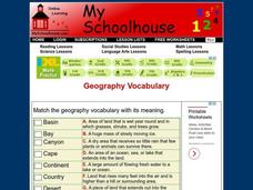
Geography Vocabulary
In this identifying geographic terms and their definitions online interactive worksheet, students match the vocabulary words with their definitions. Students match 24 answers.
New York City Department of Education
Geography and Early Peoples of the Western Hemisphere
Young historians discover the early people of the western hemisphere. The unit explores how the land changed, how it was used and homes of early Americans such as Incas, Mayans, Inuits, Aztecs, and Pueblos. Individuals also examine these...
Other popular searches
- U.s. Geography Lesson Plans
- U.s. Geography Southeast
- U.s. Geography Slavery
- U.s. Geography Northeast
- U.s. Geography California
- U.s. Geography Oregon
- U.s. Geography and Economics
- U.s. Geography Pdf
- U.s. Geography West
- U.s. Geography Activity
- U.s. Geography + Slavery
- U.s. Geography Southwest


