Curated OER
US Geography Crossword
In this 50 states activity, learners complete a crossword puzzle with facts about US geography. There are 22 words to fit in the puzzle, which has no word bank.
Curated OER
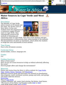
Water Sources in Cape Verde and West Africa
Young explorers study the scarcity and importance of a continuous supply of fresh water in Cape Verde. They research the five main ways that fresh water is obtained in these countries. Each research group prepares a presentation, and...
Curated OER
United States Geography: Crossword Puzzle
In this geography worksheet, students use the 14 clues in order to fill in the crossword puzzle with the appropriate United States geography answers.
Curated OER
US Geography, The Blues
This lesson enables teachers to use blues styles and performers to think about various geographical regions of the United States. By studying different blues styles from the Mississippi Delta, Texas, and the Piedmont region of the...
Richmond Community Schools
Map Skills
Young geographers will need to use a variety of map skills to complete the tasks required on this worksheet. Examples of activities include using references to label a map of Mexico, identify Canadian territories and European...
Institute for Geophysics
Understanding Maps of Earth
Here is your go-to student resource on primary geography concepts, including facts about the surface of the earth and its hemispheres, latitude and longitude, globes, types of maps, and identifying continents and oceans.
Curated OER
Understanding Latitude and Longitude
Teaching learners about latitude and longitude can get a little complicated. Present the concept by first representing it as a graph. Just like finding a location on a graph using the x and y-axis, learners will be able to locate items...
Curated OER
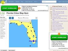
Florida Cities Map Quiz
In this online interactive geography learning exercise, students examine a map of Florida and identify the 12 noted cities on the map using a pull down menu within 3 minutes.
Curated OER
Shaky New Zealand
Students explore geography by answering study questions in class. In this plate tectonics lesson, students identify the earthquake data concerning the country of New Zealand and answer questions regarding the data. Students identify...
Curated OER
Mapping Mistakes
Young scholars examine early European maps and explore geographic errors. They also view maps of the geography of North America. Students discuss the obstacles faced by early explorers in mapping unexplored territory. They consider what...
American Museum of Natural History
Fossils
Sixteen slides showcase an average day on the job for a paleontologist, Ross MacPhee. Engaging images include world maps and real-world photographs from an archeological dig in Antarctica. A brief description accompanies each slide.
Curated OER
Maps that Teach
Learners study maps to locate the states and capital on the US map. Students locate continents, major world physical features and historical monuments. Learners locate the provinces and territories of Canada.
Curated OER
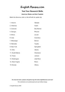
American States and Their Capital- Test Your Research Skills Worksheet
In this geography skills activity, students match the American state listed on the left with its capital city listed on the right by drawing a line from one to the other.
Curated OER
Lake Tahoe Then and Now
Students investigate the differences in Lake Tahoe from the past to the present. In this geography lesson, students read the book Washoe Seasons of Life and identify the descriptions of the land and lake. Students create a Venn diagram...
Curated OER
Landforms and Resources of the United States and Canada
In this North American geography worksheet, students read about the physical features and resources of the United States and Canada. Students take notes and answer 3 short answer comprehension questions as they read the selection.
Curated OER
General Knowledge Questions- All School Subjects Lower Intermediate
In this interactive general knowledge worksheet, students complete 24 multiple choice questions based on their knowledge in several subject areas. These subjects include science, geography, sports and music.
Curated OER
The Great American Desert
In this American deserts worksheet, students study the images and read the passages to learn about the 6 divisions in the American landscape: the Eastern lowlands, the Flood Plain, the Great Plains, the Rocky Mountains, and the Pacific...
Curated OER
Mapping the Past
Middle schoolers study historical maps to view how the world evolved from medieval times through the Renaissance. They work in groups to examine the maps and present a report on one of the listed maps.
Colorado State University
How Does the Earth Cool Itself Off?
Where does all the heat go when the sun goes down? An interesting lesson has learners explore this question by monitoring the infrared radiation emitted over time. They learn that hot spots cool more quickly that cooler spots.
Curated OER
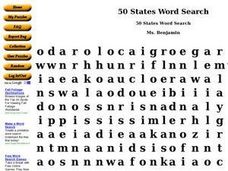
50 States Word Search
In this fifty states worksheet, students identify and locate all fifty states of the United States of America. There are 50 states located in the word search.
Curated OER
Climate Change in Canada
In this Canada worksheet, students read a 6 page detailed informational text about climate change in Canada. Students then complete 10 essay/short answer questions.
Curated OER
Sacred Places
Learners examine places considered sacred in both India and the U.S. They read and discuss a website on the Ganges River, discuss places considered sacred in the U.S., and write an essay comparing/contrasting personal sacred places and...
Curated OER
Geological Forces and Topography
Students discuss and research the Earth's geological processes. In this geology activity, students study maps of Utah and the United States to learn about geological features. Students then complete the research cards for each area of...

