Curated OER
Motivating Activities for Geography Week
Here is a great way to pique your students' interest in geography, and help them learn about their world.
Curated OER
Capitals, Oceans, And Border States
Students investigate geography by completing games with classmates. For this United States of America lesson, students examine a map of North America and identify the borders of Mexico and Canada as well as the Pacific and Atlantic....
Curated OER
Teaching Geography Through Geocaching
Bring geography to life with a real world treasure hunt.
Curated OER
This is America
Students explore world geography by viewing a documentary film in class. In this national parks lesson, students view the Ken Burns documentary about the subject and identify the contributions of individuals in support of the parks...
Curated OER
New Zealand Subduction Zone Model
Students explore world geography by creating a model in class. In this tectonic plate lesson, students identify diagrams which discuss the tectonic plates in New Zealand and how they affect everyday life. Students utilize cardboard,...
Curated OER
Ecology--Biomes
In this ecology worksheet, students view a world map and match the name of the biome with the number that identifies it. There are ten different biomes to identify.
Curated OER
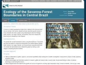
Graphing and Analyzing Biome Data
Students explore biome data. In this world geography and weather data analysis lesson, students record data about weather conditions in North Carolina, Las Vegas, and Brazil. Students convert Fahrenheit degrees to Celsius degrees and use...
Curated OER
Where in The World Am I?
Students explore the concept of absolution location. In this geography skills lesson, students discuss how to identify and locate latitude and longitude. Students play a game to reinforce the skills.
Curated OER
Latitude on World Maps
Sixth graders examine the purposes of maps. In this Geography lesson, 6th graders practice using latitude and longitude on a map.
Curated OER
Tour Of South America
Middle schoolers explore South America. In this geography instructional activity, students research landmarks of historical or national significance and use their findings to create slideshows.
Arizona Cooperative Extension
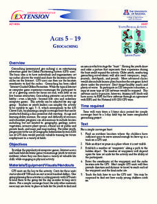
Geocaching
Using GPS units, small groups participate in a scavenger hunt to find an object that you have hidden. They use coordinates for stopping points along a pre-planned path to get to the final cache. This is a terrific activity to include in...
Curated OER
Physical Education Unit Plan: Soccer - Lesson 3
Lesson three of this unit focuses on multiculturalism in soccer. Begin class by showing video clips of soccer in other countries. This lesson includes a link to Rwandan youth playing soccer in an open space. Playing soccer in...
American Museum of Natural History
Fossils
Sixteen slides showcase an average day on the job for a paleontologist, Ross MacPhee. Engaging images include world maps and real-world photographs from an archeological dig in Antarctica. A brief description accompanies each slide.
Polar Bears International
Top of the World
Learn about polar bears and the Arctic circle with a lesson about the countries and conditions of the region. After examining how the area differs from Antarctica, kids explore climates, animals, and geographical position...
Environment Agency - Abu Dhabi
Plate Tectonics
Young scholars observe a presentation on plate tectonics, layers of the earth, and plate boundaries. They then use the Internet to research major plates and label them on a world map.
Science Matters
Ring of Fire
Over a period of 35 years, earthquakes and volcanoes combined only accounted for 1.5 percent of the deaths from natural disasters in the United States. The 15th lesson in a 20-part series connects the locations of earthquakes and...
Curated OER
Explore Surface Types on a Journey Around Earth
Students explore satellite data. In this technology cross-curriculum math and world geography instructional activity, students locate specific map areas using a microset of satellite data. Students use technology and math skills to...
Curated OER
Where Am I?
Students identify volcano locations by latitude and longitude. They analyze a world map, and complete a "Volcano Event Locations Chart."
Curated OER
Ring of Fire
Students locate some of the 1,500 active volcanoes on a world map. Then by comparing their maps with a map of the world's tectonic plates, they discover that volcanoes occur because of the dynamic nature of the Earth's lithosphere.
Curated OER
London Quiz 2
In this London worksheet, students answer short answer questions about the geography and history of London. Students answer 10 short answer questions.
Curated OER
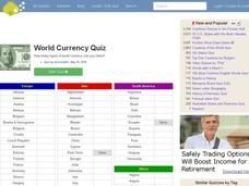
World Currency Quiz
In this online interactive geography quiz worksheet, students respond to 81 identification questions about world currencies. Students have 10 minutes to complete the quiz.
Curated OER
What in Our World Affects the Way People Live
Sixth graders study various maps that show geographical features and population. They compare the maps and make inferences about how various geographical features influence the population and human activities of an area.
Curated OER
World's Longest Rivers Map Quiz
In this online interactive geography quiz worksheet, students respond to 40 identification questions about the world's largest rivers.
Curated OER
World Lakes Map Quiz
In this online interactive geography quiz worksheet, students respond to 15 identification questions regarding major world lakes.
Other popular searches
- World War I Map
- Mapping Penny's World
- Map of the World
- World Outline Maps
- Blank Maps of World
- World War 2 Map
- World War 1 Maps
- World War I Outline Map
- Map of World
- World Climate Map
- Blank World Outline Maps
- World Biomes Map


