Curated OER
Map Scale
Students investigate the purpose of map scale and how it is used to measure the distance and the size of objects.
Curated OER
Some Things You Need to Know to Read a Map
Learners study things the you need to know to read a map and explain location.
Curated OER
What You Can Learn From a Map
Students investigate the use of road maps, shadeded relief maps, and topographic maps.
Curated OER
Sir Francis Drake
Help your learners prep for an exam testing content knowledge related to Florida's State History. Your class can use this printable page to review vocabulary, identify locations on a map, and research both knights and the Sir Francis...
Curated OER
Geography: Puerto Rico
Take a trip to Puerto Rico! Learners engage in a web quest, identify Puerto Rico on the map, and gather information related to physical features and cultural factors. Their efforts culminate when they design a brochure comparing the...
Curated OER
Cross Country Adventure
Students practice measurement and geography in this instructional activity. They build a Lego vehicle using an RCX. They predict how many seconds it will take their vehicle to reach a specific state on the United States of America map...
Curated OER
Where in the World is Hawaii?
Students compare a globe and a two-dimensional world map and explore how they both represent the planet Earth. They locate the Hawaiian Islands on the globe or the world map and describe how the geographical position is unique.
Curated OER
Create-A-Country
Sixth graders work with a partner to fill out the attached form describing their own country. They will use the information about their country to create a PowerPoint presentation to show the class. They must present a slide for each...
Curated OER
Euro-Tourism
Learners design a tourist brochure using Publisher. They research an assigned European country. Students describe tourist attractions in their country and other interesting characteristics.
Curated OER
Ecology Explorers: Historical Air Photo Interpretation
Students identify and analyze land use changes over time with historic aerial photographs, and classify different land use into categories.
Curated OER
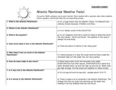
Atlantic Rainforest Weather Facts!
In this rainforest fact worksheet, students learn about rainforest weather by participating in a question/answer group activity. There are 8 questions on small cards and 8 corresponding answers. Students with questions circulate...
Curated OER
Malta: The Landscape
Pupils work in small groups to create a topographic map of Malta. They must include labeled line drawings of bordering countries and bodies of water. Students use salt and flour clay to make Malta three dimensional, showing the nearest...
Curated OER
Hungary: The Landscape
Learners work in small groups to create a topographic map of Hungary. The map will include labeled line drawing of the bordering countries. Hungary should be three dimensional, made of salt and flour clay. The mountains, plains and...
Curated OER
Italy: The Landscape
Students work in small groups to create a topographic map of Italy. They must include labeled line drawings of bordering countries and bodies of water. Students use salt and flour clay to make Italy three dimensional, showing the many...
Curated OER
Languages of the World: Principal Language
This worksheet lists roughly 30 countries and provides space for researchers to record the principal language spoken in each. Includes a key.
Curated OER
What Do Maps Show?: Lesson 1 Introduction to Maps
Learners brainstorm a list of the different types of maps they have seen or used. Using the activity sheet, they look through a social studies book to find all the maps and to determine what they are used for. Using a poster, they review...
Curated OER
Water Creates a Cave
Students study the role of water in limestone cave formation and create a cave on karst-like grid on paper.
Curated OER
Learning Directions on a Map
Students use north, south, east, and west to identify relative locations and provide directions.
Curated OER
Map Grids
Pupils examine how grids are created and used to locate positions of objects or features on a map.
Curated OER
Introduction to Maps
Students investigate a variety of maps to explain what each one is used for.
Curated OER
Lesson 4 Activity 1: Mapping the Third Dimension
Students work in pairs to construct a simple stereoscope.
Curated OER
Puerto Rico: The 51st State?
Learners explore Puerto Rico. In this Puerto Rico current events lesson, students conduct a Webquest to answer questions about Puerto Rico's culture. Learners discuss whether Puerto Rico is a country or a state, and defend their...
Curated OER
Regents High School Examination: Global History and Geography 2008
Test your learners on their knowledge of world history and geography. For this global history and geography standardized test, class members respond to 50 multiple choice questions, 1 essay, and 15 short answer questions that require...
Curated OER
Police Action: The Korean War, 1950-1953
High schoolers explore why the United States became involved in the war in Korea. They discuss the confict between Truman and MacArthur, culminating in the latter's dismissal from command. They identify on a world map foreign countires...


