Curated OER
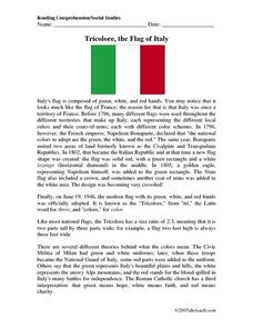
Tricolore, the Flag of Italy
In this reading comprehension activity, middle schoolers read a passage describing the history of Italy's flag. Then they respond to six multiple choice questions based on the description they read. Students discover who chose the colors...
Curated OER
Professor of Ice
For this environment experiment worksheet, students complete 3 experiments using ice. First they label each experiment and respond to the four questions given. Then students do the 3 experiments as stated, considering what the...
Curated OER
Aerial Photographs
In this geography activity, high schoolers read an excerpt about aerial photographs and how they are taken. Then they identify shape, size, tone, shadows, and other hints that might be seen. Finally, students respond to 5 short answer...
Curated OER
Getting to Know Austria- Map Skills
In this Austria map skills worksheet, students apply map skills to answer 14 fill in the blank questions about the country. They determine border countries, identify regions, find the capitol, and name rivers. They draw a map of Austria...
Curated OER
The Caspian Sea
In this comprehension and geography activity, students read an article about the Caspian Sea, identifying where it is located and what countries surround it. Then they describe three parts of the sea, what are tributaries, and how many...
Curated OER
Project Map: Latitude And Longitude Worksheet
In this latitude and longitude worksheet, learners find the coordinates of 14 cities around the world and use this information to complete 14 short answer questions. This worksheet includes online atlas web links.
Curated OER
Oh, the Places You'll Go!
Students read about and discuss the fifty-three recommended travel destinations for 2008 from the Travel section of The New York Times. They list three places they would each like to visit, read and discuss the news article, and create...
Curated OER
Reaching for the Sky
Students consider features of skyscraper using descriptive words, reflect on notion of skyscraper as orientation point in a city, and explore New York Times Building in Manhattan by reading and discussing article, "Pride and Nostalgia...
Curated OER
Clouds & Condensation
Learners use the digital atlas of Idaho to study different weather patterns. They use the Climatology section of the Digital Atlas of Idaho to explore concepts such as relative humidity, dew point, condensation, and cloud formation.
Curated OER
Geography, Ecology, and Folklife
Students identify how do geography and ecology influence a region's folklife. Then they investigate this question and consider how an outsider might view their own region in this lesson. Students also identify how the natural world, even...
Curated OER
The Underground Railroad
Students discuss how slaves fought against their situation and how did they escape. They discover what the Underground Railroad was and how it slaves used it to reach freedom. They then play a game focusing on the Underground Railroad in...
Curated OER
The First North Americans
High schoolers identify and interpret the different North American Indian groups, by region, and the type and impact of their interaction with Europeans.
Then they complete an overview of one main Native American group during the age of...
Curated OER
War of 1812
Eighth graders locate the major land forms and bodies of water on a map of Louisiana. In groups, they discuss the role of the Mississippi River in the Battle of New Orleans and how land and water affect the outcome of battles. To end...
Curated OER
Climographs
Students identify trends and characteristics of climate zones and specific places within. Then, they graph annual climate trends (primarily Temperature and Precipitation) and create, interpret and extrapolate information based on...
Curated OER
Walk in My Shoes
Students discover how culture, geography and history affect how someone views an area of the world. They role play the role of a Palestinian, Jew or Briton and examine how they felt about Israel during its formation. To end the lesson,...
Curated OER
Continents on the Move
Middle schoolers examine the tectonic plates of the Earth and how the landforms of Earth have changed position over time. In groups, they identify the evidence that the continents are still moving. To end the lesson, they practice...
Curated OER
The Time Has Come: Poetry and Drama Use in the Geography Class
Young scholars use drama and poetry in their Geography class. In groups, they role play an interviewer or the interviewee in various plays that were presented to them. In their role, they must locate and label where the countries...
Curated OER
Water, Water Everywhere?
Students discover the relationship between water availability and population growth. They change variables in a computer model using a worksheet to guide their hypotheses and conclusions. In small groups they choose a country undergoing...
Curated OER
Exploring the World's Geography
Students discuss the seven continents of Earth and the diverse geography. After discussion, they create their own paper-mache globes which properly display all seven continents, the equator, and the prime meridian. They conduct research...
Curated OER
Understanding Geography
Students create a map of their own neighborhood to show the relationships between the geography of the neighborhood and its economy and culture. They view and discuss an introductory video on how geographers study an area then go out...
Curated OER
Understanding Demographics
Students use demographic information to gain an understanding of the Dominican Republic. They compare demographic data from the United States and the Dominican Republic and describe the difference between learning about a country from...
Curated OER
Where in the World Is ...?
Students move themselves around a "world" map on the classroom floor, using lines of latitude and longitude to locate specific spots. They determine the locations of 11 countries where Peace Corps Volunteers are serving and identify in...
Curated OER
Me on the Map Lesson 2
Students analyze and interpret maps, globes and geographic information systems to define and identify cities, counties, states, countries and continents to create a booklet called me on the map. They also determine and calculate the...
Curated OER
Development on the Edge of a City
Young scholars explore and analyze examples of changing relationships between patterns of settlement and land use in the state of Minnesota. They view different avenues of transportation, cities, suburbs, city planners and suburbanization.


