Curated OER
World Map and Globe - Lesson 1 Introduction to the Globe
Students explore the earth with maps and globes. In this map lesson, students use maps and globes to locate oceans and continents.
Curated OER
Transportation
Engage in an 8-day study of different modes of transportation. Your students explore the concept of location and define the physical characteristics of places, such as, land forms, bodies of water, natural resources, and weather.
American Art Clay Co., Inc.
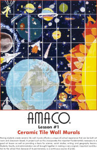
Ceramic Tile Wall Murals
Science, social studies, language arts, and art classes work together with administrators to produce a permanent, ceramic tile wall mural to install at their school.
Curated OER
Living in Kansas Today
Students compare and contrast urban and rural communities. In this geography skills instructional activity, students discover the attributes of the settings and respond to questions about cities and farms.
Curated OER
Living By Water
Young scholars research a coastal community, locate it on a map and profile its physical, geography, climate, architecture and cultural characteristics. They envision this coastal community and make a detailed drawing of it by blending...
Curated OER
Country Capitals
Students locate country capitals on a world map. For this map skills lesson, students review the definition of the word country and discuss what a capital is. Students locate and label capital cities on a world map using a map marker.
Curated OER
Oh, What A Day
Learners listen as the teacher reads A Country Far Away. They predict what they will do and what they think their partner student will be doing. Students create a KWL chart for Japan. They collect information about their activities on an...
National Wildlife Federation
Sensory Discovery Walk
Let your senses be your lead. Pairs of pupils blindfold their partners and then lead them around nature areas. They use their senses to find landmarks and create maps with their findings. Once they create their maps, they go back to the...
Curated OER
Using the Four Main Directions in the Classroom
Students use the four main directions to locate features in the classroom. In this direction instructional activity, students review the 4 main directions using a world map. Students use a magnetic compass to locate the north wall in...
Curated OER
Tracking Fall's Falling Temperatures
Young meteorologists track weather from day to day and record results on graphs, maps, or other places. They see firsthand how weather temperatures trend cooler as fall progresses and practice grade-appropriate skills in geography (map...
Curated OER
The Arkansas State Flag
Young historians take a look at the history of the Arkansas state flag. Pupils color, cut, and paste together their own versions of the flag. They learn about the meaning of the flag's colors, and what the various symbols on the flag...
Curated OER
Postmark U.S.A.
Students identify and collect postmarks from across the United States. They develop a list of ways to collect postmarks, display the postmarks on a large U.S. map, and find the exact location using MapQuest.
Education World
Thinking About Thanksgiving: Lessons Across the Curriculum
Bring two integrated curriculum resources about Thanksgiving to an elementary social studies unit. The first activity focuses on Squanto's contributions to the early Pilgrims' survival with a gardening activity in which learners add...
Curated OER
Name That Continent
Students practice locating the seven continents, four hemispheres, and four oceans using a large world map and a review song. They also import a world map to the Kid Pix computer program then type in proper labels on the map. There are...
Curated OER
Introduction to Symbols
Learners study the concept of picture symbols as a way to express ideas without using words. In this picture symbol instructional activity, students place symbols on a U.S. map according to meaning. Learners then review various...
Curated OER
United States Map - Lesson 11
Young scholars explore lakes of the United States. In this geography lesson, students identify noteworthy lakes on a map of the United States.
Curated OER
Locating Places
Students demonstrate how to use the map grid system. In this map skills lesson, students are given coordinates to locate several locations on a world map. Students use the map grid system to identify these locations.
Curated OER
Geography: World Dynamics
Students discuss and examine how the world is changing. After reading an article, they discover the immediate changes that have taken place and how they have effected living things. They complete a worksheet identifying the changes as...
Curated OER
Fifty States Field Day
Young scholars explore the 50 states in preparation for a special field day. On the actual field day, the oldest students in the school manage each of 50 physical activity stations. They share information about each state and introduce...
Curated OER
The Finer Things in Life
Momoyama and Edo are periods in Japanese history that can be defined culturally and artistically. Learners explore and discuss how the samurai used sword guards and grip enhancers. Pupils read the story "The Inch-High Samurai," examine...
Curated OER
Mapping Your State's Role in the Vietnam War
Students recognize reasons to celebrate Memorial Day. Students create a map of victims of the VIetnam War. Using the internet, students research information about soldiers from their state who were killd in action in Vietnam. Students...
Curated OER
Past, Present and Future Through the Eyes of Long Jakes
Even the littlest learners can become art historians if they have the right training. For the lesson, your preschoolers discuss the piece Long Jakes as they point out all the details they notice. They discuss what mountains and mountain...
Curated OER
What Kind of Vessel Are You?
This is a strange question; but what kind of vessel would you be and why? After examining images of a large Inca jug, the class sets to writing a creative narrative that answers that very interesting question. They start by researching...
National Endowment for the Humanities
La Familia
Young scholars identify at least one country where the Spanish language is spoken, describe similarities and differences between Spanish, Mexican, and Puerto Rican families, and practice speaking the Spanish words for several family...
Other popular searches
- World Geography Studies
- Geography Studies the Sea
- Geography Studies Rocks
- Elementary Geography Studies
- Geography Studies Cd Rom
- Social Studies Geography
- Social Studies Us Geography
- Social Studies and Geography
- Social Studies Maps Geography


