Tramline
Virtual Field Trip: Windows on the World
At this site you will find interactive activities, maps, photos, and even audio and video clips for studying the cultures of the world.
E-learning for Kids
E Learning for Kids: Math: World of Fish: 3 D Space & Size
Discover the characteristics of 3D shapes in this fantasy world of fish.
World Food Programme
World Food Programme: Free Rice: Identify Countries on the Map
By playing this educational geography game, you can help end world hunger by providing rice to hungry people for free. For each answer you get right, the World Food Programme will donate 10 grains of rice to help end hunger.
abcteach
Abcteach: Maps
[Free Registration/Login Required] Find outline maps of the continents and the United States and Canada, as well as other country and city maps.
The Newberry Library
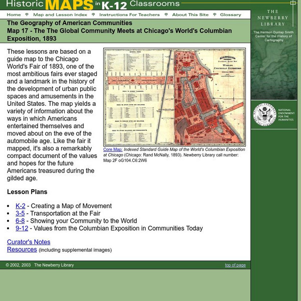
Newberry: Map 17: Geography: Chicago's World's Columbian Exposition, 1893
Students K-12 explore a map of the Chicago World's Columbian Exposition, 1893, to get a sense of how Americans entertained themselve prior to the automobile.
The Newberry Library
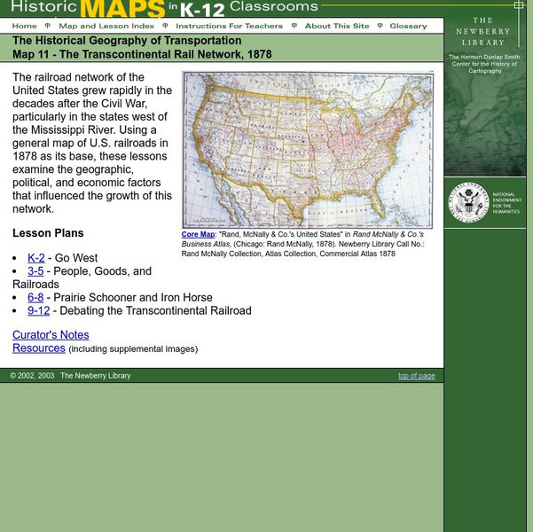
Newberry: Historical Geography: Map 11: The Transcontinental Rail Network, 1878
Lesson for K-12 using historical maps examine the geographic, political, and economic factors that influenced the growth of railroads.
The Newberry Library
Newberry: Environmental History: Map 7: Distribution of Woodland in u.s., 1873
Lesson plans for K-12 using maps that show the distribution of wooded land in 1873. Students examine the impact of humans on the environment.
The Newberry Library
Newberry: Geography of Transportation: Map 12: Auto Trails of Florida, Ca. 1924
Lessons for students K-12 using historical maps teach students about the history of travel and tourism by car, identifying the technological and economic changes taking place in the 20th Century.
PBS
Pbs Learning Media: Earth's Systems: Map It
Explore different types of maps and how different things are represented on maps in this media gallery from WGBH. Maps are used to help locate different places and different things. Map symbols are representations of larger things in the...
PBS
Pbs Learning Media: Mapping Landforms and Water Bodies: Lesson Plan
Learn about different landforms and water bodies and the various characteristics that make them distinct from one another in this lesson plan from WGBH. Navigate around a virtual island to unlock information -- including videos and...
Better Lesson
Better Lesson: Tree Mapping in 2 D
Identifying 2D shapes in common objects and sorting according to shapes connects the real world to learning shape names and attributes.
Utah Education Network
Uen: Lesson Plan: Map Trap
Lesson to reinforce maps skills and concepts. Young scholars map locations around their school and use world maps to locate major landmarks.
SMART Technologies
Smart: Final Project Map Skills
This lessons explores the different ways we can view our world along with the different parts of a map or globe.
The Newberry Library
Newberry: Historical Geography of Transportation: Map 10: United States, 1835
Lessons K-12 examining the role of transportation systems in the development and settlement of the lands between the Appalachian Mountains and the Mississippi River.
Maps of Mexico
Virtual Picture Travel Map of Massachusetts
Click on Massachusetts on the US map in order to Travel there and take a virtual tour of Boston. Visit places of interest such as Harvard University, MIT, John F. Kennedy Library and Museum, the Freedom Trail, Copley Square, Trinity...
Maps of Mexico
Virtual Picture Travel Map of Massachusetts
Click on Massachusetts on the US map in order to Travel there and take a virtual tour of Boston. Visit places of interest such as Harvard University, MIT, John F. Kennedy Library and Museum, the Freedom Trail, Copley Square, Trinity...
Maps of Mexico
Virtual Picture Travel Map of Massachusetts
Click on Massachusetts on the US map in order to Travel there and take a virtual tour of Boston. Visit places of interest such as Harvard University, MIT, John F. Kennedy Library and Museum, the Freedom Trail, Copley Square, Trinity...
Maps of Mexico
Virtual Picture Travel Map of Massachusetts
Click on Massachusetts on the US map in order to Travel there and take a virtual tour of Boston. Visit places of interest such as Harvard University, MIT, John F. Kennedy Library and Museum, the Freedom Trail, Copley Square, Trinity...
SMART Technologies
Smart: World Map
This lesson features a world map with labeled countries, a global map, and an interactive map of the seven continents.
E-learning for Kids
E Learning for Kids: Math: World of Fish: Numbers: Sharing
Students will play an interactive game to explore equal sharing.
CRW Flags
Flags of the World: Clickable Map of the United States
Includes both printable images and fascinating trivia behind the flag of each state. It includes alternate flags used in the past.
Houghton Mifflin Harcourt
Holt, Rinehart and Winston: Estados Unidos
Easy-to-read Spanish map of the United States with country information below. A nice site with links to the States and the rest of the world's countries as well!
Google
Google Earth Explore, Search and Discover
Find a specific location in the world. View exotic locations, famous buildings, and even your own home! See the terrain and buildings in 3D. Search for restaurants, hotels, parks and schools within a certain area.
Other popular searches
- World War Ii Map
- World War I Map
- World War 2 Map
- World War I Outline Map
- World Climate Map
- World Biomes Map
- World Outline Map
- Blank Map of the World
- World Political Map
- Ancient World Greece Map
- World Time Zone Map
- Deciduous Forests Map World


