Curated OER
Mapmaker, Make Me a Map!
Students are introduced to the state quarter program and examine the Colorado state quarter. They locate Colorado on a map and create a map with a key. They discuss the state motto and examine pictures of the state's geographical features.
Newspaper Association of America
Community Connections with Geography and the Newspaper
Understanding geography and government begins at the local level. Using maps and the parts of a newspaper, a unit plan introduces the concept of community. It starts with the creation of classroom and school maps, and then moves through...
Curated OER
World Map and Globe- Introduction to Symbols
Young scholars investigate picture symbols. In this symbols instructional activity, students define symbols and discuss symbols that they see in everyday life. Young scholars identify symbols on maps by using post-it notes.
Curated OER
Me on the Map: Homes, Neighborhoods, and Communities
Students read a book about maps and identify the differences between a picture and a map. In this maps lesson plan, students also label maps of their home, neighborhood, and community.
Curated OER
Through the Forest and Home Again: Maps Help Us Find Our Ways
Students read Little Red Riding Hood, focusing on her path home to Grandma's house. In this language arts and geography lesson, students perform a reader's theater, re-creating the walk home and possible routes that could have been...
Curated OER
Expanding Children's Geographic and Economic Worlds
Students learn their addresses and gain a sense of connection between their neighborhood and the rest of the world and the universe.
Curated OER
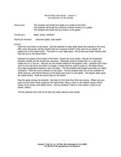
World Map and Globe - Lesson 1 Introduction to the Globe
Students explore the earth with maps and globes. In this map lesson, students use maps and globes to locate oceans and continents.
Curated OER
Map Projections
Learners view examples of various map projections using a website. Students record differences between the map projections. Learners discuss uses for the various map projections and the differences between the maps they viewed. ...
Museum of Disability
Taking Visual Impairment to School
What is the world like when you can't see, or when your vision is impaired? Learn about how Lisa communicates with the world around her with Taking Visual Impairment to School by Rita Whitman Steingold. Learners answer...
Curated OER
World Map and Globe - Lesson 15 (K-3)
Students discover mountain ranges and their locations in the world. In this physical map lesson, students locate and identify major mountain ranges of the world on a large physical map.
Curated OER
Math with Maps and Globes
Students round out their math skills with these ‘round the world' ideas. In this math and geography lesson, students try out time zone sticks, a polar race, and tic-tac-globe to engage them in learning more about globes and the...
Curated OER
World Map and Globe
Students explore symbols. In this beginning map lesson, students identify common picture symbols. Students place post-it notes with symbols drawn on them in the appropriate place on a map.
Curated OER
Cacao Tree Geography
Students use a map to learn about where chocolate comes from. In this lesson on the cacao tree, students locate various regions where the cacao tree grows. They will discuss why the cacao tree grows more favorably in particular climates...
Curated OER
How To Make an Apple Pie And See the World
Students define and discuss global interdependence. They read How to Make an Apple Pie and See the World and keep a list of the countries visited during the story and identify all of the productive resources and natural resource...
Curated OER
Celebrate Hanukkah in Israel
Explore Hanukkah and its origins with a social studies lesson. Learners discover the history of Hanukkah and its traditions. They locate Israel on a map, hear the story of the menorah and create their own...
Curated OER
Wales: An Interdisciplinary Unit
Students practice basic map and geographic skills as they compare Oregon to Wales. Students color map of Wales and Oregon using color codes to distinguish between land, water, and bordering nations or states, listen to stories and...
Curated OER
Yo Ho, Yo Ho, A Pirate's Map for Me: An Original Story
Students read Blackbeard and brainstorm their knowledge of maps. In this language arts and geography instructional activity, students use landmarks on their playground to review north, south, east and west and discuss the compass rose....
Core Knowledge Foundation
Thanksgiving with the Pilgrims
Teach kindergartners about the First Thanksgiving with a series of lessons about the Pilgrims' journey to the New World. As they practice handwriting, CVC words, reading comprehension, and fun Thanksgiving songs, they learn about what...
Curated OER
Foods and Languages of the World
Students explore cultures around the world. In this cross-curriculum geography lesson plan, students listen to This is the Way We Go to School , a Book about Children around the World , and locate various countries on the globe and a...
Curated OER
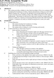
Let's Write Around the World
Students participate in an ongoing writing project about the seven world continents. In this continents writing lesson, students work on an interactive game to write about the seven continents. Students locate the continents on the map....
Curated OER
Mapping My World
Pupils are introduced to simple maps and view a map of a classroom and compare distances of items shown.
Curated OER
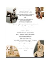
The Ancient Civilization of Mali
Learners explore the ancient civilization of Mali and examine various historical and cultural aspects of the civilization. In this ancient civilization of Mali instructional activity, students examine trade with respect to geographic...
Curated OER
Globe Game
Students are arranged into groups and are given a map or globe. Students select a location on the map. Students as yes and no questions to guess the specific place that was chosen.
Curated OER
Country Capitals
Students locate country capitals on a world map. For this map skills lesson, students review the definition of the word country and discuss what a capital is. Students locate and label capital cities on a world map using a map marker.
Other popular searches
- World War Ii Map
- World War I Map
- World War 2 Map
- World War I Outline Map
- World Climate Map
- World Biomes Map
- World Outline Map
- Blank Map of the World
- World Political Map
- Ancient World Greece Map
- World Time Zone Map
- Deciduous Forests Map World


