Curated OER
Introduction to Symbols
Learners study the concept of picture symbols as a way to express ideas without using words. In this picture symbol instructional activity, students place symbols on a U.S. map according to meaning. Learners then review various...
Curated OER
Children's Literature Across the Curriculum Ideas-The Wind Blew
Students read The Wind Blew by Pat Hutchins. They complete a variety of cross-curricular activities surrounding the study of wind and weather. Included are reading, art, math, science, writing, social studies, and library connections.
Curated OER
Globe Game
Students are arranged into groups and are given a map or globe. Students select a location on the map. Students as yes and no questions to guess the specific place that was chosen.
Indian Land Tenure Foundation
Maps and Homelands
You are never too young to learn about maps. To better understand the concept of a homeland, learners work together to construct a map of their local area out of paper puzzle pieces. They'll put the maps together and then add details by...
Curated OER
As the Kids Come and Go: Mapping a Classroom
Map the classroom with your kids to help them understand how maps work and how to read them. The lesson starts off with a story about animals living and moving around the globe, and then kids create maps of their classroom to show how...
Core Knowledge Foundation
Columbus Sailed the Ocean Blue
Young adventurers embark on a journey, setting sail along the blue ocean with Christopher Columbus. Teachers will find that this unit makes their lesson planning smooth sailing!
Curated OER
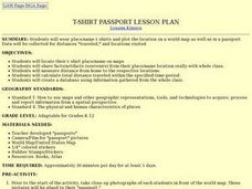
T-shirt Passport Lesson Plan
Young scholars locate their t-shirt place/name on maps, then share facts/artifacts (souvenirs) from their place/name location orally with whole class. They create a database using information gathered from the whole class.
Curated OER
Global Economy: A Simple Activity
Students explore the global economy. In this economics lesson, students examine clothing labels in search of the countries the clothing was made in. Students consider the implications of a global economy.
Curated OER
Find a Cave
Students locate their own communites and the nearest caves on a United States map. They calculate the distance to the nearest cave using rough scale.
Curated OER
Teaching the Five Themes of Geography Through Picture Books
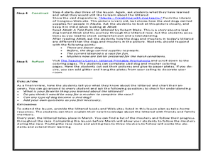
Read the story Make Way for Ducklings and introduce little ones to the five themes of geography. Reread the story, while displaying transparencies to reinforce the five themes. In groups, learners view pictures and identify the themes on...
Curated OER
Mural Mania
Students research and discuss symbols and features of their state. They create a mural representing their state and design a quarter for their state.
Curated OER
United States Map - Lesson 11
Young scholars explore lakes of the United States. In this geography lesson, students identify noteworthy lakes on a map of the United States.
Curated OER
Locating Places
Students demonstrate how to use the map grid system. In this map skills lesson, students are given coordinates to locate several locations on a world map. Students use the map grid system to identify these locations.
Curated OER
Exploring Neighborhoods through Art
Students explore neighborhoods. In this color and social studies cross-curriculum instructional activity, students listen to Harold and the Purple Crayon by Crockett Johnson, then compare and contrast neighborhoods. Students mix primary...
Curated OER
Geography: World Dynamics
Students discuss and examine how the world is changing. After reading an article, they discover the immediate changes that have taken place and how they have effected living things. They complete a worksheet identifying the changes as...
Curated OER
Recycle, Reduce, Reuse and Save a Tree
Students examine how to save and protect trees. In this conservation lesson, students read books about the usefulness of trees, write ideas in their journals about how trees can be used, and make a book of ways to protect trees.
Curated OER
How To Make an Apple Pie And See the World
Students define and discuss global interdependence. They read How to Make an Apple Pie and See the World and keep a list of the countries visited during the story and identify all of the productive resources and natural resource...
Curated OER
The Iditarod: The Last Great Race
Students investigate the Iditarod. In this last great race lesson, students explore and research the Iditarod race which takes place in Alaska. Students explore a variety of websites and images to gather background information. A...
Curated OER
Tear the Continents
Students tear paper into representative continent shapes and configure them with world oceans through relative location, direction and latitude and longitude starting points. They recognize the shape of the continents. Students recognize...
Curated OER
An Honest Cigarette Ad?
Students recognize the intended audience for a certain advertisement They recognize advertising techniques aimed at the intended audience and create their own advertisements about the truth of cigarette smoking. Students begin to see...
Curated OER
The Ancient World
Students explore the concept of migration. In this ancient civilizations lesson, students watch "The Ancient World" and research life in the Fertile Crescent. Students then write letters from the perspective of people migrating from...
Curated OER
A Bird's Eye View Of Your Community
Learners locate and identify their community by using a satellite image from the Internet. Students locate and identify common land structures within their community. You may want to include structures such as roads/streets, houses and...
Curated OER
WHERE DOES OUR FOOD COME FROM?
Students examine the sources, location and availability of local food, develop mapping skills, interact with Elders to gain pertinent information, and examine subsistence issues of the past and present.
Curated OER
Wales: An Interdisciplinary Unit
Students practice basic map and geographic skills as they compare Oregon to Wales. Students color map of Wales and Oregon using color codes to distinguish between land, water, and bordering nations or states, listen to stories and...


