Curated OER
Africa
Students complete various activities related to the continent of Africa. They label and color a map of Africa, sing the Continent Song, view pictures and discuss animals of Africa, listen to the book "Bill and Pete Go Down the Nile,"...
Curated OER
Comparing Three Religions: Islam, Judaism, and Christianity
Students work together in groups to research either Judaism, Christianity, or Islam. Once the research is complete, they share their information with the other groups in the class. They complete a worksheet on rituals and holidays in...
Curated OER
Origami Paper Fun
Students explore the art of Origami. They listen to various stories about Japan, create Origami shapes by following step-by-step directions, sing Japanese songs, locate Japan on a map, and take a quiz.
Curated OER
What Is A Map?
Students become familiar with a map and what it is used for and become familiar with school and home surroundings. With the familiarity of their surroundings they discover that maps can be created to help them with directions and how to...
Curated OER
Continent Adventure
Students review or learn information regarding the 7 continents on our planet. It is also a fun movement and fitness activity.
Curated OER
Directional Terms
Students identify and demonstrate various locational terms, and examine how a globe is a model of Earth. They repeat words and movements for various finger plays to demonstrate locational terms, play directional words games, and sing a...
Curated OER
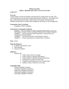
Climb a Mountain, Raft a River on Your Own Land
Students are introduced to the characteristics of a map. As a class, they discuss the uses of public lands in their community and develop symbols for each feature. They use the symbols to create a map showing the recreational uses of...
Curated OER
Symbols and Signs
Students investigate the significance of various signs and symbols. They view and discuss the Statue of Liberty as a symbol of U.S. liberty, listen to the book "The Story of the Statue of Liberty," and create a class book of signs and...
Curated OER
Max Knows Mexicao, United States and Canada
Students utilize their map skills to explore the regions of North America. They explore the physical characteristics and climates of the regions. Students label their map and prepare a presentation of their findings.
Curated OER
Where's My Dot?
Students explore the five basic elements of Monart, dot, curved line, straightline, and angle line to create a book about their home address. The concept of "big" is explored in this lesson.
Curated OER
Signs of Our Times
Students view photographs of the signs and symbols in their local community. As a class, they note the reason for the signs and write the words on the board. Individually, they complete a worksheet in which they match the symbols with...
Curated OER
Fold a Paper House
Students make a folded paper model of a Korean thatched roof house, label its parts and color it appropriately.
Curated OER
American Civilization
Students review map and globe skills. They gather background to the story of Christopher Columbus' voyage.
Curated OER
America the Beautiful
Students listen to story America the Beautiful, discuss places in America they have visited, define beautiful, and create and illustrate class book with pictures and words from song, America the Beautiful.
Curated OER
"Eggs-treme" Egg Hunt
Students practice reading a map of the classroom or playground. They hide plastic eggs and draw a map identifying the location of two eggs hidden in the classroom or on the playground.
Curated OER
North, South, East, or West
Students participate in a game to learn cardinal directions. In this map skills lesson, students move around the room using cardinal directions.
Curated OER
Vacation Matrix-Integrated Core
Students read aloud, "The Best Vacation Ever," by Stuart Murphy locate vacation spots on a map and describe their own vacations. Students illustrate their summer vacation spot and describe the vacation, placing it on a "vacation matrix"...
Curated OER
Painting a Neighborhood
Students explore the concept of neighborhoods and identify primary and secondary colors. For this colors and community lesson, students read the book Harold and the Purple Crayon and then discuss the concept of a neighborhood. Students...
Curated OER
Human Rights Violations
Students explore how human rights are different in each part of the world. In this freedome lesson, students define human rights, research how human rights in one country ultimately affect other countries, and share their findings...
Curated OER
Island Breezes: Exploring Hula Dance
Students explore Hawaii and the art of hula dance. In this art lesson, students research the art of hula dance and Hawaii. Students create their own unique hula dance.
Curated OER
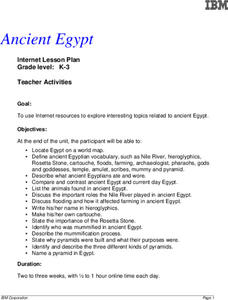
Ancient Egypt
Students use the internet to research topics on Ancient Egypt. They practice using new vocabulary and identify the types of food they ate and clothing they wore. They explain the role of the Nile as well.
Curated OER
The Arrival
Students construct classroom rules. In this philanthropy lesson, students investigate The Mayflower Compact made by the Pilgrims and use it as a guide to form their own classroom rules. Students work in small groups.
Curated OER
Women
A close study of two works of art provides the introduction to this cross-curricular writing assignment. After comparing the clothing, facial expressions, body language, setting, and color in the two 19th century paintings Tissout’s...
Curated OER
Mapping Districts
Young scholars use maps to learn about the U.S. Census. In this 2010 Census lesson plan, students visualize census data on maps, use map keys to read population maps, and explore the concept of population density.


