Curated OER
U.S. Geography: The South
Young geographers complete a research project. They list the physical features found in the American South. They then discuss the economy, culture, and geography found in the South. They work in groups to research one of the five...
Curated OER
U.S. Geography: The Northeast
Students investigate U.S. Geography by creating a map in class. In this natural resource lesson, students create a map of the United States and research the Northeast based on their resources and recyclable materials. Students...
Curated OER
Where is Kansas?
Students explore U.S. Geography by analyzing a map. In this state vs. country lesson, students utilize a U.S. map and locate the state of Kansas before researching the history and customs of the state. Students collaborate as a class to...
Curated OER
Arkansas History Lesson Plan
Students discover the history of their state by working in a group. In this U.S. history lesson, students investigate the state of Arkansas by reading their textbook and participating in art activities. Students discover the...
Curated OER
Arkansas History Lesson Plan: Identifying Arkansas on a Map
Students investigate their hometown of Arkansas. In this U.S. Geography lesson, students identify Arkansas on a map and distinguish it form the other states. Students investigate the history, state line, and personal...
Curated OER
Fifty States Field Day
Young scholars explore the 50 states in preparation for a special field day. On the actual field day, the oldest students in the school manage each of 50 physical activity stations. They share information about each state and introduce...
Curated OER
Our States, My State
Here is a very nice lesson on the shape of the United States, and the shapes of the individual states for your young geographers. They utilize worksheets embedded in the plan to color in a variety of states and to become familiar with...
Curated OER
The Branding of America (And Your State)
Students investigate about the origins of some major U.S. brands. They explore local products that stimulate the economy. Students create a map showing where those products originate. Students discover the products that their local area...
Curated OER
The 50 States and its Holidays
Though the format of this ELL lesson is confusing (the standards listed are for plate tectonics, yet the objectives are for American geography and holidays), a teacher could glean some ideas from the main idea. Here, pupils complete a...
Curated OER
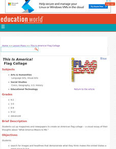
This Is America! Flag Collage
In a visual essay of their thoughts about "What America Means to Me," kids of any age can create a collage about their country. Originally intended to be created physically, learners could share their projects online by using an...
Curated OER
Let's Play Geography Twister
Students practice geography skills by playing a game based on Twister. Students manipulate their position on a map by placing their arms and legs on the appropriate state or country called out by the teacher.
US Mint
Symbols in My Eyes
Explore the hidden meanings behind the images on US currency with this elementary school lesson on symbolism. Starting with a class discussion about symbols, children go on to brainstorm different objects that represent the Unites...
Curated OER
Where in the World Is Mexico?
Learners practice map-reading skills as they locate Mexico and its cities on a world map. By creating a puzzle out of a map of Mexico, students engage in a meaningful hands-on activity to help them explore that country's geography.
US Mint
Desert Dwellers
What can a quarter possibly teach young learners about desert ecosystems? More than you might think. After displaying and discussing the included picture of the Arizona state quarter, the class participates in a series of...
Curated OER
Geography Action! Rivers 2001- Human River
Students create a 'human river' by arranging themselves into a river pattern. Each student selects an article to represent a pollutant such as paper, book, or pencil. Students at the source of the river pass their pollutant on to the...
Curated OER
ZIP Code Math
Students add or subtract to solve ZIP Code Math word problems. A ZIP Code Math work sheet is included. This lesson plan combines math with geography quite nicely.
Curated OER
Comparing Countries
Students compare facts about different countries. In this comparing lesson plan, students collect information about the US and another country and compare them. Students locate countries on the map and make a hypothesis about the lives...
Curated OER
Communities Around the World
Students investigate the idea of community by taking a field trip. In this civics lesson, students participate in a supervised walk around their neighborhood while identifying characteristics and objects that make their home town...
Curated OER
Making Sense of the Census
In this unit of lessons, students make sense of the Census. They examine why a census is taken and participate in activities.
Curated OER
My World
Students study maps. In this social studies lesson, students draw a map of either their room at home or the route they take to school. Students label items on their maps.
Curated OER
Adopt a Geographic News Story
Young scholars explore geography and the environment by reading the news. They discuss why it is important to follow the news. Students adopt a geographic news story, research the topic, and design posters to illustrate the story.
Curated OER
Where's My Dot?
Students explore the five basic elements of Monart, dot, curved line, straightline, and angle line to create a book about their home address. The concept of "big" is explored in this lesson.
Curated OER
Find a Cave
Students locate their own communites and the nearest caves on a United States map. They calculate the distance to the nearest cave using rough scale.
Curated OER
Island Breezes: Exploring Hula Dance
Students explore Hawaii and the art of hula dance. In this art lesson, students research the art of hula dance and Hawaii. Students create their own unique hula dance.
