Curated OER
The 21st Century Lewis and Clark Trail
Students create a better route through the Rocky Mountains for the Lewis and Clark expedition after tracing the original path.
Curated OER
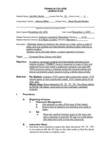
Compass Rose: Dance and Quilt
Fourth graders identify the cardinal directions by listening to a song entitled, "Stand," and by reviewing the lyrics to that song. They notice the cardinal directions that are posted around the classroom. They perform the motions as...
Curated OER
Back-to-school ESL Ideas
Pupils share their countries and languages, flags, cultural identity, and pride in home culture.
Curated OER
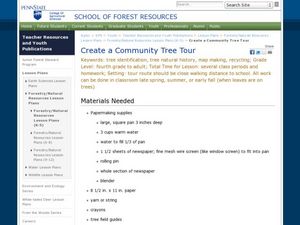
Create a Community Tree Tour
Students study tree identification. In this tree identification lesson, students design and assemble a tree tour booklet describing 5 trees found in their community. The booklet should feature common and Latin names of the species, a...
Curated OER
Context for Exploration
Students examine watershed maps from the Columbia River. They practice using maps and create their own watershed map. They share their map with the class.
Curated OER
Central Oregon Road Trip
Students work together to plan a six-day road trip through central Oregon. Using a map, they locate any place mentioned and create a list of attractions throughout the area. They list the places in the order they are going to visit them...
Curated OER
Settling Nroth America: Improvisation and Playwriting
Students map the classroom by marking the movement of the first Americans' migration from Alaska down into North America. To improve their skills in map-reading and sense of direction, students identify physical features of the map and...
Curated OER
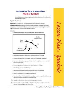
Weather Symbols
Students study weather symbols. In this weather symbols instructional activity, students review the symbols for cold, warm, and stationary fronts. Students use a weather map to study the weather symbols, complete a weather illustration...
Curated OER
Roller Coaster Mania
Fifth graders extend their knowledge of developing maps. They work in cooperative groups to develop an amusement park display and a brochure.
Curated OER
Geography Grid
Fourth graders search a database to find images and scan and affix them on an 8-foot long map of the state of Illinois. They then use it as a basis for discussion.
Curated OER
On the Way Home#122
Young scholars observe the various physical and man-made features that they pass on the route they take on their way home from school. They sketch the features before drawing and labeling a map of the route. They share the maps with...
Curated OER
Kidsville USA
Second graders create an imaginary town using Kid Pix. They demonstrate their knowledge of specific vocabulary words and their knowledge and understanding of location by placing schools, stores, parks, etc. appropriately on their maps.
Curated OER
Naming Roads
Students investigate the aspects of a historic map of roads and trails in the Southeastern United States. They explore reasons for giving roads certain names and decide on names for other roads themselves.
Curated OER
Walk and Bike Across America
Students learn how to use maps, compute mileage, and be physically active while exploring America's national parks, historical heritage, and nutritional information via key agricultural sites.
Curated OER
Elements of Biology: Biomes
Students describe the different types of biomes. In this biology lesson, students create a map of assigned biome with descriptive paragraphs. They share their findings to class.
Curated OER
No One's a Winner!
Students create two-dimensional maps showing the affects of a dam on those living both above and below the dam. Students discover the importance of educating the public before the construction of a dam.
Curated OER
The Geography of Maine Tourism
Students study topographical maps of Maine to identify the important physical features. They work in groups to create tourism pamphlet highlighting a region of the state.
Curated OER
Architectural Buildings
Fifth graders explore various styles of architecture. They work together to create a town with clay buildings that come together in order to form this small town. They discuss maps, layouts, and the structure of buildings.
Curated OER
Making a Globe
Students examine the mercator projection or nautical chart and observe how global maps do not have the same distance as flat maps. They design handmade globes using the meridians and equator as guides to draw in the land. They paint and...
Curated OER
Neighborhood Appreciation
Fifth graders examine the neighborhoods around their school. Using maps, they document landmark buildings and community organizations with digital cameras. They write about their journeys and share them with the community.
Curated OER
Hidin' Out
Fourth graders draw three major Underground Railroad routes crossing Indiana on an outline map and include habitats and towns. They produce an oral history involving at least three natural habitats and one human habitat.
Curated OER
Mississippi Under British Rule
Students construct appropriate maps to depict the following information: changes in European territorial claims as a result of the French and Indian War; boundaries of British East and West Florida; significant rivers and settlements of...
Curated OER
Hit The Road Jack(or Jill)
Students find the approximate area of the court order on a current map of Delaware. They draw a layout of their school and decide where a new hallway or outside pathway would be most needed.
Curated OER
Email Around the World
Students send and receive e-mail messages and find the location of each of the messages on a map. Students then write a description and trivia facts about their school to send to others.
Other popular searches
- United States Maps
- Weather Maps
- Topographic Maps
- Story Maps
- Maps and Charts
- Types of Maps
- Maps and Globes
- Middle East Maps
- Maps and Flags
- Historical Maps
- Maps of Europe
- Create Character Maps


