Curated OER
Map Skills
Thirds graders reinforce that a map is a drawing that shows what a place looks like from above. They use a map key and symbols to create a map of the school and its neighborhood.
Curated OER
Geo-Class Mapping My Neighborhood
Students create a map of the school and surrounding neighborhood. In this mapping lesson, students discover their school's location and learn about its past. Students use math skills and the steps in the design process to complete the...
Curated OER
Mapping Perceptions
Students create and read maps. In this map skills lesson, students draw a map of their neighborhood, then use skills acquired during map-making to interpret a classmates map and a map of the Ming Dynasty.
Parkwood Hill Intermediate
Map Skills Project
Young pupils develop their mapping skills and knowledge by designing their own islands, using geographic terms and physical features they have learned as features of their work.
Curated OER
Fantasy / Art Maps
Ninth graders analyze a fantasy art map by Jeremy Anderson, paying careful attention to the way the topographic features of the land are represented. They create a similar map of Sacramento that includes topographical features as well as...
Curated OER
An Introductory Lesson on Maps
Students identify what a map is. They draw their own map using a simplified overhead view. After hearing the book, "Nikk's Adventure," students create their own maps.
Curated OER
Connecting Cartography to Society
Older high schoolers use maps to study changes in society like migration, population loss, and economic shifts, and then connect events from historical events to present day mapping of their region (The resource focuses on Canada, but...
Curated OER
Where Am I: How to Read a Map
Third graders develop an understanding of maps. They explore what a map is, who uses maps, and how to use maps. Students investigate the compas rose. They create a compose rose which illustrates the cardinal directions. Students practice...
Curated OER
Local History: Mapping My Spot
Students explore maps to discover historical information about their local area. In this mapping and history lesson, students use panoramic maps of their own town/city to interpret historical information. Students also place themselves...
Curated OER
Mapping the News
Students explore cartography. In this map skills and map making lesson, Students work in groups to create wall size world maps including legends, compass roses, latitude and longitude, and physical features. Students collect current...
Curated OER
Map It!
Fourth graders demonstrate map making skills by using the computer to create maps of the geographic features, regions, and economy for their state.
Curated OER
Cartography Project
A lesson involving mapping, the use of a compass, writing and following directions, and exploring the first two themes of geography is here for you. Learners create original maps that show the routes they take through their own...
Curated OER
Layers with Lines
Students examine topographical maps and the challenges faced by cartographers when drawing the maps. While creating collages, they use contour lines to add dimension much in the same way they are used on maps to show elevation.
Curated OER
Understanding: Geography
Students explore their neighborhoods. In this geography lesson, students make a map of their neighborhood. They must include a key, natural terrain, buildings and streets. They also write a descriptive paragraph about their neighborhood.
Curated OER
Cartography
Students follow directions to draw a map of an island. They complete the island map adding their own details using symbols and a legend.
Curated OER
FUN WITH MAPS
Second graders receive a general overview about how maps are made and used, how specific information can be derived from them, and how a student can gain personal information about their surroundings from examining them.
Curated OER
Me On the Map
Second graders listen to Joan Sweeney's book, Me On the Map. They design a map of their bedroom and their house emphasizing the important characteristics.
Curated OER
Yo Ho, Yo Ho, A Pirate's Map for Me: An Original Story
Students read Blackbeard and brainstorm their knowledge of maps. In this language arts and geography lesson, students use landmarks on their playground to review north, south, east and west and discuss the compass rose. Students read...
Curated OER
Mapping Roxaboxen
Fourth graders read Roxaboxen and draw a map of the Roxaboxen community. In this language arts and geography lesson, 4th graders use specifications given, adding features to the map as described in the book and creating a legend.
Curated OER
Regions of Utah - Mapping
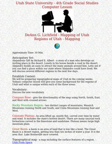
Fourth graders draw a rudimentary map of the state of Utah, dividing it into the three regions: the Great Basin, the Colorado Plateau, and the Rocky Mountain Region.
Curated OER
Mapmaking
Students examine the craft of cartography and how the Lewis and Clark expedition created and used maps. They analyze maps, read a handout, create a map, participate in a mini expedition and map out a route based on travel directions,...
Curated OER
Exploring with Cartography
Pupils are introduced to the topic of cartography. Using the internet, they research the paths and goals of early explorers. They create a PowerPoint presentation of the information they collected. They also develop a "fill-in-the-blank"...
Curated OER
Schoolyard Geology
Discover that maps show information about an area and that they have common features like scales and legends. View an aerial map of your school and find features on the map such as the playground, roads, and trees. Trace the outline of...
Curated OER
Do the Tallywalker
Students study the basics of mapmaking, then make a tally walker, (geographic location device used in secret).


