Curated OER
WWW = World Wide Wildlife
Through video, internet research, and hands-on activities, learners conduct a study of the interdependence between animals and the habitats they live in. They conduct Internet research independently in order to complete a report on a...
Curated OER
You Got The Whole World In Your Hands: Geology, Earth's Layers, Science
Young scholars make a model of the Earth's crust out of foam in order to better explain the make-up of the Earth's layers. They add continents and oceans.
Curated OER
Celebrating Ancestors
Students participate in a "hands-on" activity, to explain that African masks were and are more than aesthetic artifacts, they are functional implements of the many cultures of the African continent.
Curated OER
Getting to Know My World
Students participate in hands-on activities using maps and globes to identify geographical features. Students use map legends to identify direction. Students locate oceans, continents, countries, states and cities. Handouts and...
Curated OER
Map Projections: The Grapefruit Activity
Students partcipate in activities in which they examine different map projections. They discover the positives and negatives of each type. They use grapefruits to help them with the different types of map projections.
Curated OER
Landforms All Around
Students create a "Landform Dictionary". They develop an overlay map and participate in hands-on activities to identify the key characteristics of landforms. They discuss the plant and animal life of these areas. Handouts for the lessons...
Curated OER
Snack Tectonics
Yum! Using graham crackers, dried fruit sheets, and frosting, tectonics technicians demonstrate the different types of plate boundaries. If you want to encourage youngsters with an activity that is both educational and edible, then this...
Curated OER
Christopher Columbus: The Man, the Myth, the Legend
Learn more about maps by examining Christopher Columbus's voyage to the New World. Kindergartners will learn about basic map skills and how to identify the compass rose, oceans, and land masses. They will also discover the purpose of...
Curated OER
Where Will You Go?
Fifth graders research and plan an imaginary vacation. In this travel planning lesson, 5th graders work in pairs to use an atlas, calendar, review airplane schedules, encyclopedias, magazines, and the Internet to research information...
Curated OER
Water Uses and Children's Lives in East Africa
Students identify how water use is part of life and culture. Students record their daily water usage and compare results with classmates. Students complete the graphic organizer on water and children. Students compose an essay, which...
Curated OER
Welcome to My World!
Students use maps to locate information. They read the story, "It Looked Like Spilt Milk", view images of the continents and discuss the various continents. Afterward, they make their own Atlas to record information that they can later...
Curated OER
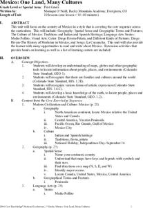
Mexico: One Land, Many Cultures
Students, through a variety of activities, discover the geography and culture of Mexico. They make maps, read folktales, write a journal, create pinatas and other artistic pieces, and review the history of Mexico.
Curated OER
Memory and Learning
Students identify parts of the brain and what each part does. In this brain anatomy lesson, students participate in activities that focus on the job of each part of the brain co connect the task to the brain section. Students make a...
Curated OER
Traveling Through North America
Students identify places and landmarks in North America, specifically Canada and the United States, by using and constructing maps. Six lessons on one page; includes test.
Curated OER
The Ocean Floor - Science
Students draw a quick plan of an ocean floor as seen from the side; including the edge of a continent, a continental shelf, a continental slope, a basin, a trench, and a range. They require their definitions to do this.
Curated OER
Let's Play Geography Twister
Students practice geography skills by playing a game based on Twister. Students manipulate their position on a map by placing their arms and legs on the appropriate state or country called out by the teacher.
Curated OER
Earth History Part II
Eighth graders hypothesize what caused the break up of continents. In this earth science lesson plan, 8th graders study about the events that took place during Mesozoic and Cenozoic Era. They reconstruct a supercontinent and report their...
California Academy of Science
Plants: Hanging Tough
Learning about the rainforest can be more fun than you think. The class discusses vocabulary-in-context as they cut cardboard boxes, destined to become part of a rainforest model. Small groups of children color, cut, and construct...
Curated OER
Plate Tectonics
Curious kids examine plate tectonics and give examples of their movement. They recognize how plates change the Earth through video, and web-based articles. In small groups, they receive complete a tectonics puzzle by silently switching...
Curated OER
Symbolic Family Flags
After learning a bit about symbolism and view the Australian flag, learners make one of their own. They discuss how flags and art can symbolically express ideas or feelings, design three symbols, and construct a flag that represents...
Curated OER
Family Traditions, Customs and Beliefs
Students discuss African childhood, explore family traditions, customs, and beliefs, examine African recipes, discuss differences or similarities in food preparation between the U.S. and Africa, and prepare a dish with adult supervision.
Curated OER
the Richness of Rattles: a Lesson in Making And Decorating Clay Rattles
Students study the history behind clay rattles. They form and create a clay rattle using ceramic sculptural techniques and important composition and design elements.
Curated OER
Mexico: One Land, Many Cultures
Students research and study the country of Mexico and complete a project about it. In this Mexico lesson plan, students research Mexico's geography, traditions, art, songs, stories, and legends that are native to Mexico.
Curated OER
The Ocean Floor -- Science
Middle schoolers work together to create a model of the ocean floor. They practice using new vocabulary associated with the ocean floor as well. They share their model with the class.


