Kenan Fellows
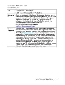
Sensors, Sensors…..Everywhere! Middle School Meteorologist Create Weather Bots!
My forecast is that you'll want to use the resource. Pupils design and create a weather bot as part of a project-based unit. These bots should be able to measure temperature, humidity, barometric pressure, wind speed and direction, and...
Curated OER
Weaving Weather Maps with the World Wide Web
Students access the Internet and use real time data from the American Meteorological Society to create a detailed weather map. They make weather predictions based on the data collected.
Curated OER
Weather and Seasons
Use pictures and manipulatives to develop vocabulary with your beginning language learners. This plan can be used with foreign language learners (although you'll have to provide the vocabulary), English language learners, or a young...
Curated OER
Create a Country
Students work in small groups to list features and elements found on a variety of grade- appropriate maps. They develop a class list of map features and elements to draw from as they create a map of an imaginary country.
Curated OER
Fantasy / Art Maps
Ninth graders analyze a fantasy art map by Jeremy Anderson, paying careful attention to the way the topographic features of the land are represented. They create a similar map of Sacramento that includes topographical features as well as...
Curated OER
Utah Weather
Fourth graders diagram the weather in Utah through the use of a glyph. In this Utah weather instructional activity, 4th graders create weather glyphs of different areas in the state. Students answer questions about the weather and then...
Curated OER
Gallery Walk Questions on Weathering and Mass Wasting
A set of questions on weathering and erosion are found in this resource. Some of them can be used as discussion topics or lecture guides. There are also suggested activities such as the examination of topographic quadrangles and the...
Curated OER
Mapping Community Values
Students discuss the origin of various maps focusing on the values behind them. Students also explore how human needs and geography influence community settlement patterns. Students extend learning by creating and mapping their own ideal...
Curated OER
Weather Report
Students present the weather report in Spanish. In this weather activity, students use weather vocabulary in Spanish. Students work in groups to present the local weather report in Spanish. Students film their report and present to the...
Curated OER
Newport Weather Project
Learners study weather and climate patterns using computer and Internet resources. They collect temperature information and share it with other classes via e-mail using graphs
Curated OER
Flipping Over Our Weather Reports
Students create their own weather report. In this weather lesson plan, students work in groups to predict the weather for three days and create their own video. They have a director, camera-person, still cameraman, and two weathermen.
Curated OER
Cloud and Weather Patterns
Fourth graders examine how weather patterns generally move from west to east across the United States, and how clouds are formed and are related to the water cycle. They view and discuss a PowerPoint presentation of the types of clouds,...
Curated OER
Cloudy With A Chance of Meatballs
Second graders explore weather. In this weather lesson, 2nd graders read Cloudy With A Chance of Meatballs and participate in four supplemental science activities. Students participate in Internet research, create weather maps,...
Curated OER
Exploring our National Parks
Students utilize maps/Atlases to find key spatial information, locate U.S. National Parks, characterize the geography of a specific region, and create a National Park brochure.
Curated OER
Weathering the War
Learners research maps, weapons and weather from a variety of wars, then create a presentation showing the impact weather and topography has had on military operations.
Curated OER
Surveying the Land
Students explore the different kinds of maps and the purpose of each. In this Geography lesson, students work in small groups to create a map which includes the use of a map key.
Curated OER
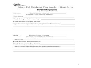
What's Up? Clouds and Your Weather
Seventh graders identify clouds and the weather that is associated with them. In this weather instructional activity students work in groups and design their own weather map.
Curated OER
Weather Forecast
Students forecast the weather. In this weather lesson plan, students are assigned a day to give the weather forecast. Students write a script and video their weather forecast.
Curated OER
Observing Weather
Students investigate the weather by reading children stories. In this weather observation lesson, students read Cloudy With a Chance of Meatballs and several other stories about weather before they create a KWL chart. Students utilize...
Curated OER
What Is A Map?
Pupils become familiar with a map and what it is used for and become familiar with school and home surroundings. With the familiarity of their surroundings they discover that maps can be created to help them with directions and how to...
Curated OER
Weather Reporter
Fourth graders explore the components of a weather map, mark cities on the map and place the appropriate temperatures and weather conditions occurring in the cities on the weather map created.
Curated OER
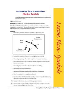
Weather Symbols
Students study weather symbols. In this weather symbols instructional activity, students review the symbols for cold, warm, and stationary fronts. Students use a weather map to study the weather symbols, complete a weather illustration...
Curated OER
Make Your Own "Weather" Map
Learners create their own "weather" map using data from x-ray sources. They analyze and discuss why it is important to organize data in a fashion in which is easy to read. They compare and contrast different x-ray sources using a stellar...
Curated OER
Will There Be a White Christmas This Year?
Young scholars examine historical weather data, and create map and color key that illustrates the likelihood of a white Christmas in different locations across the United States.


