Curated OER
Landforms of Illinois
Fifth and sixth graders are introduced to the primary landforms of Illinois and discover how they were created. Landform cards are made for each pupil. They use the twenty-questions format until they have identified each one. Then,...
Curated OER
How Does Your Soil Stack Up?
Students examine the soil in their local area and create a soil profile. They record observations in the field and the classroom. They create their own display of the soil profile as well.
Curated OER
Water Works Wonders
Students examine where water is found in the world, how we use it, and the various forms it takes. They observe the refraction of light through a prism, record the day and night sky over a week's time, and create a topographic model of...
Curated OER
Settlement Exploration: Then and Now
NASA has crafted an imaginative and memorable series of lessons, "NASA and Jamestown Education Module." This lesson is one of the five components. In it, middle schoolers connect history and science by comparing the settlement of...
Curated OER
I Can Find that Where? - A Study of Landforms
First graders make landform maps of the United States. In this landform lessons, 1st graders participate in a discussion of local landforms and make a landform map of the United States. They follow the teacher's directions to add plains,...
Curated OER
Landforms of Illinois
Students discover the primary landforms of Illinois. They examine how those landforms were formed as well. In groups, they research one of the landforms from their vocabulary list. They create their landform in a shoebox and present it...
Curated OER
Wave Erosion Lesson
Fourth graders examine the effects of waves as they erode coastal land. They discover how the power of water can change the appearance of land formations.
Curated OER
Polygons, Pingos, and Themokarst! Oh MY!
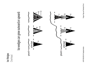
Students complete activities to learn about the common land features in Alaska. In this land study instructional activity, students study an overhead for permafrost features. Students define ice wedge polygons, thermokarst, and pingos....
Curated OER
Glaciers Leave Their Imprint
Students study various types of glaciers and the landforms they create. Working in pairs, they research a type of glacial landform and construct a calendar page illustrating and describing it. The pages be compiled to create a class...
Curated OER
Indiana Ice Investigations
Fourth graders create a model of the formation of Indiana by glaciers. Working in groups with appropriate materials, they create a model documenting how glaciers moved through the land and formed the geological structure and land masses...
Curated OER
Learning About the Basin
Students use watershed maps to explore the Lake Pontchartrain Basin in Louisiana. In this geography lesson, students identify important features such as elevation, vegetation, cultural, historical and land use on a map of Lake...
Curated OER
Sunlight and Warm Air
Students discuss radiant energy from the sun, performing a simple experiment with sun glasses and bright light to demonstrate the concept. Students further participate in simple in-class experiments to demonstrate: air density as it...
Curated OER
Acid Rain and pH
Students study acidic and alkaline balance. In this acid and pH levels lesson, students read information about pH, the formation of acid rain and its impact on environments. Students then complete an experiment to learn about the effects...
Curated OER
Nature and Place Names in Arkansas
Middle schoolers examine the way that many place names in Arkansas came to be. By looking at Arkansas highway maps, they find names that come from the characteristics of each of the state's six geographical divisions. This interesting...
Curated OER
Exploring our National Parks
Students utilize maps/Atlases to find key spatial information, locate U.S. National Parks, characterize the geography of a specific region, and create a National Park brochure.
Curated OER
Sense of Place
Students identify the major folk regions of Louisiana and the relationship between folklife, geography, and ecology. They give deeper thought to what makes their own community unique, what their sense of place actually is. Students...
Curated OER
Find Yourself with Global Positioning
Students examine different types of new mapping technologies. They use the internet to gather information about mapping and navigation. They create their own global positioning tool and defend it to the class.
Curated OER
Crowley's Ridge: An Upland in the Lowlands
Young geographers examine how Crowley's Ridge was formed. This is one Arkansa's six natural geologic divisions. The history of Crowley's Ridge is important in that the first settlers of the state were attracted to this region, and it...
Curated OER
Crowley's Ridge: An Upland in the Lowlands
This clever lesson combines elements of geography, art, literature, and storytelling. Pupils take a close look at the six geographical regions of Arkansas, and pay close attention to Crowley's Ridge - which is one of the six. In groups,...
Curated OER
A-Z List
Students practice using vocabulary terms about the Louisiana Purchase by creating a picture dictionary, an ABC book of terms, a word sort, or a game. Each project should include people, places and terms as they relate to the Louisiana...
Curated OER
Living Swamps, Bayous and Forests
Third graders explore interesting environments by exploring Louisiana. For this wetland lesson, 3rd graders utilize the web to research the State of Louisiana, the bayous in the area, and the Gulf of Mexico. Students write a journal...
Curated OER
Regions: Meet the Experts Presentation
Students gather information and create a web site on prairies and plains using a variety of resources, including the internet.


