Curated OER
Our Way of Life
Learners interview Native American Elders about animal migration, traditional food gathering, and subsistence. They research endangered animals, draw a game cycle, and create maps of local migration of animals.
Curated OER
Monarch Butterflies
First graders identify monarch butterflies and study their life cycles. They order the stages of the life cycle and create a monarch butterfly of construction paper. This well-designed lesson should be easy to implement in your classroom.
Curated OER
Where Should We Put a Store?
Students analyze population data. They convert population data into simple density maps to help make decisions about their world. They select the best location for a school store based on population density. They present their maps...
Curated OER
Where is Everybody?
Students collect data from different grade levels at their school and develop thematic maps which show population density, and determine how this might affect the school and themselves in the future.
Curated OER
Louisiana
Third graders study factual information about Louisiana including the state flag, bird, tree, and important geographical points using the Internet and maps. They explain the different groups that settled the state in this mini-unit.
Curated OER
Coming to America: U.S. Immigration
Students study immigration in the late 19th and early 20th century. In this immigration lesson plan, students participate in activities including creating maps, responding to non fiction text, memorizing and analyzing poetry, and...
Curated OER
Aboriginal Peoples And The Universals of Culture
Sixth graders research specific features of a province or territory of Canada. In this Canadian history lesson, 6th graders identify aboriginal culture areas on a map, identify cultural features represented in their region, and...
Curated OER
Four Ancient River Civilizations
Students explore how the environment shapes man, how man transformed his world, nd how art became part of the human process. The group is divided into clans and their migratory routes developed in the eight lessons of this unit.
Curated OER
Take Me Out To the Ball Game
Young scholars use a map to graph and locate major league teams of different sports. In groups, they analyze the population data of the United States and compare it with the amount and location of the major league teams. They share their...
Curated OER
Make Way for Wild Migrants
Students discuss the threats facing migratory species and track the seasonal journeys of wildlife in real space and in cyberspace. Once they have gathered information from several sources, they create a portfolio to share with others...
Curated OER
Water, Water Everywhere
Students are introduced to the complex issues of water resources around the globe. In groups, they take on the role of a country and map out the location of water sources. They barter, sell or take over other groups to have access to...
Curated OER
Let's Have a Lesson Within a Lesson
Pupils role-play the role of a student who does not comprehend the language the lesson plan is being instructed in. Using the internet, they research the characteristics, distribution and migration of human populations over time. In...
Curated OER
Town Growth and Immigration
Fourth graders describe how Michigan has changed and stayed the same over time. They explain reasons why people settled/settle in Michigan, then explain the role of geography on the settlement of Michigan.
Curated OER
Native Americans
Learners, in groups, research various Native American tribes. They wirte a report about the tribe which includes information about their food and ceremonies, among other things. They create a diorama and a poster that shows how they...
Curated OER
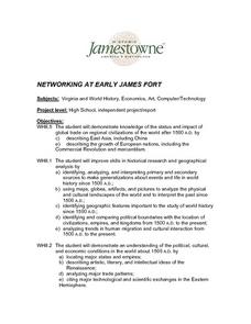
Networking at Early James Fort
Students examine the impact of global trade on regional civilizations of the world after 1500. They research and analyze images of pottery excavated at Jamestown, and create a poster that presents information about world trade networks...
